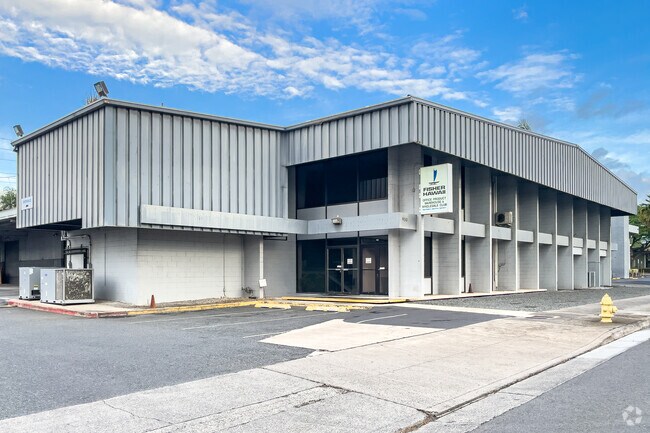
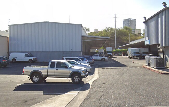
Property Record
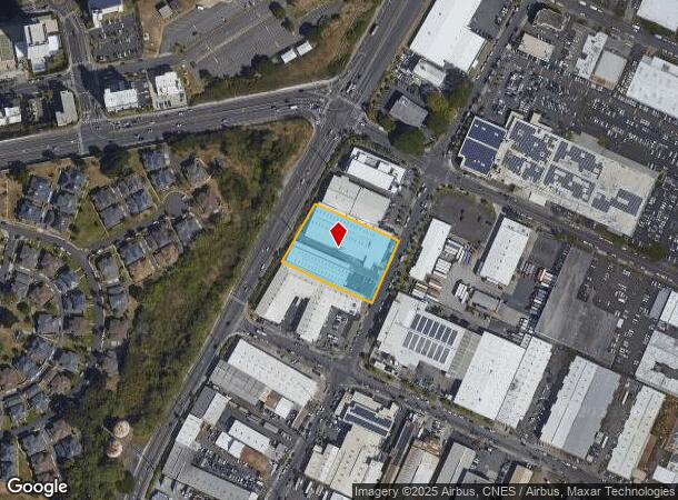
930 Mapunapuna St, Honolulu, HI 96819

NEARBY LISTINGS FOR SALE OR LEASE
Property Detail
930 Mapunapuna St
Urban Honolulu, HI
Sony Corp
1-1-1-007-003-0000
LOT 2963 MAP 372 LCAPP 1074 68,992 SF SUBJ/E 230 (20-FT WIDE)
Industrialgeneral
Honolulu
X
Hawaii
15003C0353G
2963
2024
1.58 AC
2025
Leeward
981300
Hawaii
36,080 SF
DEMOGRAPHICS near 930 Mapunapuna St
1 Mile
3 Mile
5 Mile
2024 Total Population
22,768
131,011
263,246
2029 Population
22,365
126,276
256,601
Pop Growth 2024-2029
(1.77%)
(3.61%)
(2.52%)
Average Age
40
39
41
2024 Total Households
8,419
36,847
93,067
HH Growth 2024-2029
(2.49%)
(4.15%)
(2.67%)
Median Household Inc
$90,388
$84,898
$79,981
Avg Household Size
2.60
3.10
2.60
2024 Avg HH Vehicles
2.00
2.00
2.00
Median Home Value
$601,311
$767,567
$732,813
Median Year Built
1977
1973
1975
Nearby Places
Map Layers
Map Styles
 Street
 Aerial
- Restaurants
- Banks
- Shops
- Fitness
- Groceries
PUBLIC TRANSPORTATION
AIRPORT
Daniel K Inouye International
DRIVE
WALK
Distance
Daniel K Inouye International
8 min
2.6 mi
Freight Ports
Honolulu Harbor, Oahu
DRIVE
WALK
Distance
Honolulu Harbor, Oahu
11 min
4.4 mi
SALE & LEASE HISTORY
LISTING DATE
SALE/LEASE

Sep 09, 2022
For Lease
Nearby Properties
Address
Land Use
TOTAL SIZE
Lot Size
Zoning
Address
Land Use
TOTAL SIZE
Lot Size
Zoning
1,675.63 AC
C/61/60
Address
Land Use
TOTAL SIZE
Lot Size
Zoning
355.21 AC
F-1
Address
Land Use
TOTAL SIZE
Lot Size
Zoning
1,153,381 SF
425.42 AC
R-5
Address
Land Use
TOTAL SIZE
Lot Size
Zoning
1,725,655 SF
11 AC
I-2
Address
Land Use
TOTAL SIZE
Lot Size
Zoning
1,725,655 SF
11 AC
I-2
Address
Land Use
TOTAL SIZE
Lot Size
Zoning
12,430 SF
86.69 AC
I-3
Address
Land Use
TOTAL SIZE
Lot Size
Zoning
163,285 SF
15.08 AC
R-7.5
Address
Land Use
TOTAL SIZE
Lot Size
Zoning
26,537 SF
2,470.86 AC
I-2
Address
Land Use
TOTAL SIZE
Lot Size
Zoning
1,447,909 SF
12.54 AC
IMX-1
Address
Land Use
TOTAL SIZE
Lot Size
Zoning
919,972 SF
14.45 AC
I-2
Address
Land Use
TOTAL SIZE
Lot Size
Zoning
6.20 AC
I-2
Address
Land Use
TOTAL SIZE
Lot Size
Zoning
960 SF
71.97 AC
P-2
Address
Land Use
TOTAL SIZE
Lot Size
Zoning
16.46 AC
I-2
Address
Land Use
TOTAL SIZE
Lot Size
Zoning
37.94 AC
I-3
Address
Land Use
TOTAL SIZE
Lot Size
Zoning
267,131 SF
6.06 AC
I-2
Address
Land Use
TOTAL SIZE
Lot Size
Zoning
347,039 SF
12.61 AC
IMX-1
Address
Land Use
TOTAL SIZE
Lot Size
Zoning
619,404 SF
10.83 AC
IMX-1
Address
Land Use
TOTAL SIZE
Lot Size
Zoning
262,068 SF
27.25 AC
I-3
Address
Land Use
TOTAL SIZE
Lot Size
Zoning
12.54 AC
IMX-1
Address
Land Use
TOTAL SIZE
Lot Size
Zoning
350,452 SF
9 AC
IMX-1
Address
Land Use
TOTAL SIZE
Lot Size
Zoning
9.58 AC
IMX-1
Address
Land Use
TOTAL SIZE
Lot Size
Zoning
154,018 SF
15.24 AC
F-1
Address
Land Use
TOTAL SIZE
Lot Size
Zoning
9.46 AC
IMX-1
Address
Land Use
TOTAL SIZE
Lot Size
Zoning
12.47 AC
F-1
Address
Land Use
TOTAL SIZE
Lot Size
Zoning
57,554 SF
10.05 AC
I-2
Address
Land Use
TOTAL SIZE
Lot Size
Zoning
390,709 SF
6.78 AC
IMX-1
Address
Land Use
TOTAL SIZE
Lot Size
Zoning
14,553 SF
14.57 AC
B-2
Address
Land Use
TOTAL SIZE
Lot Size
Zoning
117,641 SF
9.61 AC
B-2
Address
Land Use
TOTAL SIZE
Lot Size
Zoning
140,483 SF
5.65 AC
IMX-1
Address
Land Use
TOTAL SIZE
Lot Size
Zoning
245,081 SF
11.42 AC
IMX-1
The World's #1 Commercial Real Estate Marketplace
Connect with us
© 2025 CoStar Group
The information above has been obtained from sources believed reliable. While we do not doubt its accuracy we have not verified it and make no guarantee, warranty or representation about it. It is your responsibility to independently confirm its accuracy and completeness. Any projections, opinions, assumptions, or estimates used are for example only and do not represent the current or future performance of the property. The value of this transaction to you depends on tax and other factors which should be evaluated by your tax, financial, and legal advisors. You and your advisors should conduct a careful, independent investigation of the property to determine to your satisfaction the suitability of the property for your needs.