Property Record
930 Mullet Rd, Cape Canaveral, FL 32920

NEARBY LISTINGS FOR SALE OR LEASE
-
-
View all Cape Canaveral listings for sale on LoopNet.com
Property Detail
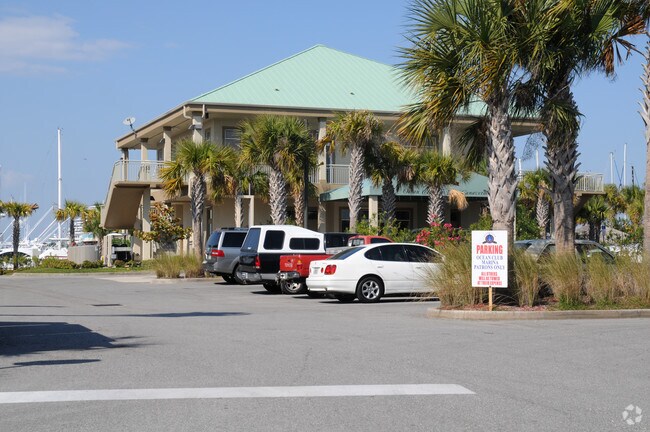
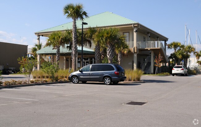
930 Mullet Rd
24-37-09-00-00757.0-0000.00
Ocean Club At Port Canaveral
Portharbor
PT OF SE 1/4 OF SEC AS DESC IN ORB 2918 PG 2659 (PORT AUTHORITY LEASE ACCT #45)
AE
Brevard
12009C0345H
Florida
2024
1.24 AC
2025
Brevard County
068604
Other Market Areas
10,762 SF
Palm Bay-Melbourne-Titusville, FL
DEMOGRAPHICS near 930 Mullet Rd
1 Mile
3 Mile
5 Mile
2024 Total Population
246
18,872
45,698
2029 Population
272
21,278
51,141
Pop Growth 2024-2029
+ 10.57%
+ 12.75%
+ 11.91%
Average Age
53
53
52
2024 Total Households
141
10,408
23,578
HH Growth 2024-2029
+ 10.64%
+ 12.86%
+ 12.27%
Median Household Inc
$61,364
$70,602
$73,695
Avg Household Size
1.80
1.80
1.90
2024 Avg HH Vehicles
1.00
2.00
2.00
Median Home Value
$338,333
$353,030
$362,899
Median Year Built
1999
1984
1980
Nearby Places
Map Layers
Map Styles
 Street
 Aerial
- Restaurants
- Banks
- Shops
- Fitness
- Groceries
PUBLIC TRANSPORTATION
AIRPORT
Melbourne Orlando International
DRIVE
WALK
Distance
Melbourne Orlando International
56 min
39.3 mi
Freight Ports
Port Canaveral
DRIVE
WALK
Distance
Port Canaveral
5 min
1.2 mi
SALE & LEASE HISTORY
LISTING DATE
SALE/LEASE

Sep 23, 2016
For Sale
Nearby Properties
Address
Land Use
TOTAL SIZE
Lot Size
Zoning
Address
Land Use
TOTAL SIZE
Lot Size
Zoning
431,568 SF
190 AC
Address
Land Use
TOTAL SIZE
Lot Size
Zoning
211,222 SF
149.12 AC
Address
Land Use
TOTAL SIZE
Lot Size
Zoning
127,650 SF
8.38 AC
Address
Land Use
TOTAL SIZE
Lot Size
Zoning
642.79 AC
Address
Land Use
TOTAL SIZE
Lot Size
Zoning
126,317 SF
6.23 AC
C1
Address
Land Use
TOTAL SIZE
Lot Size
Zoning
157,523 SF
6.90 AC
C1
Address
Land Use
TOTAL SIZE
Lot Size
Zoning
587.88 AC
Address
Land Use
TOTAL SIZE
Lot Size
Zoning
115,442 SF
3 AC
C2
Address
Land Use
TOTAL SIZE
Lot Size
Zoning
109,762 SF
3.32 AC
C1
Address
Land Use
TOTAL SIZE
Lot Size
Zoning
47,511 SF
379.81 AC
Address
Land Use
TOTAL SIZE
Lot Size
Zoning
180,092 SF
38.20 AC
PIP
Address
Land Use
TOTAL SIZE
Lot Size
Zoning
222,527 SF
9.55 AC
C1
Address
Land Use
TOTAL SIZE
Lot Size
Zoning
195,210 SF
10.99 AC
R3
Address
Land Use
TOTAL SIZE
Lot Size
Zoning
107,898 SF
3.41 AC
Address
Land Use
TOTAL SIZE
Lot Size
Zoning
164,552 SF
3.82 AC
R2
Address
Land Use
TOTAL SIZE
Lot Size
Zoning
81,694 SF
5.01 AC
C1
Address
Land Use
TOTAL SIZE
Lot Size
Zoning
95,520 SF
4.69 AC
C1
Address
Land Use
TOTAL SIZE
Lot Size
Zoning
83,746 SF
15.11 AC
RM1
Address
Land Use
TOTAL SIZE
Lot Size
Zoning
78,379 SF
12.68 AC
R3
Address
Land Use
TOTAL SIZE
Lot Size
Zoning
166,317 SF
12.44 AC
C2
Address
Land Use
TOTAL SIZE
Lot Size
Zoning
80,222 SF
5.51 AC
C2
Address
Land Use
TOTAL SIZE
Lot Size
Zoning
75,326 SF
8.33 AC
CN
Address
Land Use
TOTAL SIZE
Lot Size
Zoning
126,725 SF
11.03 AC
Address
Land Use
TOTAL SIZE
Lot Size
Zoning
Address
Land Use
TOTAL SIZE
Lot Size
Zoning
61,339 SF
28.83 AC
Address
Land Use
TOTAL SIZE
Lot Size
Zoning
69,068 SF
6.10 AC
Address
Land Use
TOTAL SIZE
Lot Size
Zoning
61,207 SF
16.03 AC
GU
Address
Land Use
TOTAL SIZE
Lot Size
Zoning
77,657 SF
10.86 AC
C2
Address
Land Use
TOTAL SIZE
Lot Size
Zoning
2,024 SF
92 AC
Address
Land Use
TOTAL SIZE
Lot Size
Zoning
12,300 SF
4.35 AC
R3
The World's #1 Commercial Real Estate Marketplace
Connect with us
© 2026 CoStar Group
The information above has been obtained from sources believed reliable. While we do not doubt its accuracy we have not verified it and make no guarantee, warranty or representation about it. It is your responsibility to independently confirm its accuracy and completeness. Any projections, opinions, assumptions, or estimates used are for example only and do not represent the current or future performance of the property. The value of this transaction to you depends on tax and other factors which should be evaluated by your tax, financial, and legal advisors. You and your advisors should conduct a careful, independent investigation of the property to determine to your satisfaction the suitability of the property for your needs.