Property Record
930 Pine Rd, Ocala, FL 34472


Property Detail
930 Pine Rd
Ocala, FL
SEC 06 TWP 16 RGE 23 PLAT BOOK 08 PAGE 80 CRYSTAL SQUARE LOTS 2.3.4.5.6.7
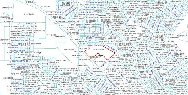
9019-0000-02
MARION
Commercialacreage
Florida
B2
2
B and X Area of moderate flood hazard, usually the area between the limits of the 100-year and 500-year floods.
19.92 AC
2025
Outlying Marion County
2025
Ocala
001209
NEARBY LISTINGS FOR SALE OR LEASE
DEMOGRAPHICS near 930 Pine Rd
1 mile
3 mile
5 mile
2025 Total Population
7,461
42,247
79,129
2030 Population
8,428
47,817
89,244
Pop Growth 2025-2030
+ 12.96%
+ 13.18%
+ 12.78%
Average Age
38
40
41
2025 Total Households
2,606
15,929
30,575
HH Growth 2025-2030
+ 13.28%
+ 13.55%
+ 13.10%
Median Household Inc
$61,714
$66,980
$67,860
Avg Household Size
2.80
2.60
2.60
2025 Avg HH Vehicles
2.00
2.00
2.00
Median Home Value
$239,154
$238,564
$255,206
Median Year Built
2003
1995
1990
Nearby Places
Map Layers
Map Styles
 Street
 Aerial
Transit
 Traffic
 Biking
Places
Listings with unknown addresses are not visible on the map
- Restaurants
- Banks
- Shops
- Fitness
- Groceries
SALE & LEASE HISTORY
LISTING DATE
SALE/LEASE

Sep 24, 2016
For Sale
Dec 21, 2018
For Sale
Nearby Properties
Address
Land Use
TOTAL SIZE
Lot Size
Zoning
Address
Land Use
TOTAL SIZE
Lot Size
Zoning
211,884 SF
80 AC
GU
Address
Land Use
TOTAL SIZE
Lot Size
Zoning
188,132 SF
35.86 AC
B4
Address
Land Use
TOTAL SIZE
Lot Size
Zoning
71,791 SF
10.86 AC
B2
Address
Land Use
TOTAL SIZE
Lot Size
Zoning
97,177 SF
23.01 AC
R3
Address
Land Use
TOTAL SIZE
Lot Size
Zoning
680,069 SF
62.96 AC
B5
Address
Land Use
TOTAL SIZE
Lot Size
Zoning
60,710 SF
66.65 AC
A1
Address
Land Use
TOTAL SIZE
Lot Size
Zoning
26,020 SF
10.46 AC
B2
Address
Land Use
TOTAL SIZE
Lot Size
Zoning
64,020 SF
9.08 AC
B5
Address
Land Use
TOTAL SIZE
Lot Size
Zoning
69,860 SF
5.05 AC
B2
Address
Land Use
TOTAL SIZE
Lot Size
Zoning
682 SF
468.13 AC
A1
Address
Land Use
TOTAL SIZE
Lot Size
Zoning
93,120 SF
34.47 AC
PUD
Address
Land Use
TOTAL SIZE
Lot Size
Zoning
68,186 SF
6.20 AC
B5
Address
Land Use
TOTAL SIZE
Lot Size
Zoning
99,544 SF
10 AC
M2
Address
Land Use
TOTAL SIZE
Lot Size
Zoning
64,319 SF
7.60 AC
B2
Address
Land Use
TOTAL SIZE
Lot Size
Zoning
61,220 SF
3.82 AC
B5
Address
Land Use
TOTAL SIZE
Lot Size
Zoning
20,040 SF
2.77 AC
B4
Address
Land Use
TOTAL SIZE
Lot Size
Zoning
23,865 SF
90.97 AC
GU
Address
Land Use
TOTAL SIZE
Lot Size
Zoning
20,242 SF
4.23 AC
B4
Address
Land Use
TOTAL SIZE
Lot Size
Zoning
34,277 SF
14.94 AC
B5
Address
Land Use
TOTAL SIZE
Lot Size
Zoning
22,812 SF
14.13 AC
M1
Address
Land Use
TOTAL SIZE
Lot Size
Zoning
28,474 SF
4.10 AC
R1
Address
Land Use
TOTAL SIZE
Lot Size
Zoning
55,219 SF
8.83 AC
B2
Address
Land Use
TOTAL SIZE
Lot Size
Zoning
37,765 SF
7.23 AC
B2
Address
Land Use
TOTAL SIZE
Lot Size
Zoning
9,687 SF
118.25 AC
B5
Address
Land Use
TOTAL SIZE
Lot Size
Zoning
8,782 SF
4.73 AC
B2
Address
Land Use
TOTAL SIZE
Lot Size
Zoning
17,595 SF
2.51 AC
B2
Address
Land Use
TOTAL SIZE
Lot Size
Zoning
198.70 AC
R3
Address
Land Use
TOTAL SIZE
Lot Size
Zoning
31,398 SF
8.82 AC
B5
Address
Land Use
TOTAL SIZE
Lot Size
Zoning
10,044 SF
83.35 AC
A1
Address
Land Use
TOTAL SIZE
Lot Size
Zoning
16,742 SF
13.49 AC
A1
The World's #1 Commercial Real Estate Marketplace
Connect with us
© 2026 CoStar Group
The information above has been obtained from sources believed reliable. While we do not doubt its accuracy we have not verified it and make no guarantee, warranty or representation about it. It is your responsibility to independently confirm its accuracy and completeness. Any projections, opinions, assumptions, or estimates used are for example only and do not represent the current or future performance of the property. The value of this transaction to you depends on tax and other factors which should be evaluated by your tax, financial, and legal advisors. You and your advisors should conduct a careful, independent investigation of the property to determine to your satisfaction the suitability of the property for your needs.