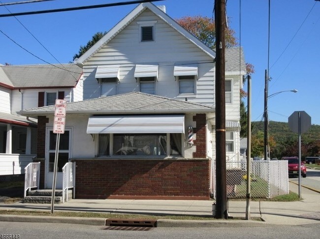
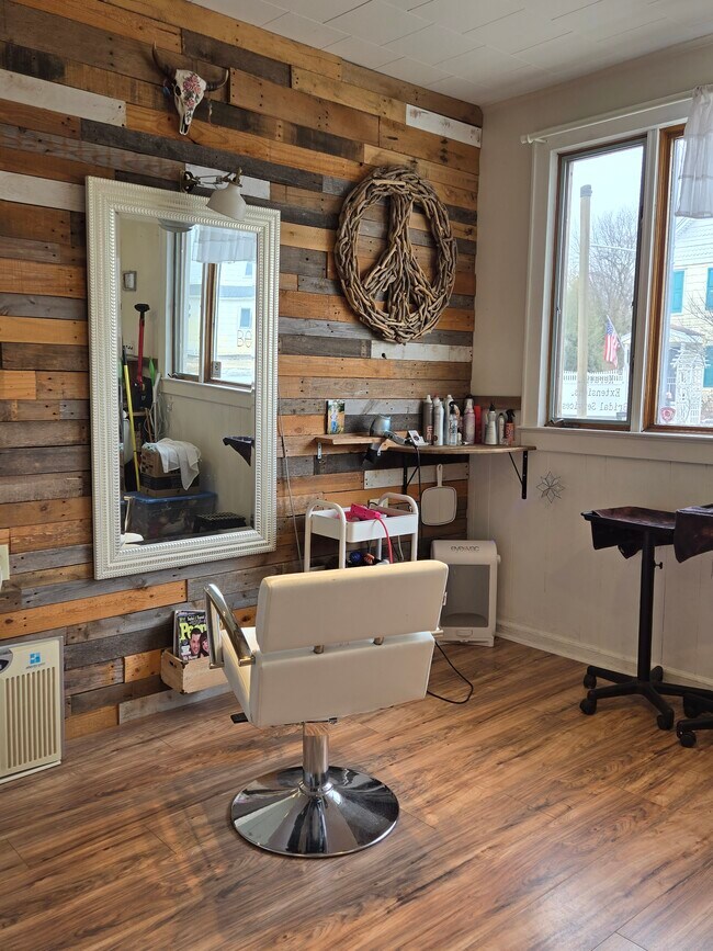
Property Record
930 Ringwood Ave, Haskell, NJ 07420
NEARBY LISTINGS FOR SALE OR LEASE
-
-
-
-
No Photo
-
-
-
-
View all Haskell listings for lease on LoopNet.com
Property Detail
930 Ringwood Ave
New York-Jersey City-White Plains, NY-NJ
Passaic
13-00309-0000-00025
New Jersey
Sfr
0.09 AC
X
Upper Suburban Passaic
34031C0141G
Northern New Jersey
1,564 SF
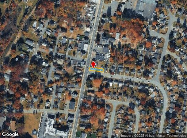
DEMOGRAPHICS near 930 Ringwood Ave
1 Mile
3 Mile
5 Mile
2024 Total Population
6,400
35,447
99,179
2029 Population
6,328
35,132
98,637
Pop Growth 2024-2029
(1.13%)
(0.89%)
(0.55%)
Average Age
48
43
43
2024 Total Households
2,576
13,535
36,796
HH Growth 2024-2029
(1.20%)
(1.04%)
(0.74%)
Median Household Inc
$102,239
$107,120
$118,831
Avg Household Size
2.40
2.60
2.60
2024 Avg HH Vehicles
2.00
2.00
2.00
Median Home Value
$331,536
$374,037
$426,251
Median Year Built
1974
1964
1966
Nearby Places
Map Layers
Map Styles
 Street
 Aerial
- Restaurants
- Banks
- Shops
- Fitness
- Groceries
PUBLIC TRANSPORTATION
COMMUTER RAIL
Lincoln Park (Montclair-Boonton Line - NJ Transit Commuter Rail (NJ Transit))
DRIVE
WALK
Distance
Lincoln Park (Montclair-Boonton Line - NJ Transit Commuter Rail (NJ Transit))
14 min
8.5 mi
AIRPORT
Newark Liberty International
DRIVE
WALK
Distance
Newark Liberty International
39 min
32.4 mi
LaGuardia
DRIVE
WALK
Distance
LaGuardia
51 min
36.0 mi
Westchester County
DRIVE
WALK
Distance
Westchester County
60 min
44.9 mi
Freight Ports
Maher Terminal
DRIVE
WALK
Distance
Maher Terminal
47 min
32.2 mi
SALE & LEASE HISTORY
LISTING DATE
SALE/LEASE

Oct 26, 2016
For Lease
Feb 21, 2025
For Lease
Nearby Properties
Address
Land Use
TOTAL SIZE
Lot Size
Zoning
Address
Land Use
TOTAL SIZE
Lot Size
Zoning
Address
Land Use
TOTAL SIZE
Lot Size
Zoning
23.48 AC
Address
Land Use
TOTAL SIZE
Lot Size
Zoning
14.04 AC
B2
Address
Land Use
TOTAL SIZE
Lot Size
Zoning
10.42 AC
B2
Address
Land Use
TOTAL SIZE
Lot Size
Zoning
231.26 AC
PRC
Address
Land Use
TOTAL SIZE
Lot Size
Zoning
7.58 AC
R-4
Address
Land Use
TOTAL SIZE
Lot Size
Zoning
1,675.67 AC
Address
Land Use
TOTAL SIZE
Lot Size
Zoning
Address
Land Use
TOTAL SIZE
Lot Size
Zoning
2.50 AC
B2
Address
Land Use
TOTAL SIZE
Lot Size
Zoning
357,779 SF
16.98 AC
Address
Land Use
TOTAL SIZE
Lot Size
Zoning
434 SF
53.04 AC
I-3
Address
Land Use
TOTAL SIZE
Lot Size
Zoning
4.48 AC
R-6
Address
Land Use
TOTAL SIZE
Lot Size
Zoning
14.40 AC
Address
Land Use
TOTAL SIZE
Lot Size
Zoning
3.43 AC
B2
Address
Land Use
TOTAL SIZE
Lot Size
Zoning
Address
Land Use
TOTAL SIZE
Lot Size
Zoning
44.65 AC
I-3
Address
Land Use
TOTAL SIZE
Lot Size
Zoning
8.33 AC
R-4
Address
Land Use
TOTAL SIZE
Lot Size
Zoning
26.10 AC
R15
Address
Land Use
TOTAL SIZE
Lot Size
Zoning
2.20 AC
B-2
Address
Land Use
TOTAL SIZE
Lot Size
Zoning
5.26 AC
RA3
Address
Land Use
TOTAL SIZE
Lot Size
Zoning
196.40 AC
C
Address
Land Use
TOTAL SIZE
Lot Size
Zoning
2.89 AC
B2
Address
Land Use
TOTAL SIZE
Lot Size
Zoning
4.20 AC
RA3
Address
Land Use
TOTAL SIZE
Lot Size
Zoning
1.28 AC
R-4
Address
Land Use
TOTAL SIZE
Lot Size
Zoning
166 AC
C
Address
Land Use
TOTAL SIZE
Lot Size
Zoning
37 AC
R-20
Address
Land Use
TOTAL SIZE
Lot Size
Zoning
7.97 AC
RA2
Address
Land Use
TOTAL SIZE
Lot Size
Zoning
1,089 SF
2.53 AC
I3
Address
Land Use
TOTAL SIZE
Lot Size
Zoning
1.84 AC
R-1
Address
Land Use
TOTAL SIZE
Lot Size
Zoning
3.03 AC
CO
The World's #1 Commercial Real Estate Marketplace
Connect with us
© 2025 CoStar Group
The information above has been obtained from sources believed reliable. While we do not doubt its accuracy we have not verified it and make no guarantee, warranty or representation about it. It is your responsibility to independently confirm its accuracy and completeness. Any projections, opinions, assumptions, or estimates used are for example only and do not represent the current or future performance of the property. The value of this transaction to you depends on tax and other factors which should be evaluated by your tax, financial, and legal advisors. You and your advisors should conduct a careful, independent investigation of the property to determine to your satisfaction the suitability of the property for your needs.