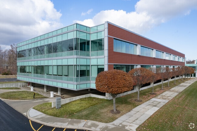
Property Record
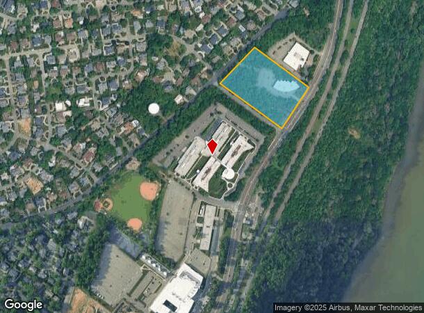
930 Sylvan Ave, Englewood Cliffs, NJ 07632
Current Lease Availabilities
NEARBY LISTINGS FOR SALE OR LEASE
Property Detail
930 Sylvan Ave
16-01201-0000-00009-04
10.447 AC
Commercialnec
Bergen
X
New Jersey
34003C0214H
9.4
2024
10.45 AC
2025
GW Bridge
016000
Northern New Jersey
478 SF
New York-Jersey City-White Plains, NY-NJ
DEMOGRAPHICS near 930 Sylvan Ave
1 Mile
3 Mile
5 Mile
2024 Total Population
3,352
288,619
1,340,163
2029 Population
3,374
276,427
1,272,036
Pop Growth 2024-2029
+ 0.66%
(4.22%)
(5.08%)
Average Age
44
42
39
2024 Total Households
1,148
111,920
485,213
HH Growth 2024-2029
+ 0.52%
(4.70%)
(5.48%)
Median Household Inc
$212,275
$70,168
$54,111
Avg Household Size
2.90
2.50
2.60
2024 Avg HH Vehicles
2.00
1.00
1.00
Median Home Value
$1,100,195
$492,952
$487,377
Median Year Built
1966
1952
1949
Nearby Places
Map Layers
Map Styles
 Street
 Aerial
- Restaurants
- Banks
- Shops
- Fitness
- Groceries
PUBLIC TRANSPORTATION
COMMUTER RAIL
Spuyten Duyvil Station (Hudson Line - Metro-North Commuter Railroad Company (Metro-North))
DRIVE
WALK
Distance
Spuyten Duyvil Station (Hudson Line - Metro-North Commuter Railroad Company (Metro-North))
18 min
9.2 mi
AIRPORT
LaGuardia
DRIVE
WALK
Distance
LaGuardia
28 min
15.0 mi
Newark Liberty International
DRIVE
WALK
Distance
Newark Liberty International
27 min
22.1 mi
Westchester County
DRIVE
WALK
Distance
Westchester County
48 min
31.7 mi
Freight Ports
NY - Red Hook Container Terminal
DRIVE
WALK
Distance
NY - Red Hook Container Terminal
39 min
21.3 mi
Nearby Properties
Address
Land Use
TOTAL SIZE
Lot Size
Zoning
Address
Land Use
TOTAL SIZE
Lot Size
Zoning
1,299,700 SF
29.82 AC
R6
Address
Land Use
TOTAL SIZE
Lot Size
Zoning
111.37 AC
P1
Address
Land Use
TOTAL SIZE
Lot Size
Zoning
24.08 AC
B2-A
Address
Land Use
TOTAL SIZE
Lot Size
Zoning
72 AC
P1
Address
Land Use
TOTAL SIZE
Lot Size
Zoning
572,137 SF
14.11 AC
R-D
Address
Land Use
TOTAL SIZE
Lot Size
Zoning
74,550 SF
11.28 AC
OI
Address
Land Use
TOTAL SIZE
Lot Size
Zoning
1,237,424 SF
21.25 AC
R6
Address
Land Use
TOTAL SIZE
Lot Size
Zoning
219.71 AC
O
Address
Land Use
TOTAL SIZE
Lot Size
Zoning
42.68 AC
P1
Address
Land Use
TOTAL SIZE
Lot Size
Zoning
13.09 AC
C3
Address
Land Use
TOTAL SIZE
Lot Size
Zoning
100,151 SF
22.13 AC
B2
Address
Land Use
TOTAL SIZE
Lot Size
Zoning
39 AC
P1
Address
Land Use
TOTAL SIZE
Lot Size
Zoning
43.65 AC
PARK
Address
Land Use
TOTAL SIZE
Lot Size
Zoning
32 AC
P1
Address
Land Use
TOTAL SIZE
Lot Size
Zoning
15.76 AC
B2
Address
Land Use
TOTAL SIZE
Lot Size
Zoning
259.87 AC
PARK
Address
Land Use
TOTAL SIZE
Lot Size
Zoning
Address
Land Use
TOTAL SIZE
Lot Size
Zoning
393,924 SF
4.50 AC
R7-2
Address
Land Use
TOTAL SIZE
Lot Size
Zoning
12.68 AC
P1
Address
Land Use
TOTAL SIZE
Lot Size
Zoning
4,928 SF
64.19 AC
PARK
Address
Land Use
TOTAL SIZE
Lot Size
Zoning
135.51 AC
RR
Address
Land Use
TOTAL SIZE
Lot Size
Zoning
25 AC
P1
Address
Land Use
TOTAL SIZE
Lot Size
Zoning
367,715 SF
8.28 AC
C3
Address
Land Use
TOTAL SIZE
Lot Size
Zoning
94.42 AC
P
Address
Land Use
TOTAL SIZE
Lot Size
Zoning
Address
Land Use
TOTAL SIZE
Lot Size
Zoning
87,000 SF
455.70 AC
PARK
Address
Land Use
TOTAL SIZE
Lot Size
Zoning
225.36 AC
O
Address
Land Use
TOTAL SIZE
Lot Size
Zoning
450,784 SF
42.36 AC
R4
Address
Land Use
TOTAL SIZE
Lot Size
Zoning
251,884 SF
21.53 AC
R6
Address
Land Use
TOTAL SIZE
Lot Size
Zoning
2.63 AC
OI
The World's #1 Commercial Real Estate Marketplace
Connect with us
© 2026 CoStar Group
The information above has been obtained from sources believed reliable. While we do not doubt its accuracy we have not verified it and make no guarantee, warranty or representation about it. It is your responsibility to independently confirm its accuracy and completeness. Any projections, opinions, assumptions, or estimates used are for example only and do not represent the current or future performance of the property. The value of this transaction to you depends on tax and other factors which should be evaluated by your tax, financial, and legal advisors. You and your advisors should conduct a careful, independent investigation of the property to determine to your satisfaction the suitability of the property for your needs.