Property Record
9300 Valley Childrens Pl, Madera, CA 93636


NEARBY LISTINGS FOR SALE OR LEASE
Property Detail
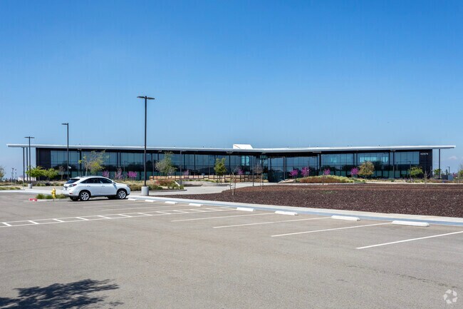
9300 Valley Childrens Pl
Madera, CA
SECS 16 & 17 T12 R20 PM 4282 68/47 PAR 10
049-680-010
Madera
Commercialnec
California
2024
3.74 AC
2025
Outlying Madera County
001100
Fresno
44,747 SF
DEMOGRAPHICS near 9300 Valley Childrens Pl
1 Mile
3 Mile
5 Mile
2024 Total Population
239
33,048
126,865
2029 Population
269
34,279
130,201
Pop Growth 2024-2029
+ 12.55%
+ 3.72%
+ 2.63%
Average Age
42
40
41
2024 Total Households
84
13,167
49,007
HH Growth 2024-2029
+ 11.90%
+ 3.46%
+ 2.55%
Median Household Inc
$147,916
$111,134
$95,222
Avg Household Size
2.90
2.50
2.50
2024 Avg HH Vehicles
2.00
2.00
2.00
Median Home Value
$532,051
$505,420
$431,879
Median Year Built
1999
1991
1988
Nearby Places
Map Layers
Map Styles
 Street
 Aerial
- Restaurants
- Banks
- Shops
- Fitness
- Groceries
PUBLIC TRANSPORTATION
AIRPORT
Fresno Yosemite International
DRIVE
WALK
Distance
Fresno Yosemite International
21 min
13.1 mi
Freight Ports
Port of Stockton
DRIVE
WALK
Distance
Port of Stockton
157 min
124.6 mi
Nearby Properties
Address
Land Use
TOTAL SIZE
Lot Size
Zoning
Address
Land Use
TOTAL SIZE
Lot Size
Zoning
39.39 AC
Address
Land Use
TOTAL SIZE
Lot Size
Zoning
143,370 SF
6.92 AC
CP
Address
Land Use
TOTAL SIZE
Lot Size
Zoning
180,161 SF
10.38 AC
Address
Land Use
TOTAL SIZE
Lot Size
Zoning
119,869 SF
11.08 AC
C1
Address
Land Use
TOTAL SIZE
Lot Size
Zoning
328,887 SF
16.34 AC
R3
Address
Land Use
TOTAL SIZE
Lot Size
Zoning
188,177 SF
5.58 AC
CP
Address
Land Use
TOTAL SIZE
Lot Size
Zoning
181,538 SF
0.01 AC
CP
Address
Land Use
TOTAL SIZE
Lot Size
Zoning
251,904 SF
16.70 AC
SPLIT
Address
Land Use
TOTAL SIZE
Lot Size
Zoning
152,550 SF
9.23 AC
R3
Address
Land Use
TOTAL SIZE
Lot Size
Zoning
105,916 SF
2.61 AC
C6
Address
Land Use
TOTAL SIZE
Lot Size
Zoning
137,094 SF
4.88 AC
CM
Address
Land Use
TOTAL SIZE
Lot Size
Zoning
117,490 SF
0.01 AC
CP
Address
Land Use
TOTAL SIZE
Lot Size
Zoning
122,486 SF
6.24 AC
CP
Address
Land Use
TOTAL SIZE
Lot Size
Zoning
70,678 SF
4.23 AC
Address
Land Use
TOTAL SIZE
Lot Size
Zoning
67,677 SF
4 AC
CP
Address
Land Use
TOTAL SIZE
Lot Size
Zoning
126,286 SF
9.60 AC
C6
Address
Land Use
TOTAL SIZE
Lot Size
Zoning
66,859 SF
1.99 AC
SPLIT
Address
Land Use
TOTAL SIZE
Lot Size
Zoning
42,166 SF
1.63 AC
CM
Address
Land Use
TOTAL SIZE
Lot Size
Zoning
67,677 SF
3.72 AC
CP
Address
Land Use
TOTAL SIZE
Lot Size
Zoning
124,828 SF
5.70 AC
C2
Address
Land Use
TOTAL SIZE
Lot Size
Zoning
210,336 SF
11.97 AC
CP
Address
Land Use
TOTAL SIZE
Lot Size
Zoning
59,711 SF
1.35 AC
C6
Address
Land Use
TOTAL SIZE
Lot Size
Zoning
43,944 SF
3.21 AC
CM
Address
Land Use
TOTAL SIZE
Lot Size
Zoning
71,060 SF
0.01 AC
CP
Address
Land Use
TOTAL SIZE
Lot Size
Zoning
66,476 SF
5.08 AC
CM
Address
Land Use
TOTAL SIZE
Lot Size
Zoning
52,200 SF
3 AC
CP
Address
Land Use
TOTAL SIZE
Lot Size
Zoning
136,597 SF
10.87 AC
CM
The World's #1 Commercial Real Estate Marketplace
Connect with us
© 2025 CoStar Group
The information above has been obtained from sources believed reliable. While we do not doubt its accuracy we have not verified it and make no guarantee, warranty or representation about it. It is your responsibility to independently confirm its accuracy and completeness. Any projections, opinions, assumptions, or estimates used are for example only and do not represent the current or future performance of the property. The value of this transaction to you depends on tax and other factors which should be evaluated by your tax, financial, and legal advisors. You and your advisors should conduct a careful, independent investigation of the property to determine to your satisfaction the suitability of the property for your needs.