Property Record
9301 E Highway 290, Austin, TX 78724
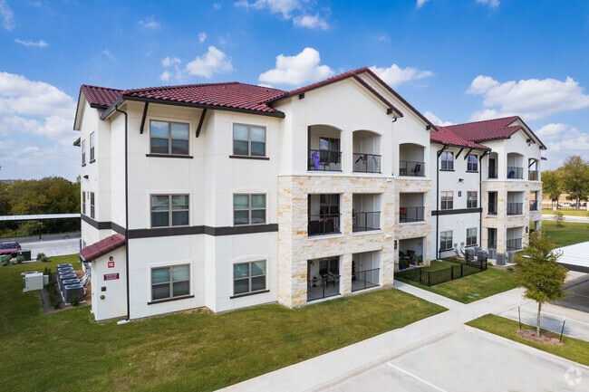


Property Detail
9301 E Highway 290
Austin-Round Rock-San Marcos, TX
LOT 2 HIGH POINT PRESERVE
945875
Travis
Multifamilydwelling
Texas
B and X Area of moderate flood hazard, usually the area between the limits of the 100-year and 500-year floods.
2
0
26.47 AC
2025
Walnut Creek
002201
Austin
376,385 SF
NEARBY LISTINGS FOR SALE OR LEASE
DEMOGRAPHICS near 9301 E Highway 290
1 mile
3 mile
5 mile
2025 Total Population
4,748
70,274
228,291
2030 Population
5,092
74,048
240,730
Pop Growth 2025-2030
+ 7.25%
+ 5.37%
+ 5.45%
Average Age
36
36
36
2025 Total Households
1,588
24,564
88,647
HH Growth 2025-2030
+ 7.62%
+ 5.92%
+ 6.11%
Median Household Inc
$71,058
$77,932
$80,589
Avg Household Size
2.90
2.70
2.50
2025 Avg HH Vehicles
2.00
2.00
2.00
Median Home Value
$394,515
$421,420
$467,273
Median Year Built
2002
1994
1994
Nearby Places
Map Layers
Map Styles
 Street
 Aerial
Transit
 Traffic
 Biking
Places
Listings with unknown addresses are not visible on the map
- Restaurants
- Banks
- Shops
- Fitness
- Groceries
PUBLIC TRANSPORTATION
AIRPORT
Austin-Bergstrom International
Drive
Walk
Distance
Austin-Bergstrom International
27 min
16.2 mi
Freight Ports
Calhoun Port
Drive
Walk
Distance
Calhoun Port
191 min
163.7 mi
Nearby Properties
Address
Land Use
TOTAL SIZE
Lot Size
Zoning
Address
Land Use
TOTAL SIZE
Lot Size
Zoning
372,075 SF
4.97 AC
Address
Land Use
TOTAL SIZE
Lot Size
Zoning
729,000 SF
16.16 AC
Address
Land Use
TOTAL SIZE
Lot Size
Zoning
126.15 AC
Address
Land Use
TOTAL SIZE
Lot Size
Zoning
274,943 SF
42.35 AC
Address
Land Use
TOTAL SIZE
Lot Size
Zoning
769,240 SF
71.87 AC
Address
Land Use
TOTAL SIZE
Lot Size
Zoning
320,797 SF
12.04 AC
Address
Land Use
TOTAL SIZE
Lot Size
Zoning
264,401 SF
10.48 AC
Address
Land Use
TOTAL SIZE
Lot Size
Zoning
277,987 SF
11.01 AC
Address
Land Use
TOTAL SIZE
Lot Size
Zoning
92.83 AC
Address
Land Use
TOTAL SIZE
Lot Size
Zoning
241,800 SF
13.27 AC
Address
Land Use
TOTAL SIZE
Lot Size
Zoning
399,650 SF
22.87 AC
Address
Land Use
TOTAL SIZE
Lot Size
Zoning
326,138 SF
15.95 AC
Address
Land Use
TOTAL SIZE
Lot Size
Zoning
594,000 SF
55.12 AC
Address
Land Use
TOTAL SIZE
Lot Size
Zoning
228,331 SF
13.63 AC
Address
Land Use
TOTAL SIZE
Lot Size
Zoning
336,658 SF
22.91 AC
Address
Land Use
TOTAL SIZE
Lot Size
Zoning
253,578 SF
21.12 AC
Address
Land Use
TOTAL SIZE
Lot Size
Zoning
206,250 SF
6 AC
Address
Land Use
TOTAL SIZE
Lot Size
Zoning
350,341 SF
30.34 AC
Address
Land Use
TOTAL SIZE
Lot Size
Zoning
168,450 SF
8.16 AC
Address
Land Use
TOTAL SIZE
Lot Size
Zoning
272,286 SF
27.02 AC
Address
Land Use
TOTAL SIZE
Lot Size
Zoning
320.84 AC
Address
Land Use
TOTAL SIZE
Lot Size
Zoning
319,535 SF
20.06 AC
Address
Land Use
TOTAL SIZE
Lot Size
Zoning
304,658 SF
15.73 AC
Address
Land Use
TOTAL SIZE
Lot Size
Zoning
4,187 SF
117.72 AC
Address
Land Use
TOTAL SIZE
Lot Size
Zoning
36,000 SF
42 AC
Address
Land Use
TOTAL SIZE
Lot Size
Zoning
235,337 SF
12.21 AC
Address
Land Use
TOTAL SIZE
Lot Size
Zoning
237,896 SF
11.61 AC
Address
Land Use
TOTAL SIZE
Lot Size
Zoning
238,200 SF
23.35 AC
Address
Land Use
TOTAL SIZE
Lot Size
Zoning
244,732 SF
10.77 AC
The World's #1 Commercial Real Estate Marketplace
Connect with us
© 2026 CoStar Group
The information above has been obtained from sources believed reliable. While we do not doubt its accuracy we have not verified it and make no guarantee, warranty or representation about it. It is your responsibility to independently confirm its accuracy and completeness. Any projections, opinions, assumptions, or estimates used are for example only and do not represent the current or future performance of the property. The value of this transaction to you depends on tax and other factors which should be evaluated by your tax, financial, and legal advisors. You and your advisors should conduct a careful, independent investigation of the property to determine to your satisfaction the suitability of the property for your needs.