Property Record
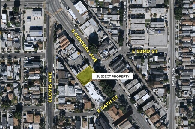
9301 S Central Ave, Los Angeles, CA 90002


NEARBY LISTINGS FOR SALE OR LEASE
Property Detail
9301 S Central Ave
Los Angeles-Long Beach-Glendale, CA
7953
6049-031-012
TRACT # 7953 LOTS 92 AND LOT 93
Commercialacreage
Los Angeles
X
California
06037C1785G
92,93
2024
0.12 AC
2025
Mid-Cities
240700
Los Angeles
DEMOGRAPHICS near 9301 S Central Ave
1 Mile
3 Mile
5 Mile
2024 Total Population
53,073
440,597
990,086
2029 Population
50,553
419,881
937,760
Pop Growth 2024-2029
(4.75%)
(4.70%)
(5.28%)
Average Age
34
35
36
2024 Total Households
12,712
112,014
260,550
HH Growth 2024-2029
(5.25%)
(5.14%)
(5.66%)
Median Household Inc
$50,316
$50,351
$54,966
Avg Household Size
3.90
3.70
3.60
2024 Avg HH Vehicles
2.00
2.00
2.00
Median Home Value
$473,173
$526,816
$579,326
Median Year Built
1951
1953
1953
Nearby Places
Map Layers
Map Styles
 Street
 Aerial
- Restaurants
- Banks
- Shops
- Fitness
- Groceries
PUBLIC TRANSPORTATION
COMMUTER RAIL
Union Station (91 Line - Southern California Regional Rail Authority (Metrolink), Antelope Valley Line - Southern California Regional Rail Authority (Metrolink), Orange County Line - Southern California Regional Rail Authority (Metrolink), Riverside Line - Southern California Regional Rail Authority (Metrolink), San Bernardino Line - Southern California Regional Rail Authority (Metrolink), Ventura County Line - Southern California Regional Rail Authority (Metrolink))
DRIVE
WALK
Distance
Union Station (91 Line - Southern California Regional Rail Authority (Metrolink), Antelope Valley Line - Southern California Regional Rail Authority (Metrolink), Orange County Line - Southern California Regional Rail Authority (Metrolink), Riverside Line - Southern California Regional Rail Authority (Metrolink), San Bernardino Line - Southern California Regional Rail Authority (Metrolink), Ventura County Line - Southern California Regional Rail Authority (Metrolink))
17 min
8.0 mi
Commerce (91 Line - Southern California Regional Rail Authority (Metrolink), Orange County Line - Southern California Regional Rail Authority (Metrolink))
DRIVE
WALK
Distance
Commerce (91 Line - Southern California Regional Rail Authority (Metrolink), Orange County Line - Southern California Regional Rail Authority (Metrolink))
18 min
9.5 mi
AIRPORT
Los Angeles International
DRIVE
WALK
Distance
Los Angeles International
17 min
11.9 mi
Long Beach (Daugherty Field)
DRIVE
WALK
Distance
Long Beach (Daugherty Field)
23 min
13.8 mi
Bob Hope
DRIVE
WALK
Distance
Bob Hope
35 min
25.7 mi
Freight Ports
Port of Long Beach
DRIVE
WALK
Distance
Port of Long Beach
25 min
17.5 mi
SALE & LEASE HISTORY
LISTING DATE
SALE/LEASE

Oct 03, 2024
For Sale
Jan 15, 2025
For Sale
Nearby Properties
Address
Land Use
TOTAL SIZE
Lot Size
Zoning
Address
Land Use
TOTAL SIZE
Lot Size
Zoning
323,368 SF
15.18 AC
LYM*
Address
Land Use
TOTAL SIZE
Lot Size
Zoning
108,598 SF
15.93 AC
LCC3*
Address
Land Use
TOTAL SIZE
Lot Size
Zoning
248,925 SF
10.91 AC
LYCB1*
Address
Land Use
TOTAL SIZE
Lot Size
Zoning
Address
Land Use
TOTAL SIZE
Lot Size
Zoning
37,867 SF
8.32 AC
COMH-B*
Address
Land Use
TOTAL SIZE
Lot Size
Zoning
116,728 SF
0.86 AC
HPCP*
Address
Land Use
TOTAL SIZE
Lot Size
Zoning
63,922 SF
1.82 AC
LCA16000*
Address
Land Use
TOTAL SIZE
Lot Size
Zoning
200,043 SF
8.68 AC
LYM*
Address
Land Use
TOTAL SIZE
Lot Size
Zoning
498,163 SF
11.53 AC
LYM*
Address
Land Use
TOTAL SIZE
Lot Size
Zoning
127,484 SF
7.33 AC
LAM2
Address
Land Use
TOTAL SIZE
Lot Size
Zoning
81,735 SF
4.10 AC
LAR4
Address
Land Use
TOTAL SIZE
Lot Size
Zoning
104,291 SF
7.35 AC
LAR3
Address
Land Use
TOTAL SIZE
Lot Size
Zoning
134,514 SF
1.94 AC
LCM2*
Address
Land Use
TOTAL SIZE
Lot Size
Zoning
103,656 SF
6.98 AC
LCM1
Address
Land Use
TOTAL SIZE
Lot Size
Zoning
293,886 SF
4.98 AC
SGM3
Address
Land Use
TOTAL SIZE
Lot Size
Zoning
111,213 SF
12.04 AC
LAR4
Address
Land Use
TOTAL SIZE
Lot Size
Zoning
101,562 SF
7.53 AC
LAR3
Address
Land Use
TOTAL SIZE
Lot Size
Zoning
74,882 SF
5.25 AC
LYCB1*
Address
Land Use
TOTAL SIZE
Lot Size
Zoning
52,331 SF
4.17 AC
SG
Address
Land Use
TOTAL SIZE
Lot Size
Zoning
102,260 SF
16.84 AC
LAR4
Address
Land Use
TOTAL SIZE
Lot Size
Zoning
155,946 SF
6.58 AC
LYM*
Address
Land Use
TOTAL SIZE
Lot Size
Zoning
90,887 SF
0.94 AC
LCR320U*
Address
Land Use
TOTAL SIZE
Lot Size
Zoning
152,151 SF
3.59 AC
LCM2*
Address
Land Use
TOTAL SIZE
Lot Size
Zoning
61,653 SF
3.47 AC
LYCB1*
Address
Land Use
TOTAL SIZE
Lot Size
Zoning
589,061 SF
19.32 AC
SGM3
Address
Land Use
TOTAL SIZE
Lot Size
Zoning
184,500 SF
3 AC
COML*
Address
Land Use
TOTAL SIZE
Lot Size
Zoning
165,404 SF
1.12 AC
HPDTSP
Address
Land Use
TOTAL SIZE
Lot Size
Zoning
113,733 SF
1.59 AC
LAM2
Address
Land Use
TOTAL SIZE
Lot Size
Zoning
28,390 SF
1.37 AC
HPCG-R1-R3
Address
Land Use
TOTAL SIZE
Lot Size
Zoning
73,360 SF
0.65 AC
HPCG-R3
The World's #1 Commercial Real Estate Marketplace
Connect with us
© 2025 CoStar Group
The information above has been obtained from sources believed reliable. While we do not doubt its accuracy we have not verified it and make no guarantee, warranty or representation about it. It is your responsibility to independently confirm its accuracy and completeness. Any projections, opinions, assumptions, or estimates used are for example only and do not represent the current or future performance of the property. The value of this transaction to you depends on tax and other factors which should be evaluated by your tax, financial, and legal advisors. You and your advisors should conduct a careful, independent investigation of the property to determine to your satisfaction the suitability of the property for your needs.