Property Record
9303 Westgate Blvd, Duluth, MN 55810


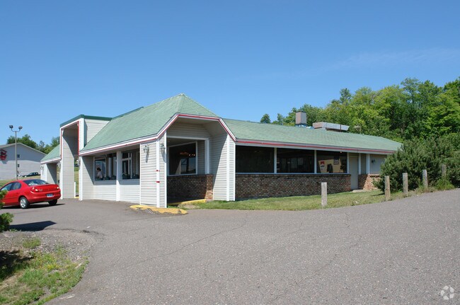
Property Detail
9303 Westgate Blvd
185024001065
WLY 155 FT OF E1/2 OF NE 1/4 OF NE1/4OF SE1/4 EX NLY 154.53 FT OF E1/2 OFOF NE1/4 OF NE1/4 OF SE1/4 SERIAL #
Commercialnec
Saint Louis
B and X Area of moderate flood hazard, usually the area between the limits of the 100-year and 500-year floods.
Minnesota
2026
0.57 AC
2024
South St Louis County
010100
Duluth
6,510 SF
Duluth, MN-WI
NEARBY LISTINGS FOR SALE OR LEASE
-
-
View all Duluth listings for sale on LoopNet.com
DEMOGRAPHICS near 9303 Westgate Blvd
1 mile
3 mile
5 mile
2025 Total Population
1,416
15,443
34,837
2030 Population
1,388
15,164
34,177
Pop Growth 2025-2030
(1.98%)
(1.81%)
(1.89%)
Average Age
45
41
41
2025 Total Households
650
6,649
14,708
HH Growth 2025-2030
(2.31%)
(1.91%)
(2.02%)
Median Household Inc
$63,341
$64,397
$71,386
Avg Household Size
2.10
2.20
2.20
2025 Avg HH Vehicles
2.00
2.00
2.00
Median Home Value
$155,084
$198,719
$218,123
Median Year Built
1983
1949
1951
Nearby Places
Map Layers
Map Styles
 Street
 Aerial
Layers
 Traffic
 Biking
Places
Listings with unknown addresses are not visible on the map
- Restaurants
- Banks
- Shops
- Fitness
- Groceries
PUBLIC TRANSPORTATION
AIRPORT
Duluth International
Drive
Walk
Distance
Duluth International
22 min
9.5 mi
Nearby Properties
Address
Land Use
TOTAL SIZE
Lot Size
Zoning
Address
Land Use
TOTAL SIZE
Lot Size
Zoning
93,584 SF
0.66 AC
Address
Land Use
TOTAL SIZE
Lot Size
Zoning
87,768 SF
2.42 AC
Address
Land Use
TOTAL SIZE
Lot Size
Zoning
429,896 SF
15 AC
Address
Land Use
TOTAL SIZE
Lot Size
Zoning
557,127 SF
37 AC
Address
Land Use
TOTAL SIZE
Lot Size
Zoning
185,313 SF
Address
Land Use
TOTAL SIZE
Lot Size
Zoning
73,973 SF
2.84 AC
Address
Land Use
TOTAL SIZE
Lot Size
Zoning
24,555 SF
1.14 AC
Address
Land Use
TOTAL SIZE
Lot Size
Zoning
71,291 SF
0.61 AC
TND
Address
Land Use
TOTAL SIZE
Lot Size
Zoning
76,000 SF
36.67 AC
Address
Land Use
TOTAL SIZE
Lot Size
Zoning
59,368 SF
0.46 AC
R1C
Address
Land Use
TOTAL SIZE
Lot Size
Zoning
83,290 SF
0.58 AC
C2
Address
Land Use
TOTAL SIZE
Lot Size
Zoning
24,873 SF
73.59 AC
Address
Land Use
TOTAL SIZE
Lot Size
Zoning
38,160 SF
2.28 AC
Address
Land Use
TOTAL SIZE
Lot Size
Zoning
38,160 SF
1.97 AC
Address
Land Use
TOTAL SIZE
Lot Size
Zoning
44,004 SF
1.66 AC
C2
Address
Land Use
TOTAL SIZE
Lot Size
Zoning
66,848 SF
1.31 AC
Address
Land Use
TOTAL SIZE
Lot Size
Zoning
52,152 SF
0.29 AC
Address
Land Use
TOTAL SIZE
Lot Size
Zoning
48,528 SF
3.42 AC
Address
Land Use
TOTAL SIZE
Lot Size
Zoning
68,714 SF
3.99 AC
Address
Land Use
TOTAL SIZE
Lot Size
Zoning
41,458 SF
1.97 AC
Address
Land Use
TOTAL SIZE
Lot Size
Zoning
20,320 SF
1.85 AC
Address
Land Use
TOTAL SIZE
Lot Size
Zoning
8,428 SF
40 AC
Address
Land Use
TOTAL SIZE
Lot Size
Zoning
69,293 SF
1.22 AC
R3
Address
Land Use
TOTAL SIZE
Lot Size
Zoning
758 SF
1.15 AC
Address
Land Use
TOTAL SIZE
Lot Size
Zoning
32,760 SF
2.21 AC
Address
Land Use
TOTAL SIZE
Lot Size
Zoning
18,950 SF
0.46 AC
Address
Land Use
TOTAL SIZE
Lot Size
Zoning
42,500 SF
1.51 AC
Address
Land Use
TOTAL SIZE
Lot Size
Zoning
61,800 SF
2.28 AC
Address
Land Use
TOTAL SIZE
Lot Size
Zoning
6,486 SF
0.14 AC
Address
Land Use
TOTAL SIZE
Lot Size
Zoning
5,696 SF
3.70 AC
C2
The World's #1 Commercial Real Estate Marketplace
Connect with us
© 2026 CoStar Group
The information above has been obtained from sources believed reliable. While we do not doubt its accuracy we have not verified it and make no guarantee, warranty or representation about it. It is your responsibility to independently confirm its accuracy and completeness. Any projections, opinions, assumptions, or estimates used are for example only and do not represent the current or future performance of the property. The value of this transaction to you depends on tax and other factors which should be evaluated by your tax, financial, and legal advisors. You and your advisors should conduct a careful, independent investigation of the property to determine to your satisfaction the suitability of the property for your needs.