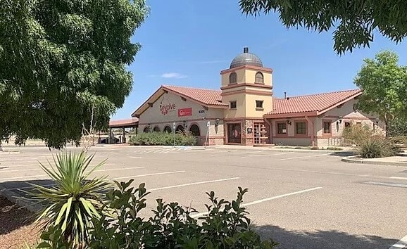
Property Record
9305 N Loop Dr, El Paso, TX 79907

Property Detail
9305 N Loop Dr
L217-999-0010-0200
1 LE BARRON PARK WLY PT OF 1 BEG 35.37 FT SE OF SWC (C339.08 FT ON WLY-218.92 FT ON NLY-335.90 FT ON ELY-IRREG ON SLY) (65340 SQ FT)
Commercialnec
El Paso
C1S
Texas
B and X Area of moderate flood hazard, usually the area between the limits of the 100-year and 500-year floods.
1.50 AC
2024
East
2025
El Paso
004004
El Paso, TX
5,492 SF
NEARBY LISTINGS FOR SALE OR LEASE
DEMOGRAPHICS near 9305 N Loop Dr
1 mile
3 mile
5 mile
2025 Total Population
14,917
72,649
187,784
2030 Population
14,953
73,067
189,929
Pop Growth 2025-2030
+ 0.24%
+ 0.58%
+ 1.14%
Average Age
39
39
38
2025 Total Households
5,185
24,400
63,186
HH Growth 2025-2030
+ 0.33%
+ 0.60%
+ 1.10%
Median Household Inc
$43,305
$50,645
$57,267
Avg Household Size
2.80
2.90
2.90
2025 Avg HH Vehicles
2.00
2.00
2.00
Median Home Value
$141,901
$154,100
$179,558
Median Year Built
1983
1986
1987
Nearby Places
Map Layers
Map Styles
 Street
 Aerial
Transit
 Traffic
 Biking
Places
Listings with unknown addresses are not visible on the map
- Restaurants
- Banks
- Shops
- Fitness
- Groceries
PUBLIC TRANSPORTATION
AIRPORT
El Paso International
Drive
Walk
Distance
El Paso International
27 min
12.5 mi
SALE & LEASE HISTORY
LISTING DATE
SALE/LEASE

Sep 24, 2016
For Sale
Nearby Properties
Address
Land Use
TOTAL SIZE
Lot Size
Zoning
Address
Land Use
TOTAL SIZE
Lot Size
Zoning
770,870 SF
44.65 AC
Address
Land Use
TOTAL SIZE
Lot Size
Zoning
799,095 SF
52.29 AC
Address
Land Use
TOTAL SIZE
Lot Size
Zoning
393,206 SF
66.48 AC
SU
Address
Land Use
TOTAL SIZE
Lot Size
Zoning
260,501 SF
14.05 AC
A2
Address
Land Use
TOTAL SIZE
Lot Size
Zoning
463,000 SF
24.75 AC
C4
Address
Land Use
TOTAL SIZE
Lot Size
Zoning
123,306 SF
53.62 AC
M1
Address
Land Use
TOTAL SIZE
Lot Size
Zoning
366,600 SF
21.24 AC
Address
Land Use
TOTAL SIZE
Lot Size
Zoning
89,251 SF
9.39 AC
AM
Address
Land Use
TOTAL SIZE
Lot Size
Zoning
400,929 SF
30.05 AC
Address
Land Use
TOTAL SIZE
Lot Size
Zoning
80,049 SF
8.90 AC
C4
Address
Land Use
TOTAL SIZE
Lot Size
Zoning
652,080 SF
32.64 AC
Address
Land Use
TOTAL SIZE
Lot Size
Zoning
118,114 SF
13.80 AC
C4S
Address
Land Use
TOTAL SIZE
Lot Size
Zoning
656,540 SF
36.94 AC
M1S
Address
Land Use
TOTAL SIZE
Lot Size
Zoning
166,671 SF
24.61 AC
C4S
Address
Land Use
TOTAL SIZE
Lot Size
Zoning
334,161 SF
20.28 AC
Address
Land Use
TOTAL SIZE
Lot Size
Zoning
230,263 SF
27.25 AC
C3S
Address
Land Use
TOTAL SIZE
Lot Size
Zoning
321,764 SF
18.61 AC
C4
Address
Land Use
TOTAL SIZE
Lot Size
Zoning
209,006 SF
18.18 AC
C4
Address
Land Use
TOTAL SIZE
Lot Size
Zoning
274,580 SF
13.86 AC
C4S
Address
Land Use
TOTAL SIZE
Lot Size
Zoning
230,152 SF
14.09 AC
C4S
Address
Land Use
TOTAL SIZE
Lot Size
Zoning
179,391 SF
8.23 AC
SD
Address
Land Use
TOTAL SIZE
Lot Size
Zoning
180,139 SF
24.81 AC
Address
Land Use
TOTAL SIZE
Lot Size
Zoning
246,136 SF
14.33 AC
Address
Land Use
TOTAL SIZE
Lot Size
Zoning
246,136 SF
15.68 AC
Address
Land Use
TOTAL SIZE
Lot Size
Zoning
110,080 SF
10.36 AC
Address
Land Use
TOTAL SIZE
Lot Size
Zoning
347,235 SF
33.50 AC
A2
Address
Land Use
TOTAL SIZE
Lot Size
Zoning
111,558 SF
16.25 AC
C4
Address
Land Use
TOTAL SIZE
Lot Size
Zoning
215,378 SF
9.60 AC
M1
Address
Land Use
TOTAL SIZE
Lot Size
Zoning
281,279 SF
14.74 AC
C4
Address
Land Use
TOTAL SIZE
Lot Size
Zoning
377,504 SF
24.32 AC
C4S
The World's #1 Commercial Real Estate Marketplace
Connect with us
© 2026 CoStar Group
The information above has been obtained from sources believed reliable. While we do not doubt its accuracy we have not verified it and make no guarantee, warranty or representation about it. It is your responsibility to independently confirm its accuracy and completeness. Any projections, opinions, assumptions, or estimates used are for example only and do not represent the current or future performance of the property. The value of this transaction to you depends on tax and other factors which should be evaluated by your tax, financial, and legal advisors. You and your advisors should conduct a careful, independent investigation of the property to determine to your satisfaction the suitability of the property for your needs.