Property Record
931 Mcpherson Ave, Cincinnati, OH 45205
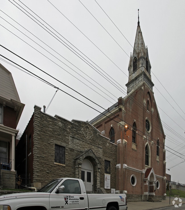

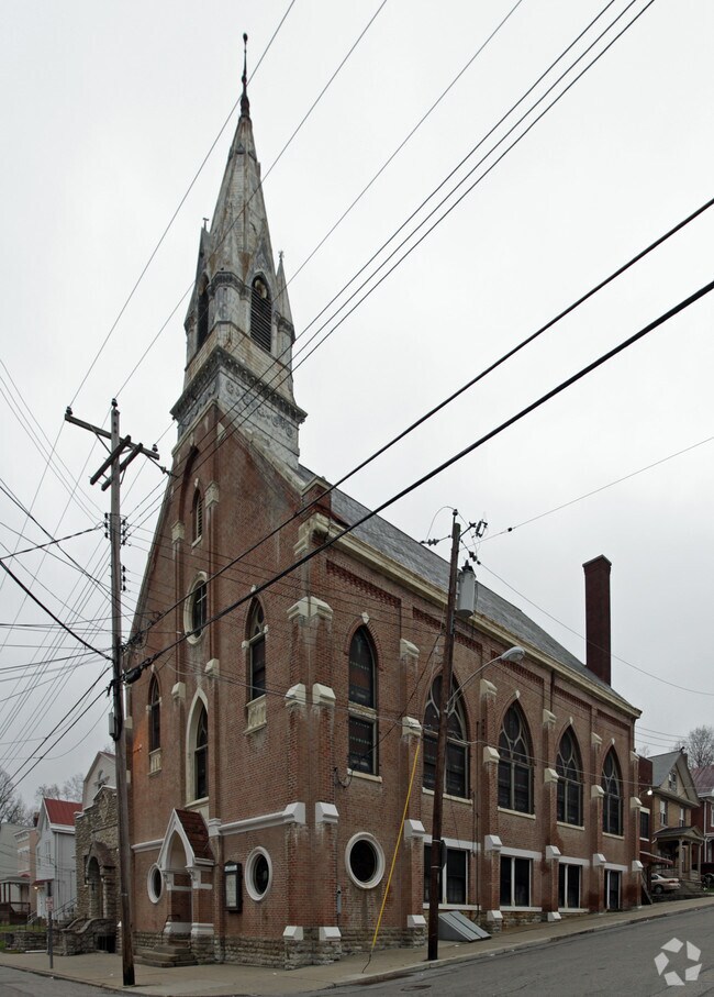
Property Detail
931 Mcpherson Ave
176-0022-0091
MCPHERSON AVE FT IRR LOTS 10-54-57 GLEN GROVE SUB PARS 91-92-151 CONS
Religious
HAMILTON
SF2
Ohio
B and X Area of moderate flood hazard, usually the area between the limits of the 100-year and 500-year floods.
10-54
2025
0.08 AC
2025
Queensgate
009500
Cincinnati/Dayton
10,040 SF
Cincinnati, OH-KY-IN
NEARBY LISTINGS FOR SALE OR LEASE
DEMOGRAPHICS near 931 Mcpherson Ave
1 mile
3 mile
5 mile
2025 Total Population
20,089
119,151
311,652
2030 Population
20,438
121,754
318,976
Pop Growth 2025-2030
+ 1.74%
+ 2.18%
+ 2.35%
Average Age
35
37
37
2025 Total Households
7,751
49,716
134,894
HH Growth 2025-2030
+ 1.81%
+ 2.35%
+ 2.53%
Median Household Inc
$46,416
$49,863
$58,706
Avg Household Size
2.40
2.30
2.10
2025 Avg HH Vehicles
1.00
1.00
1.00
Median Home Value
$110,047
$177,420
$226,988
Median Year Built
1948
1956
1956
Nearby Places
Map Layers
Map Styles
 Street
 Aerial
Layers
 Traffic
 Biking
Places
Listings with unknown addresses are not visible on the map
- Restaurants
- Banks
- Shops
- Fitness
- Groceries
PUBLIC TRANSPORTATION
COMMUTER RAIL
Drive
Walk
Distance
9 min
3.1 mi
AIRPORT
Cincinnati/Northern Kentucky International
Drive
Walk
Distance
Cincinnati/Northern Kentucky International
27 min
14.9 mi
Nearby Properties
Address
Land Use
TOTAL SIZE
Lot Size
Zoning
Address
Land Use
TOTAL SIZE
Lot Size
Zoning
11.82 AC
Address
Land Use
TOTAL SIZE
Lot Size
Zoning
11.62 AC
Address
Land Use
TOTAL SIZE
Lot Size
Zoning
3.09 AC
Address
Land Use
TOTAL SIZE
Lot Size
Zoning
9,962 SF
712 AC
Address
Land Use
TOTAL SIZE
Lot Size
Zoning
28,160 SF
1 AC
DD
Address
Land Use
TOTAL SIZE
Lot Size
Zoning
9.38 AC
PR
Address
Land Use
TOTAL SIZE
Lot Size
Zoning
Address
Land Use
TOTAL SIZE
Lot Size
Zoning
3 AC
DD
Address
Land Use
TOTAL SIZE
Lot Size
Zoning
3.27 AC
CCA
Address
Land Use
TOTAL SIZE
Lot Size
Zoning
23.05 AC
Address
Land Use
TOTAL SIZE
Lot Size
Zoning
2.51 AC
MG
Address
Land Use
TOTAL SIZE
Lot Size
Zoning
8.18 AC
SF4
Address
Land Use
TOTAL SIZE
Lot Size
Zoning
77,628 SF
2.18 AC
Address
Land Use
TOTAL SIZE
Lot Size
Zoning
13.44 AC
Address
Land Use
TOTAL SIZE
Lot Size
Zoning
50,350 SF
15.41 AC
MG
Address
Land Use
TOTAL SIZE
Lot Size
Zoning
1.47 AC
Address
Land Use
TOTAL SIZE
Lot Size
Zoning
2.16 AC
MG
Address
Land Use
TOTAL SIZE
Lot Size
Zoning
414,133 SF
4.07 AC
RMX
Address
Land Use
TOTAL SIZE
Lot Size
Zoning
0.93 AC
Address
Land Use
TOTAL SIZE
Lot Size
Zoning
374,644 SF
0.68 AC
DD
Address
Land Use
TOTAL SIZE
Lot Size
Zoning
1.73 AC
RM12
Address
Land Use
TOTAL SIZE
Lot Size
Zoning
46,464 SF
1.66 AC
Address
Land Use
TOTAL SIZE
Lot Size
Zoning
148,769 SF
0.37 AC
DD
Address
Land Use
TOTAL SIZE
Lot Size
Zoning
12,564 SF
0.98 AC
CCP
Address
Land Use
TOTAL SIZE
Lot Size
Zoning
2,496 SF
0.69 AC
DD
Address
Land Use
TOTAL SIZE
Lot Size
Zoning
Address
Land Use
TOTAL SIZE
Lot Size
Zoning
6,537 SF
12.55 AC
Address
Land Use
TOTAL SIZE
Lot Size
Zoning
61,192 SF
1.26 AC
Address
Land Use
TOTAL SIZE
Lot Size
Zoning
143,083 SF
1.82 AC
DD
Address
Land Use
TOTAL SIZE
Lot Size
Zoning
111,020 SF
2.11 AC
The World's #1 Commercial Real Estate Marketplace
Connect with us
© 2026 CoStar Group
The information above has been obtained from sources believed reliable. While we do not doubt its accuracy we have not verified it and make no guarantee, warranty or representation about it. It is your responsibility to independently confirm its accuracy and completeness. Any projections, opinions, assumptions, or estimates used are for example only and do not represent the current or future performance of the property. The value of this transaction to you depends on tax and other factors which should be evaluated by your tax, financial, and legal advisors. You and your advisors should conduct a careful, independent investigation of the property to determine to your satisfaction the suitability of the property for your needs.