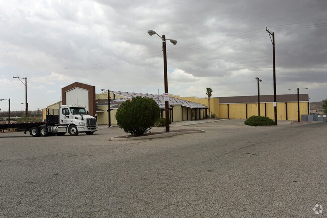
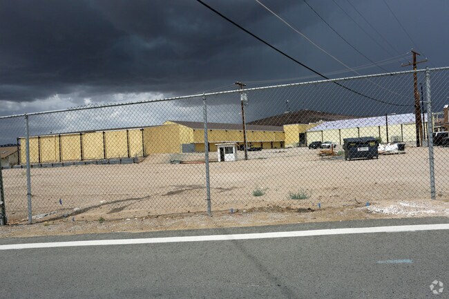
Property Record
931 W Main St, Barstow, CA 92311

NEARBY LISTINGS FOR SALE OR LEASE
Property Detail
931 W Main St
0182-061-20
PARCEL MAP 9937 PARCEL 4 BOOK 147 PAGE 30
Storebuilding
San Bernardino
X
California
06071C3918J
8.99 AC
2024
Mojave River Valley
2025
Inland Empire (California)
0094001015
Riverside-San Bernardino-Ontario, CA
16,443 SF
DEMOGRAPHICS near 931 W Main St
1 Mile
3 Mile
5 Mile
2024 Total Population
5,443
31,590
37,436
2029 Population
5,659
32,648
38,737
Pop Growth 2024-2029
+ 3.97%
+ 3.35%
+ 3.48%
Average Age
34
35
35
2024 Total Households
1,953
10,977
12,917
HH Growth 2024-2029
+ 4.05%
+ 3.38%
+ 3.49%
Median Household Inc
$34,445
$52,318
$53,674
Avg Household Size
2.70
2.80
2.80
2024 Avg HH Vehicles
1.00
2.00
2.00
Median Home Value
$149,702
$174,873
$165,180
Median Year Built
1959
1972
1973
Nearby Places
Map Layers
Map Styles
 Street
 Aerial
- Restaurants
- Banks
- Shops
- Fitness
- Groceries
PUBLIC TRANSPORTATION
COMMUTER RAIL
Barstow (Southwest Chief - Amtrak)
DRIVE
WALK
Distance
Barstow (Southwest Chief - Amtrak)
3 min
1.4 mi
Freight Ports
Port of Long Beach
DRIVE
WALK
Distance
Port of Long Beach
148 min
127.9 mi
SALE & LEASE HISTORY
LISTING DATE
SALE/LEASE

Sep 25, 2016
For Lease
Jan 23, 2017
For Lease
Nearby Properties
Address
Land Use
TOTAL SIZE
Lot Size
Zoning
Address
Land Use
TOTAL SIZE
Lot Size
Zoning
82,869 SF
19.81 AC
Address
Land Use
TOTAL SIZE
Lot Size
Zoning
187,036 SF
21.12 AC
Address
Land Use
TOTAL SIZE
Lot Size
Zoning
115,000 SF
6.15 AC
Address
Land Use
TOTAL SIZE
Lot Size
Zoning
88,060 SF
6.04 AC
Address
Land Use
TOTAL SIZE
Lot Size
Zoning
123,706 SF
13.95 AC
Address
Land Use
TOTAL SIZE
Lot Size
Zoning
93,225 SF
10.10 AC
Address
Land Use
TOTAL SIZE
Lot Size
Zoning
80,658 SF
7.18 AC
Address
Land Use
TOTAL SIZE
Lot Size
Zoning
36,502 SF
1.69 AC
Address
Land Use
TOTAL SIZE
Lot Size
Zoning
125,847 SF
9.74 AC
Address
Land Use
TOTAL SIZE
Lot Size
Zoning
96,403 SF
5.24 AC
Address
Land Use
TOTAL SIZE
Lot Size
Zoning
4,247 SF
8.77 AC
Address
Land Use
TOTAL SIZE
Lot Size
Zoning
65,367 SF
7.49 AC
Address
Land Use
TOTAL SIZE
Lot Size
Zoning
70,580 SF
6.06 AC
Address
Land Use
TOTAL SIZE
Lot Size
Zoning
65,464 SF
3.81 AC
Address
Land Use
TOTAL SIZE
Lot Size
Zoning
44,788 SF
3.39 AC
Address
Land Use
TOTAL SIZE
Lot Size
Zoning
32,832 SF
3.40 AC
Address
Land Use
TOTAL SIZE
Lot Size
Zoning
30,380 SF
2.79 AC
Address
Land Use
TOTAL SIZE
Lot Size
Zoning
83,880 SF
5.71 AC
Address
Land Use
TOTAL SIZE
Lot Size
Zoning
64,728 SF
4.50 AC
Address
Land Use
TOTAL SIZE
Lot Size
Zoning
7,808 SF
117.11 AC
RL10AP
Address
Land Use
TOTAL SIZE
Lot Size
Zoning
48,910 SF
2.60 AC
Address
Land Use
TOTAL SIZE
Lot Size
Zoning
80,885 SF
3.09 AC
Address
Land Use
TOTAL SIZE
Lot Size
Zoning
6,691 SF
0.67 AC
Address
Land Use
TOTAL SIZE
Lot Size
Zoning
31,148 SF
2.05 AC
Address
Land Use
TOTAL SIZE
Lot Size
Zoning
14,798 SF
1.93 AC
RS1
Address
Land Use
TOTAL SIZE
Lot Size
Zoning
672 SF
4.61 AC
Address
Land Use
TOTAL SIZE
Lot Size
Zoning
16,498 SF
3.62 AC
Address
Land Use
TOTAL SIZE
Lot Size
Zoning
3,642 SF
1.23 AC
Address
Land Use
TOTAL SIZE
Lot Size
Zoning
2,516 SF
0.78 AC
Address
Land Use
TOTAL SIZE
Lot Size
Zoning
17,322 SF
2.12 AC
The World's #1 Commercial Real Estate Marketplace
Connect with us
© 2025 CoStar Group
The information above has been obtained from sources believed reliable. While we do not doubt its accuracy we have not verified it and make no guarantee, warranty or representation about it. It is your responsibility to independently confirm its accuracy and completeness. Any projections, opinions, assumptions, or estimates used are for example only and do not represent the current or future performance of the property. The value of this transaction to you depends on tax and other factors which should be evaluated by your tax, financial, and legal advisors. You and your advisors should conduct a careful, independent investigation of the property to determine to your satisfaction the suitability of the property for your needs.