Property Record
9318 Sprinkle Rd, Austin, TX 78754
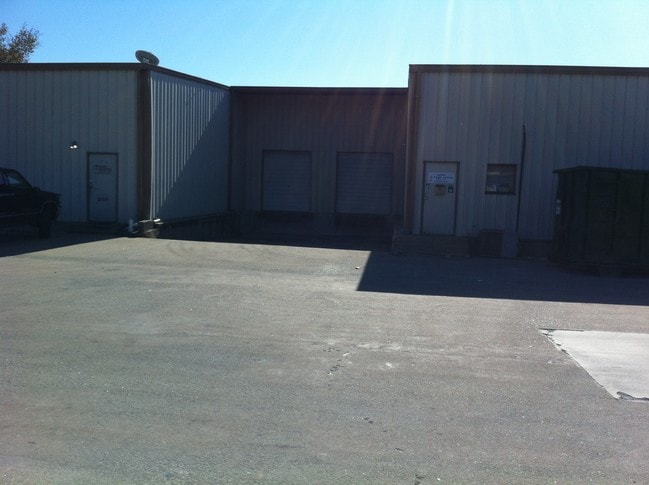

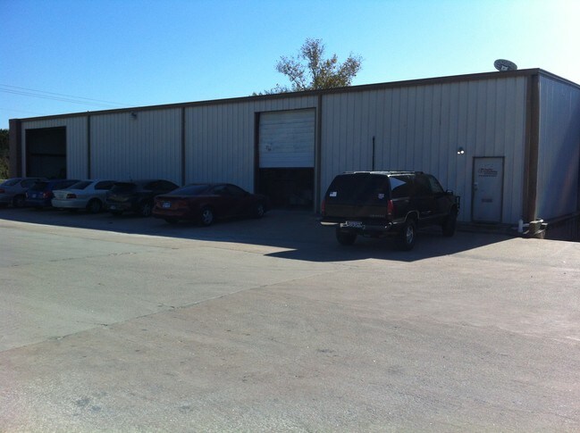
Property Detail
9318 Sprinkle Rd
238560
ABS 675 SUR 31 RICE J O ACR 3.670
Industrialgeneral
Travis
B and X Area of moderate flood hazard, usually the area between the limits of the 100-year and 500-year floods.
Texas
2025
3.67 AC
2025
Northeast
043500
Austin
21,586 SF
Austin-Round Rock-San Marcos, TX
NEARBY LISTINGS FOR SALE OR LEASE
DEMOGRAPHICS near 9318 Sprinkle Rd
1 mile
3 mile
5 mile
2024 Total Population
3,899
103,225
286,693
2029 Population
4,220
108,129
302,065
Pop Growth 2024-2029
+ 8.23%
+ 4.75%
+ 5.36%
Average Age
37
36
36
2024 Total Households
1,652
38,717
117,324
HH Growth 2024-2029
+ 8.47%
+ 5.41%
+ 6.02%
Median Household Inc
$108,979
$68,651
$79,511
Avg Household Size
2.40
2.50
2.30
2024 Avg HH Vehicles
2.00
2.00
2.00
Median Home Value
$385,112
$416,858
$482,048
Median Year Built
2010
1987
1993
Nearby Places
Map Layers
Map Styles
 Street
 Aerial
Transit
 Traffic
 Biking
Places
Listings with unknown addresses are not visible on the map
- Restaurants
- Banks
- Shops
- Fitness
- Groceries
PUBLIC TRANSPORTATION
COMMUTER RAIL
Austin (Texas Eagle - Amtrak)
Drive
Walk
Distance
Austin (Texas Eagle - Amtrak)
18 min
10.0 mi
AIRPORT
Austin-Bergstrom International
Drive
Walk
Distance
Austin-Bergstrom International
28 min
16.2 mi
Freight Ports
Calhoun Port
Drive
Walk
Distance
Calhoun Port
194 min
159.7 mi
SALE & LEASE HISTORY
LISTING DATE
SALE/LEASE

Oct 17, 2016
For Lease
Nearby Properties
Address
Land Use
TOTAL SIZE
Lot Size
Zoning
Address
Land Use
TOTAL SIZE
Lot Size
Zoning
372,075 SF
4.97 AC
Address
Land Use
TOTAL SIZE
Lot Size
Zoning
729,000 SF
16.16 AC
Address
Land Use
TOTAL SIZE
Lot Size
Zoning
348,496 SF
17.59 AC
Address
Land Use
TOTAL SIZE
Lot Size
Zoning
398,475 SF
35.14 AC
Address
Land Use
TOTAL SIZE
Lot Size
Zoning
379,500 SF
17.99 AC
Address
Land Use
TOTAL SIZE
Lot Size
Zoning
274,943 SF
42.35 AC
Address
Land Use
TOTAL SIZE
Lot Size
Zoning
459,304 SF
28.36 AC
Address
Land Use
TOTAL SIZE
Lot Size
Zoning
752,804 SF
180.91 AC
Address
Land Use
TOTAL SIZE
Lot Size
Zoning
376,385 SF
26.47 AC
Address
Land Use
TOTAL SIZE
Lot Size
Zoning
384,776 SF
22.88 AC
Address
Land Use
TOTAL SIZE
Lot Size
Zoning
769,240 SF
71.87 AC
Address
Land Use
TOTAL SIZE
Lot Size
Zoning
264,401 SF
10.48 AC
Address
Land Use
TOTAL SIZE
Lot Size
Zoning
254,796 SF
11.29 AC
Address
Land Use
TOTAL SIZE
Lot Size
Zoning
277,987 SF
11.01 AC
Address
Land Use
TOTAL SIZE
Lot Size
Zoning
400,630 SF
15.30 AC
Address
Land Use
TOTAL SIZE
Lot Size
Zoning
241,800 SF
13.27 AC
Address
Land Use
TOTAL SIZE
Lot Size
Zoning
261,594 SF
6.66 AC
Address
Land Use
TOTAL SIZE
Lot Size
Zoning
331,943 SF
22.87 AC
Address
Land Use
TOTAL SIZE
Lot Size
Zoning
326,138 SF
15.95 AC
Address
Land Use
TOTAL SIZE
Lot Size
Zoning
594,000 SF
55.12 AC
Address
Land Use
TOTAL SIZE
Lot Size
Zoning
316,064 SF
18.98 AC
Address
Land Use
TOTAL SIZE
Lot Size
Zoning
336,658 SF
22.91 AC
Address
Land Use
TOTAL SIZE
Lot Size
Zoning
350,341 SF
30.34 AC
Address
Land Use
TOTAL SIZE
Lot Size
Zoning
297,000 SF
16.85 AC
Address
Land Use
TOTAL SIZE
Lot Size
Zoning
168,450 SF
8.16 AC
Address
Land Use
TOTAL SIZE
Lot Size
Zoning
138,338 SF
12.52 AC
Address
Land Use
TOTAL SIZE
Lot Size
Zoning
272,286 SF
27.02 AC
Address
Land Use
TOTAL SIZE
Lot Size
Zoning
320.84 AC
Address
Land Use
TOTAL SIZE
Lot Size
Zoning
289,982 SF
21.01 AC
Address
Land Use
TOTAL SIZE
Lot Size
Zoning
2,326,880 SF
180.02 AC
The World's #1 Commercial Real Estate Marketplace
Connect with us
© 2026 CoStar Group
The information above has been obtained from sources believed reliable. While we do not doubt its accuracy we have not verified it and make no guarantee, warranty or representation about it. It is your responsibility to independently confirm its accuracy and completeness. Any projections, opinions, assumptions, or estimates used are for example only and do not represent the current or future performance of the property. The value of this transaction to you depends on tax and other factors which should be evaluated by your tax, financial, and legal advisors. You and your advisors should conduct a careful, independent investigation of the property to determine to your satisfaction the suitability of the property for your needs.