Property Record
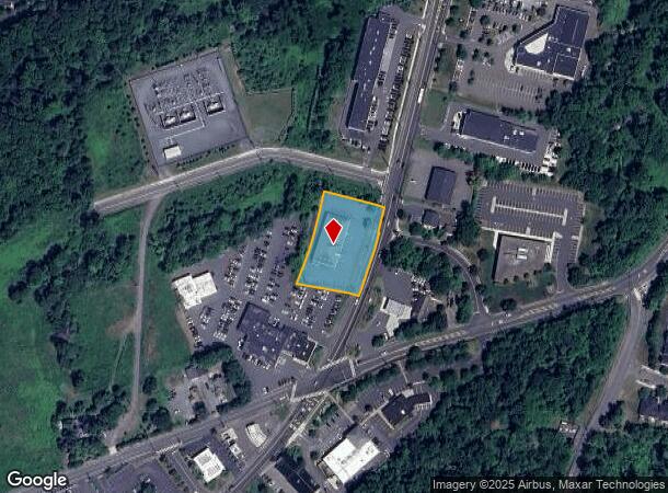
932 State Rd, Princeton, NJ 08540
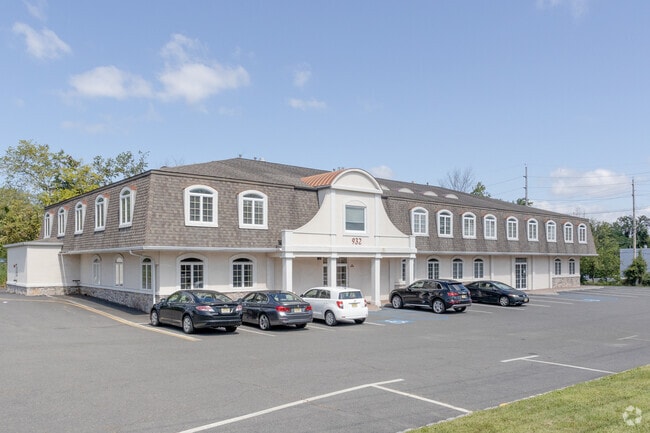
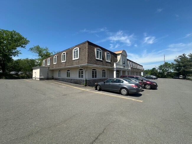
This Property Is For Sale
NEARBY LISTINGS FOR SALE OR LEASE
Property Detail
932 State Rd
13-34001-0000-00073
Somerset
Commercialnec
New Jersey
X
73
34035C0244F
1.09 AC
2024
Princeton North
2025
Northern New Jersey
004203
Newark, NJ-PA
DEMOGRAPHICS near 932 State Rd
1 Mile
3 Mile
5 Mile
2024 Total Population
5,665
31,470
77,259
2029 Population
5,597
31,411
77,268
Pop Growth 2024-2029
(1.20%)
(0.19%)
+ 0.01%
Average Age
43
42
41
2024 Total Households
2,155
11,821
27,334
HH Growth 2024-2029
(1.48%)
(0.38%)
+ 0.02%
Median Household Inc
$154,167
$167,851
$171,759
Avg Household Size
2.50
2.60
2.70
2024 Avg HH Vehicles
2.00
2.00
2.00
Median Home Value
$535,298
$737,741
$723,751
Median Year Built
1993
1982
1986
Nearby Places
- Restaurants
- Banks
- Shops
- Fitness
- Groceries
PUBLIC TRANSPORTATION
COMMUTER RAIL
Princeton (Princeton Branch - NJ Transit Commuter Rail (NJ Transit))
DRIVE
WALK
Distance
Princeton (Princeton Branch - NJ Transit Commuter Rail (NJ Transit))
9 min
3.9 mi
Princeton Junction (Northeast Corridor Line - NJ Transit Commuter Rail (NJ Transit), Princeton Branch - NJ Transit Commuter Rail (NJ Transit))
DRIVE
WALK
Distance
Princeton Junction (Northeast Corridor Line - NJ Transit Commuter Rail (NJ Transit), Princeton Branch - NJ Transit Commuter Rail (NJ Transit))
15 min
6.5 mi
AIRPORT
Trenton Mercer
DRIVE
WALK
Distance
Trenton Mercer
30 min
15.8 mi
Newark Liberty International
DRIVE
WALK
Distance
Newark Liberty International
62 min
41.4 mi
Freight Ports
New York Container Terminal
DRIVE
WALK
Distance
New York Container Terminal
57 min
36.5 mi
Nearby Properties
Address
Land Use
TOTAL SIZE
Lot Size
Zoning
Address
Land Use
TOTAL SIZE
Lot Size
Zoning
24.85 AC
E
Address
Land Use
TOTAL SIZE
Lot Size
Zoning
265,000 SF
4.84 AC
Address
Land Use
TOTAL SIZE
Lot Size
Zoning
23.64 AC
PMUD
Address
Land Use
TOTAL SIZE
Lot Size
Zoning
8.97 AC
HMC
Address
Land Use
TOTAL SIZE
Lot Size
Zoning
44.62 AC
R5A
Address
Land Use
TOTAL SIZE
Lot Size
Zoning
115,000 SF
7.98 AC
OR2
Address
Land Use
TOTAL SIZE
Lot Size
Zoning
405,811 SF
4.14 AC
Address
Land Use
TOTAL SIZE
Lot Size
Zoning
216,000 SF
22.79 AC
SC
Address
Land Use
TOTAL SIZE
Lot Size
Zoning
Address
Land Use
TOTAL SIZE
Lot Size
Zoning
2.49 AC
E3
Address
Land Use
TOTAL SIZE
Lot Size
Zoning
2.29 AC
Address
Land Use
TOTAL SIZE
Lot Size
Zoning
151,475 SF
2.12 AC
E1
Address
Land Use
TOTAL SIZE
Lot Size
Zoning
21.79 AC
R3
Address
Land Use
TOTAL SIZE
Lot Size
Zoning
52,000 SF
0.62 AC
CBCP
Address
Land Use
TOTAL SIZE
Lot Size
Zoning
12.20 AC
E
Address
Land Use
TOTAL SIZE
Lot Size
Zoning
36.45 AC
E4
Address
Land Use
TOTAL SIZE
Lot Size
Zoning
0.26 AC
OR2
Address
Land Use
TOTAL SIZE
Lot Size
Zoning
4.94 AC
E1
Address
Land Use
TOTAL SIZE
Lot Size
Zoning
4.44 AC
Address
Land Use
TOTAL SIZE
Lot Size
Zoning
72,000 SF
0.09 AC
CB
Address
Land Use
TOTAL SIZE
Lot Size
Zoning
86,765 SF
2.07 AC
E2
Address
Land Use
TOTAL SIZE
Lot Size
Zoning
30 AC
E4
Address
Land Use
TOTAL SIZE
Lot Size
Zoning
128,724 SF
11.89 AC
E1
Address
Land Use
TOTAL SIZE
Lot Size
Zoning
30.02 AC
OB-1
Address
Land Use
TOTAL SIZE
Lot Size
Zoning
23,067 SF
4.46 AC
Address
Land Use
TOTAL SIZE
Lot Size
Zoning
72,988 SF
1.51 AC
Address
Land Use
TOTAL SIZE
Lot Size
Zoning
345.28 AC
M3
Address
Land Use
TOTAL SIZE
Lot Size
Zoning
4.39 AC
Address
Land Use
TOTAL SIZE
Lot Size
Zoning
27.04 AC
R1
Address
Land Use
TOTAL SIZE
Lot Size
Zoning
35.71 AC
OR1
The World's #1 Commercial Real Estate Marketplace
Connect with us
© 2025 CoStar Group
The information above has been obtained from sources believed reliable. While we do not doubt its accuracy we have not verified it and make no guarantee, warranty or representation about it. It is your responsibility to independently confirm its accuracy and completeness. Any projections, opinions, assumptions, or estimates used are for example only and do not represent the current or future performance of the property. The value of this transaction to you depends on tax and other factors which should be evaluated by your tax, financial, and legal advisors. You and your advisors should conduct a careful, independent investigation of the property to determine to your satisfaction the suitability of the property for your needs.