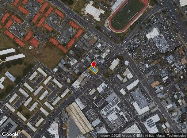
Property Record
932 Waiakamilo Rd, Honolulu, HI 96817
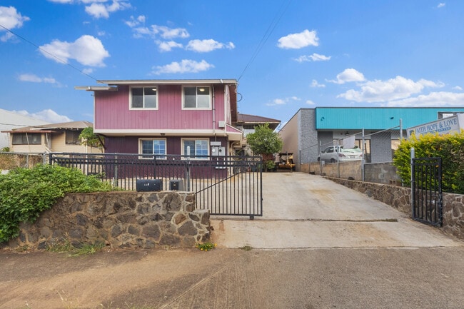
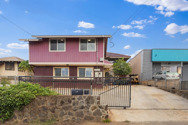
This Property Is For Sale
NEARBY LISTINGS FOR SALE OR LEASE
Property Detail
932 Waiakamilo Rd
Urban Honolulu, HI
140
1-1-5-002-007-0000
LOT 13-C-1 SECTION C 4811 SF MAP 140 LCAPP 750
Commercialnec
Honolulu
X
Hawaii
15003C0353G
13-c-
2024
0.11 AC
2025
Kalihi-Palama
005800
Hawaii
1,707 SF
DEMOGRAPHICS near 932 Waiakamilo Rd
1 Mile
3 Mile
5 Mile
2024 Total Population
46,819
184,223
336,674
2029 Population
45,892
183,359
339,201
Pop Growth 2024-2029
(1.98%)
(0.47%)
+ 0.75%
Average Age
41
43
43
2024 Total Households
12,307
68,782
132,055
HH Growth 2024-2029
(2.53%)
(0.41%)
+ 1.08%
Median Household Inc
$75,199
$86,638
$84,523
Avg Household Size
3.40
2.50
2.30
2024 Avg HH Vehicles
2.00
1.00
1.00
Median Home Value
$826,723
$792,068
$807,648
Median Year Built
1967
1975
1974
Nearby Places
- Restaurants
- Banks
- Shops
- Fitness
- Groceries
PUBLIC TRANSPORTATION
AIRPORT
Daniel K Inouye International
DRIVE
WALK
Distance
Daniel K Inouye International
9 min
4.1 mi
Freight Ports
Honolulu Harbor, Oahu
DRIVE
WALK
Distance
Honolulu Harbor, Oahu
9 min
3.7 mi
Nearby Properties
Address
Land Use
TOTAL SIZE
Lot Size
Zoning
Address
Land Use
TOTAL SIZE
Lot Size
Zoning
1,675.63 AC
C/61/60
Address
Land Use
TOTAL SIZE
Lot Size
Zoning
13,088 SF
75.21 AC
P-2
Address
Land Use
TOTAL SIZE
Lot Size
Zoning
355.21 AC
F-1
Address
Land Use
TOTAL SIZE
Lot Size
Zoning
55.93 AC
WI
Address
Land Use
TOTAL SIZE
Lot Size
Zoning
1,153,381 SF
425.42 AC
R-5
Address
Land Use
TOTAL SIZE
Lot Size
Zoning
45.65 AC
Kak
Address
Land Use
TOTAL SIZE
Lot Size
Zoning
1,599,500 SF
7.27 AC
BMX-3
Address
Land Use
TOTAL SIZE
Lot Size
Zoning
2.32 AC
Kak
Address
Land Use
TOTAL SIZE
Lot Size
Zoning
254,832 SF
2.92 AC
BMX-4
Address
Land Use
TOTAL SIZE
Lot Size
Zoning
1,725,655 SF
11 AC
I-2
Address
Land Use
TOTAL SIZE
Lot Size
Zoning
1,725,655 SF
11 AC
I-2
Address
Land Use
TOTAL SIZE
Lot Size
Zoning
12,430 SF
86.69 AC
I-3
Address
Land Use
TOTAL SIZE
Lot Size
Zoning
9,272 SF
141.38 AC
P-2
Address
Land Use
TOTAL SIZE
Lot Size
Zoning
163,285 SF
15.08 AC
R-7.5
Address
Land Use
TOTAL SIZE
Lot Size
Zoning
1,447,909 SF
12.54 AC
IMX-1
Address
Land Use
TOTAL SIZE
Lot Size
Zoning
446,464 SF
9.90 AC
Kak
Address
Land Use
TOTAL SIZE
Lot Size
Zoning
919,972 SF
14.45 AC
I-2
Address
Land Use
TOTAL SIZE
Lot Size
Zoning
14.38 AC
Kak
Address
Land Use
TOTAL SIZE
Lot Size
Zoning
936,400 SF
6.88 AC
Kak
Address
Land Use
TOTAL SIZE
Lot Size
Zoning
386,846 SF
8.76 AC
A-1
Address
Land Use
TOTAL SIZE
Lot Size
Zoning
960 SF
71.97 AC
P-2
Address
Land Use
TOTAL SIZE
Lot Size
Zoning
468,275 SF
10.47 AC
BMX-3
Address
Land Use
TOTAL SIZE
Lot Size
Zoning
158,215 SF
1.83 AC
BMX-4
Address
Land Use
TOTAL SIZE
Lot Size
Zoning
204,596 SF
0.12 AC
BMX-4
Address
Land Use
TOTAL SIZE
Lot Size
Zoning
253,254 SF
10.73 AC
Kak
Address
Land Use
TOTAL SIZE
Lot Size
Zoning
16.46 AC
I-2
Address
Land Use
TOTAL SIZE
Lot Size
Zoning
49,330 SF
50 AC
I-3
Address
Land Use
TOTAL SIZE
Lot Size
Zoning
10.84 AC
B-2
Address
Land Use
TOTAL SIZE
Lot Size
Zoning
13.77 AC
U/34/30
The World's #1 Commercial Real Estate Marketplace
Connect with us
© 2025 CoStar Group
The information above has been obtained from sources believed reliable. While we do not doubt its accuracy we have not verified it and make no guarantee, warranty or representation about it. It is your responsibility to independently confirm its accuracy and completeness. Any projections, opinions, assumptions, or estimates used are for example only and do not represent the current or future performance of the property. The value of this transaction to you depends on tax and other factors which should be evaluated by your tax, financial, and legal advisors. You and your advisors should conduct a careful, independent investigation of the property to determine to your satisfaction the suitability of the property for your needs.