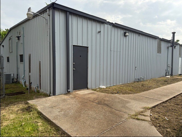
Property Record
9321 Meldrum Ln, Houston, TX 77075

NEARBY LISTINGS FOR SALE OR LEASE
Property Detail
9321 Meldrum Ln
Houston-The Woodlands-Sugar Land, TX
Easthaven
0630320140005
LTS 5 & 6 BLK 14 EASTHAVEN
Parkinglot
Harris
X
Texas
48201C0915N
5,6
2024
0.46 AC
2025
South Hwy 35
333302
Houston
600 SF
DEMOGRAPHICS near 9321 Meldrum Ln
1 Mile
3 Mile
5 Mile
2024 Total Population
16,398
126,101
305,979
2029 Population
16,680
128,970
313,671
Pop Growth 2024-2029
+ 1.72%
+ 2.28%
+ 2.51%
Average Age
32
35
35
2024 Total Households
5,763
41,539
98,731
HH Growth 2024-2029
+ 1.89%
+ 2.31%
+ 2.51%
Median Household Inc
$47,640
$52,199
$56,187
Avg Household Size
2.80
3.00
3.00
2024 Avg HH Vehicles
2.00
2.00
2.00
Median Home Value
$165,552
$165,060
$177,401
Median Year Built
1979
1977
1976
Nearby Places
Map Layers
Map Styles
 Street
 Aerial
- Restaurants
- Banks
- Shops
- Fitness
- Groceries
PUBLIC TRANSPORTATION
AIRPORT
William P Hobby
DRIVE
WALK
Distance
William P Hobby
11 min
3.6 mi
George Bush Intcntl/Houston
DRIVE
WALK
Distance
George Bush Intcntl/Houston
42 min
33.1 mi
Freight Ports
Port of Houston
DRIVE
WALK
Distance
Port of Houston
18 min
10.0 mi
SALE & LEASE HISTORY
LISTING DATE
SALE/LEASE

Mar 08, 2022
For Lease
Nearby Properties
Address
Land Use
TOTAL SIZE
Lot Size
Zoning
Address
Land Use
TOTAL SIZE
Lot Size
Zoning
690,590 SF
31.88 AC
Address
Land Use
TOTAL SIZE
Lot Size
Zoning
359,985 SF
12.56 AC
Address
Land Use
TOTAL SIZE
Lot Size
Zoning
794,499 SF
31.71 AC
Address
Land Use
TOTAL SIZE
Lot Size
Zoning
309,102 SF
16.81 AC
Address
Land Use
TOTAL SIZE
Lot Size
Zoning
334,780 SF
13.48 AC
Address
Land Use
TOTAL SIZE
Lot Size
Zoning
331,734 SF
15.82 AC
Address
Land Use
TOTAL SIZE
Lot Size
Zoning
369,871 SF
13.68 AC
Address
Land Use
TOTAL SIZE
Lot Size
Zoning
229,446 SF
21.05 AC
Address
Land Use
TOTAL SIZE
Lot Size
Zoning
411,252 SF
18.28 AC
Address
Land Use
TOTAL SIZE
Lot Size
Zoning
279,627 SF
15.98 AC
Address
Land Use
TOTAL SIZE
Lot Size
Zoning
397,739 SF
15.93 AC
Address
Land Use
TOTAL SIZE
Lot Size
Zoning
342,149 SF
23.56 AC
Address
Land Use
TOTAL SIZE
Lot Size
Zoning
227,864 SF
9.83 AC
Address
Land Use
TOTAL SIZE
Lot Size
Zoning
245,028 SF
12.44 AC
Address
Land Use
TOTAL SIZE
Lot Size
Zoning
556,568 SF
20 AC
Address
Land Use
TOTAL SIZE
Lot Size
Zoning
262,774 SF
10.87 AC
Address
Land Use
TOTAL SIZE
Lot Size
Zoning
230,218 SF
10.67 AC
Address
Land Use
TOTAL SIZE
Lot Size
Zoning
186,046 SF
13.34 AC
Address
Land Use
TOTAL SIZE
Lot Size
Zoning
188,110 SF
2.22 AC
Address
Land Use
TOTAL SIZE
Lot Size
Zoning
219,424 SF
7.25 AC
Address
Land Use
TOTAL SIZE
Lot Size
Zoning
Address
Land Use
TOTAL SIZE
Lot Size
Zoning
203,158 SF
10 AC
Address
Land Use
TOTAL SIZE
Lot Size
Zoning
241,245 SF
9 AC
Address
Land Use
TOTAL SIZE
Lot Size
Zoning
136,335 SF
4.32 AC
Address
Land Use
TOTAL SIZE
Lot Size
Zoning
291,181 SF
11.07 AC
Address
Land Use
TOTAL SIZE
Lot Size
Zoning
391,576 SF
19.94 AC
Address
Land Use
TOTAL SIZE
Lot Size
Zoning
446,728 SF
16.69 AC
Address
Land Use
TOTAL SIZE
Lot Size
Zoning
353,676 SF
19.86 AC
Address
Land Use
TOTAL SIZE
Lot Size
Zoning
284,290 SF
20 AC
Address
Land Use
TOTAL SIZE
Lot Size
Zoning
224,598 SF
11 AC
The World's #1 Commercial Real Estate Marketplace
Connect with us
© 2026 CoStar Group
The information above has been obtained from sources believed reliable. While we do not doubt its accuracy we have not verified it and make no guarantee, warranty or representation about it. It is your responsibility to independently confirm its accuracy and completeness. Any projections, opinions, assumptions, or estimates used are for example only and do not represent the current or future performance of the property. The value of this transaction to you depends on tax and other factors which should be evaluated by your tax, financial, and legal advisors. You and your advisors should conduct a careful, independent investigation of the property to determine to your satisfaction the suitability of the property for your needs.