Property Record
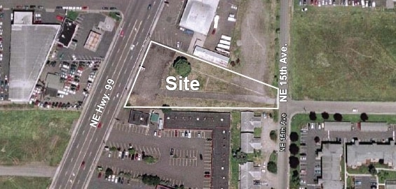
9321 Ne Highway 99, Vancouver, WA 98665


NEARBY LISTINGS FOR SALE OR LEASE
Property Detail
9321 Ne Highway 99
144957-000
#29 SEC 2 T2NR1EWM 1.440A FOR ASSESSOR USE ONLY BAAP WCH IS 1322.8 FT E & S 1 DG 18 MIN W 102.3 FT FRM NW COR SEC 2 2N 1EWM SD POB BEING THE INTERSEC OF ELY LI OF PAC HWY R/W WI E LI FRACTIONAL NW 1/4 OF NW 1/4 SEC 2 2N 1E WM TH S 1 DG 18 MIN W AL E
Vacantlandnec
Clark
X
Washington
53011C0358D
1.44 AC
2025
Hazel Dell/Salmon Creek
2025
Portland
040809
Portland-Vancouver-Hillsboro, OR-WA
DEMOGRAPHICS near 9321 Ne Highway 99
1 Mile
3 Mile
5 Mile
2024 Total Population
17,265
95,966
202,069
2029 Population
18,468
103,073
217,910
Pop Growth 2024-2029
+ 6.97%
+ 7.41%
+ 7.84%
Average Age
39
41
40
2024 Total Households
6,950
36,815
79,632
HH Growth 2024-2029
+ 7.12%
+ 7.58%
+ 8.11%
Median Household Inc
$59,577
$87,623
$78,417
Avg Household Size
2.40
2.60
2.50
2024 Avg HH Vehicles
2.00
2.00
2.00
Median Home Value
$407,986
$446,561
$437,462
Median Year Built
1985
1986
1987
Nearby Places
Map Layers
Map Styles
 Street
 Aerial
- Restaurants
- Banks
- Shops
- Fitness
- Groceries
PUBLIC TRANSPORTATION
COMMUTER RAIL
DRIVE
WALK
Distance
11 min
5.5 mi
AIRPORT
Portland International
DRIVE
WALK
Distance
Portland International
25 min
15.1 mi
Freight Ports
Port of Vancouver
DRIVE
WALK
Distance
Port of Vancouver
13 min
5.9 mi
SALE & LEASE HISTORY
LISTING DATE
SALE/LEASE

Sep 24, 2016
For Sale
May 18, 2017
For Sale
May 17, 2017
For Sale
Jan 30, 2019
For Lease
Apr 09, 2025
For Lease
Nearby Properties
Address
Land Use
TOTAL SIZE
Lot Size
Zoning
Address
Land Use
TOTAL SIZE
Lot Size
Zoning
494,738 SF
7.33 AC
GC
Address
Land Use
TOTAL SIZE
Lot Size
Zoning
281,852 SF
13.14 AC
OR-22
Address
Land Use
TOTAL SIZE
Lot Size
Zoning
335,784 SF
12.93 AC
GC
Address
Land Use
TOTAL SIZE
Lot Size
Zoning
335,004 SF
17.06 AC
IL
Address
Land Use
TOTAL SIZE
Lot Size
Zoning
238,150 SF
11.52 AC
R-43
Address
Land Use
TOTAL SIZE
Lot Size
Zoning
262,710 SF
14.99 AC
R-22
Address
Land Use
TOTAL SIZE
Lot Size
Zoning
211,613 SF
28.21 AC
R1-6
Address
Land Use
TOTAL SIZE
Lot Size
Zoning
204,060 SF
4.36 AC
R-43
Address
Land Use
TOTAL SIZE
Lot Size
Zoning
280,541 SF
63.94 AC
IL
Address
Land Use
TOTAL SIZE
Lot Size
Zoning
275,000 SF
67.54 AC
R1-7.5
Address
Land Use
TOTAL SIZE
Lot Size
Zoning
202,980 SF
8.72 AC
R-18
Address
Land Use
TOTAL SIZE
Lot Size
Zoning
143,094 SF
6.42 AC
OR-30
Address
Land Use
TOTAL SIZE
Lot Size
Zoning
194,195 SF
8.65 AC
R-18
Address
Land Use
TOTAL SIZE
Lot Size
Zoning
169,980 SF
15.98 AC
R-18
Address
Land Use
TOTAL SIZE
Lot Size
Zoning
357,176 SF
9.82 AC
R-22
Address
Land Use
TOTAL SIZE
Lot Size
Zoning
185,080 SF
14.49 AC
R-30
Address
Land Use
TOTAL SIZE
Lot Size
Zoning
118,879 SF
35.19 AC
R-22
Address
Land Use
TOTAL SIZE
Lot Size
Zoning
137,393 SF
6.89 AC
R-30
Address
Land Use
TOTAL SIZE
Lot Size
Zoning
140,325 SF
2.93 AC
R-18
Address
Land Use
TOTAL SIZE
Lot Size
Zoning
197,650 SF
35.36 AC
R1-7.5
Address
Land Use
TOTAL SIZE
Lot Size
Zoning
146,302 SF
3.33 AC
GC
Address
Land Use
TOTAL SIZE
Lot Size
Zoning
141,175 SF
9.83 AC
R-18
Address
Land Use
TOTAL SIZE
Lot Size
Zoning
145,493 SF
6.79 AC
R-18
Address
Land Use
TOTAL SIZE
Lot Size
Zoning
277,402 SF
5.57 AC
R-43
Address
Land Use
TOTAL SIZE
Lot Size
Zoning
113,469 SF
6.81 AC
R-18
Address
Land Use
TOTAL SIZE
Lot Size
Zoning
170,119 SF
10.95 AC
IL
Address
Land Use
TOTAL SIZE
Lot Size
Zoning
91,328 SF
7.38 AC
GC
Address
Land Use
TOTAL SIZE
Lot Size
Zoning
138,850 SF
7.09 AC
R-43
Address
Land Use
TOTAL SIZE
Lot Size
Zoning
80,038 SF
3.78 AC
CC
Address
Land Use
TOTAL SIZE
Lot Size
Zoning
283,259 SF
16.93 AC
IL
The World's #1 Commercial Real Estate Marketplace
Connect with us
© 2026 CoStar Group
The information above has been obtained from sources believed reliable. While we do not doubt its accuracy we have not verified it and make no guarantee, warranty or representation about it. It is your responsibility to independently confirm its accuracy and completeness. Any projections, opinions, assumptions, or estimates used are for example only and do not represent the current or future performance of the property. The value of this transaction to you depends on tax and other factors which should be evaluated by your tax, financial, and legal advisors. You and your advisors should conduct a careful, independent investigation of the property to determine to your satisfaction the suitability of the property for your needs.