Property Record
9324 Robson Rd, Galt, CA 95632


NEARBY LISTINGS FOR SALE OR LEASE
Property Detail
9324 Robson Rd
Sacramento--Roseville--Arden-Arcade, CA
Frac Sub
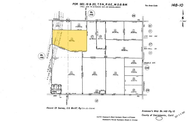
148-0100-003
FRAC SUB 22 RANCHO SAN JON DE LOS MOQUELUMNOS LOCATED IN SECS 19 & 20 TWP 5 N R 6 E M D B & M BEING FURTHER DES IN BK 944 O R
Vineyard
Sacramento
A
California
06077C0050G
78.17 AC
2024
Outer Sacramento County
2025
Sacramento
009501
DEMOGRAPHICS near 9324 Robson Rd
1 Mile
3 Mile
5 Mile
2024 Total Population
100
12,278
29,539
2029 Population
98
12,218
29,586
Pop Growth 2024-2029
(2.00%)
(0.49%)
+ 0.16%
Average Age
39
40
39
2024 Total Households
29
4,036
9,285
HH Growth 2024-2029
(3.45%)
(0.52%)
+ 0.12%
Median Household Inc
$87,500
$83,531
$83,962
Avg Household Size
3.30
3.00
3.10
2024 Avg HH Vehicles
3.00
2.00
2.00
Median Home Value
$687,500
$453,099
$452,181
Median Year Built
1983
1990
1992
Nearby Places
Map Layers
Map Styles
 Street
 Aerial
- Restaurants
- Banks
- Shops
- Fitness
- Groceries
PUBLIC TRANSPORTATION
AIRPORT
Stockton Metro
DRIVE
WALK
Distance
Stockton Metro
47 min
33.8 mi
Freight Ports
Port of Stockton
DRIVE
WALK
Distance
Port of Stockton
45 min
32.0 mi
Nearby Properties
Address
Land Use
TOTAL SIZE
Lot Size
Zoning
Address
Land Use
TOTAL SIZE
Lot Size
Zoning
284,700 SF
19.12 AC
LM
Address
Land Use
TOTAL SIZE
Lot Size
Zoning
223,974 SF
12.06 AC
LM
Address
Land Use
TOTAL SIZE
Lot Size
Zoning
127,249 SF
11.18 AC
HC
Address
Land Use
TOTAL SIZE
Lot Size
Zoning
65,200 SF
5.04 AC
HC
Address
Land Use
TOTAL SIZE
Lot Size
Zoning
0.99 AC
HC
Address
Land Use
TOTAL SIZE
Lot Size
Zoning
1.53 AC
LM
Address
Land Use
TOTAL SIZE
Lot Size
Zoning
316.88 AC
AG-80
Address
Land Use
TOTAL SIZE
Lot Size
Zoning
18,089 SF
10.36 AC
LM
Address
Land Use
TOTAL SIZE
Lot Size
Zoning
67,312 SF
10.20 AC
LM
Address
Land Use
TOTAL SIZE
Lot Size
Zoning
102,790 SF
6.29 AC
LM
Address
Land Use
TOTAL SIZE
Lot Size
Zoning
6,156 SF
493.47 AC
AG-80
Address
Land Use
TOTAL SIZE
Lot Size
Zoning
760 SF
8.35 AC
LM
Address
Land Use
TOTAL SIZE
Lot Size
Zoning
32,567 SF
6.27 AC
R3
Address
Land Use
TOTAL SIZE
Lot Size
Zoning
8,844 SF
6.16 AC
OP
Address
Land Use
TOTAL SIZE
Lot Size
Zoning
64,868 SF
3.69 AC
LM
Address
Land Use
TOTAL SIZE
Lot Size
Zoning
4.51 AC
LM
Address
Land Use
TOTAL SIZE
Lot Size
Zoning
43,000 SF
1.90 AC
HC
Address
Land Use
TOTAL SIZE
Lot Size
Zoning
80,666 SF
10.48 AC
LM
Address
Land Use
TOTAL SIZE
Lot Size
Zoning
31,660 SF
2.45 AC
R3
Address
Land Use
TOTAL SIZE
Lot Size
Zoning
19,999 SF
1.16 AC
HC
Address
Land Use
TOTAL SIZE
Lot Size
Zoning
39,377 SF
2.94 AC
R3
Address
Land Use
TOTAL SIZE
Lot Size
Zoning
2,000 SF
1.04 AC
HC
Address
Land Use
TOTAL SIZE
Lot Size
Zoning
15,900 SF
1.64 AC
HC
Address
Land Use
TOTAL SIZE
Lot Size
Zoning
54,000 SF
6.99 AC
LM
Address
Land Use
TOTAL SIZE
Lot Size
Zoning
68,400 SF
4.28 AC
LM
Address
Land Use
TOTAL SIZE
Lot Size
Zoning
10,200 SF
0.99 AC
HC
Address
Land Use
TOTAL SIZE
Lot Size
Zoning
44,304 SF
1.32 AC
HC
Address
Land Use
TOTAL SIZE
Lot Size
Zoning
287.52 AC
AG-80
Address
Land Use
TOTAL SIZE
Lot Size
Zoning
60,000 SF
2.91 AC
LM
Address
Land Use
TOTAL SIZE
Lot Size
Zoning
283.24 AC
AG-80
The World's #1 Commercial Real Estate Marketplace
Connect with us
© 2025 CoStar Group
The information above has been obtained from sources believed reliable. While we do not doubt its accuracy we have not verified it and make no guarantee, warranty or representation about it. It is your responsibility to independently confirm its accuracy and completeness. Any projections, opinions, assumptions, or estimates used are for example only and do not represent the current or future performance of the property. The value of this transaction to you depends on tax and other factors which should be evaluated by your tax, financial, and legal advisors. You and your advisors should conduct a careful, independent investigation of the property to determine to your satisfaction the suitability of the property for your needs.