Property Record
9325 Fm 428, Aubrey, TX 76227
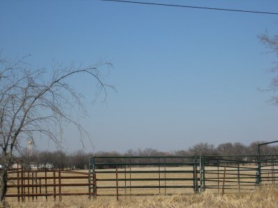


Property Detail
9325 Fm 428
R36525
A0489A D.P. GROUND, TR 7,9,10,11,12, 44.546 ACRES
Agriculturalland
Denton
AE The base floodplain where base flood elevations are provided. AE Zones are now used on new format FIRMs instead of A1-A30 Zones.
Texas
2024
44.55 AC
2025
Outlying Denton County
020205
Dallas/Ft Worth
8,236 SF
Dallas-Fort Worth-Arlington, TX
NEARBY LISTINGS FOR SALE OR LEASE
DEMOGRAPHICS near 9325 Fm 428
1 mile
3 mile
5 mile
2025 Total Population
364
3,582
38,759
2030 Population
414
4,162
43,856
Pop Growth 2025-2030
+ 13.74%
+ 16.19%
+ 13.15%
Average Age
49
39
38
2025 Total Households
137
1,177
14,922
HH Growth 2025-2030
+ 13.87%
+ 16.14%
+ 13.25%
Median Household Inc
$118,269
$85,777
$87,029
Avg Household Size
2.60
2.90
2.50
2025 Avg HH Vehicles
2.00
2.00
2.00
Median Home Value
$544,643
$418,990
$334,525
Median Year Built
1993
2000
1990
Nearby Places
Map Layers
Map Styles
 Street
 Aerial
Layers
 Traffic
 Biking
Places
Listings with unknown addresses are not visible on the map
- Restaurants
- Banks
- Shops
- Fitness
- Groceries
PUBLIC TRANSPORTATION
COMMUTER RAIL
Downtown Denton Transit Center (A-train - Denton County Transportation Authority)
Drive
Walk
Distance
Downtown Denton Transit Center (A-train - Denton County Transportation Authority)
13 min
6.6 mi
Medpark Station (A-train - Denton County Transportation Authority)
Drive
Walk
Distance
Medpark Station (A-train - Denton County Transportation Authority)
17 min
9.3 mi
AIRPORT
Dallas-Fort Worth International
Drive
Walk
Distance
Dallas-Fort Worth International
45 min
32.9 mi
Freight Ports
Port of Shreveport
Drive
Walk
Distance
Port of Shreveport
264 min
239.5 mi
Nearby Properties
Address
Land Use
TOTAL SIZE
Lot Size
Zoning
Address
Land Use
TOTAL SIZE
Lot Size
Zoning
149,145 SF
31.45 AC
Address
Land Use
TOTAL SIZE
Lot Size
Zoning
300,000 SF
11.31 AC
Address
Land Use
TOTAL SIZE
Lot Size
Zoning
42,163 SF
15.76 AC
Address
Land Use
TOTAL SIZE
Lot Size
Zoning
40.09 AC
Address
Land Use
TOTAL SIZE
Lot Size
Zoning
27.51 AC
Address
Land Use
TOTAL SIZE
Lot Size
Zoning
207.54 AC
Address
Land Use
TOTAL SIZE
Lot Size
Zoning
72,184 SF
1.80 AC
Address
Land Use
TOTAL SIZE
Lot Size
Zoning
4,508 SF
1.68 AC
Address
Land Use
TOTAL SIZE
Lot Size
Zoning
57,685 SF
10.62 AC
Address
Land Use
TOTAL SIZE
Lot Size
Zoning
11,120 SF
3.86 AC
Address
Land Use
TOTAL SIZE
Lot Size
Zoning
2.34 AC
Address
Land Use
TOTAL SIZE
Lot Size
Zoning
3,240 SF
1.54 AC
Address
Land Use
TOTAL SIZE
Lot Size
Zoning
7,177 SF
41.62 AC
Address
Land Use
TOTAL SIZE
Lot Size
Zoning
15,998 SF
16.96 AC
Address
Land Use
TOTAL SIZE
Lot Size
Zoning
14,641 SF
135.26 AC
Address
Land Use
TOTAL SIZE
Lot Size
Zoning
12,493 SF
50 AC
Address
Land Use
TOTAL SIZE
Lot Size
Zoning
25.48 AC
Address
Land Use
TOTAL SIZE
Lot Size
Zoning
12,000 SF
1.15 AC
Address
Land Use
TOTAL SIZE
Lot Size
Zoning
6,529 SF
7.93 AC
Address
Land Use
TOTAL SIZE
Lot Size
Zoning
6,940 SF
25 AC
Address
Land Use
TOTAL SIZE
Lot Size
Zoning
7,381 SF
7.16 AC
Address
Land Use
TOTAL SIZE
Lot Size
Zoning
2,808 SF
0.97 AC
Address
Land Use
TOTAL SIZE
Lot Size
Zoning
5,718 SF
20.78 AC
Address
Land Use
TOTAL SIZE
Lot Size
Zoning
8,800 SF
10 AC
Address
Land Use
TOTAL SIZE
Lot Size
Zoning
54.97 AC
Address
Land Use
TOTAL SIZE
Lot Size
Zoning
1,904 SF
0.96 AC
Address
Land Use
TOTAL SIZE
Lot Size
Zoning
69,600 SF
62.31 AC
Address
Land Use
TOTAL SIZE
Lot Size
Zoning
8.67 AC
Address
Land Use
TOTAL SIZE
Lot Size
Zoning
4,512 SF
14.14 AC
Address
Land Use
TOTAL SIZE
Lot Size
Zoning
4,816 SF
5 AC
The World's #1 Commercial Real Estate Marketplace
Connect with us
© 2026 CoStar Group
The information above has been obtained from sources believed reliable. While we do not doubt its accuracy we have not verified it and make no guarantee, warranty or representation about it. It is your responsibility to independently confirm its accuracy and completeness. Any projections, opinions, assumptions, or estimates used are for example only and do not represent the current or future performance of the property. The value of this transaction to you depends on tax and other factors which should be evaluated by your tax, financial, and legal advisors. You and your advisors should conduct a careful, independent investigation of the property to determine to your satisfaction the suitability of the property for your needs.