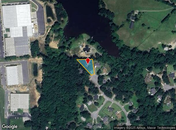
Property Record
933 Magnolia Ridge Way, Fuquay Varina, NC 27526
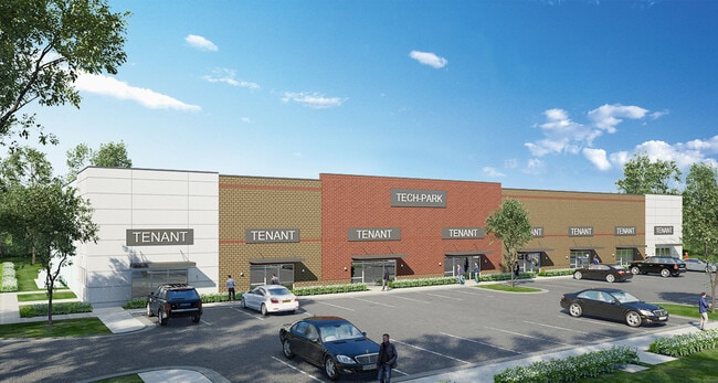
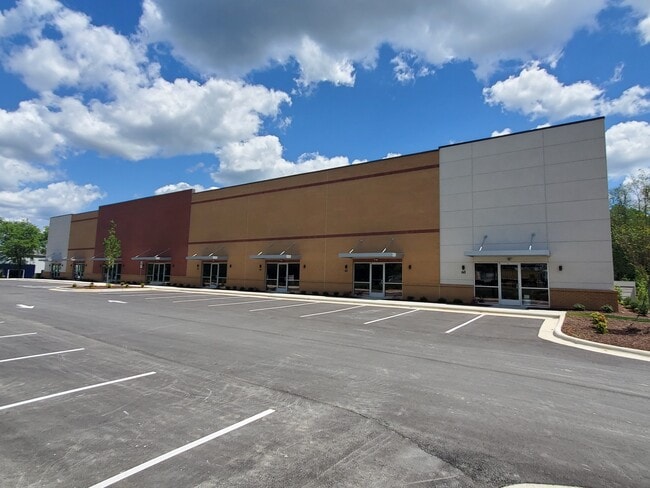
Current Lease Availabilities
NEARBY LISTINGS FOR SALE OR LEASE
Property Detail
933 Magnolia Ridge Way
Raleigh, NC
Magnolia Ridge Sub
0657.02-89-2442-000
Wake
Sfr
North Carolina
X
0.40 AC
3720065700K
Southwest Wake County
1,244 SF
Raleigh/Durham
DEMOGRAPHICS near 933 Magnolia Ridge Way
1 Mile
3 Mile
5 Mile
2024 Total Population
7,295
47,226
112,563
2029 Population
8,018
51,994
123,762
Pop Growth 2024-2029
+ 9.91%
+ 10.10%
+ 9.95%
Average Age
37
39
38
2024 Total Households
2,578
16,853
38,641
HH Growth 2024-2029
+ 9.66%
+ 10.07%
+ 9.97%
Median Household Inc
$94,178
$98,299
$107,971
Avg Household Size
2.80
2.80
2.90
2024 Avg HH Vehicles
2.00
2.00
2.00
Median Home Value
$373,623
$373,210
$392,771
Median Year Built
2010
2004
2005
Nearby Places
- Restaurants
- Banks
- Shops
- Fitness
- Groceries
PUBLIC TRANSPORTATION
AIRPORT
Raleigh-Durham International
DRIVE
WALK
Distance
Raleigh-Durham International
37 min
26.7 mi
Freight Ports
Port of Wilmington
DRIVE
WALK
Distance
Port of Wilmington
158 min
130.2 mi
Nearby Properties
Address
Land Use
TOTAL SIZE
Lot Size
Zoning
Address
Land Use
TOTAL SIZE
Lot Size
Zoning
553,292 SF
91.44 AC
RR
Address
Land Use
TOTAL SIZE
Lot Size
Zoning
295,615 SF
38.04 AC
SP
Address
Land Use
TOTAL SIZE
Lot Size
Zoning
435,576 SF
29.37 AC
RHD-C
Address
Land Use
TOTAL SIZE
Lot Size
Zoning
378,367 SF
26.21 AC
RHD-C
Address
Land Use
TOTAL SIZE
Lot Size
Zoning
313,307 SF
21.58 AC
MXR
Address
Land Use
TOTAL SIZE
Lot Size
Zoning
311,701 SF
19.97 AC
RHD
Address
Land Use
TOTAL SIZE
Lot Size
Zoning
301,882 SF
19.44 AC
MXR
Address
Land Use
TOTAL SIZE
Lot Size
Zoning
244,266 SF
11.74 AC
PUD
Address
Land Use
TOTAL SIZE
Lot Size
Zoning
242,251 SF
35.55 AC
SR
Address
Land Use
TOTAL SIZE
Lot Size
Zoning
201,371 SF
9.68 AC
O&I
Address
Land Use
TOTAL SIZE
Lot Size
Zoning
213,912 SF
16.33 AC
MXR
Address
Land Use
TOTAL SIZE
Lot Size
Zoning
207,800 SF
7.18 AC
NMU
Address
Land Use
TOTAL SIZE
Lot Size
Zoning
208,958 SF
14.34 AC
MXR
Address
Land Use
TOTAL SIZE
Lot Size
Zoning
159,046 SF
6.47 AC
CB
Address
Land Use
TOTAL SIZE
Lot Size
Zoning
154,305 SF
12.87 AC
NMX
Address
Land Use
TOTAL SIZE
Lot Size
Zoning
161,685 SF
14.55 AC
O&I
Address
Land Use
TOTAL SIZE
Lot Size
Zoning
68,452 SF
50.57 AC
OI-CZD
Address
Land Use
TOTAL SIZE
Lot Size
Zoning
140,774 SF
8.56 AC
MXR
Address
Land Use
TOTAL SIZE
Lot Size
Zoning
83,117 SF
9.74 AC
NR
Address
Land Use
TOTAL SIZE
Lot Size
Zoning
149,526 SF
10.91 AC
HI
Address
Land Use
TOTAL SIZE
Lot Size
Zoning
83,208 SF
27.68 AC
O&I
Address
Land Use
TOTAL SIZE
Lot Size
Zoning
101,680 SF
2.36 AC
UMU
Address
Land Use
TOTAL SIZE
Lot Size
Zoning
145,707 SF
15.40 AC
PUD
Address
Land Use
TOTAL SIZE
Lot Size
Zoning
340,556 SF
33.92 AC
RLI
Address
Land Use
TOTAL SIZE
Lot Size
Zoning
180,595 SF
35.61 AC
CB
Address
Land Use
TOTAL SIZE
Lot Size
Zoning
86,659 SF
10.08 AC
CB
Address
Land Use
TOTAL SIZE
Lot Size
Zoning
93,174 SF
9.07 AC
PUD
Address
Land Use
TOTAL SIZE
Lot Size
Zoning
99,307 SF
10.91 AC
CC
Address
Land Use
TOTAL SIZE
Lot Size
Zoning
81,948 SF
38.04 AC
SP
Address
Land Use
TOTAL SIZE
Lot Size
Zoning
50,239 SF
1.30 AC
DMX
The World's #1 Commercial Real Estate Marketplace
Connect with us
© 2025 CoStar Group
The information above has been obtained from sources believed reliable. While we do not doubt its accuracy we have not verified it and make no guarantee, warranty or representation about it. It is your responsibility to independently confirm its accuracy and completeness. Any projections, opinions, assumptions, or estimates used are for example only and do not represent the current or future performance of the property. The value of this transaction to you depends on tax and other factors which should be evaluated by your tax, financial, and legal advisors. You and your advisors should conduct a careful, independent investigation of the property to determine to your satisfaction the suitability of the property for your needs.