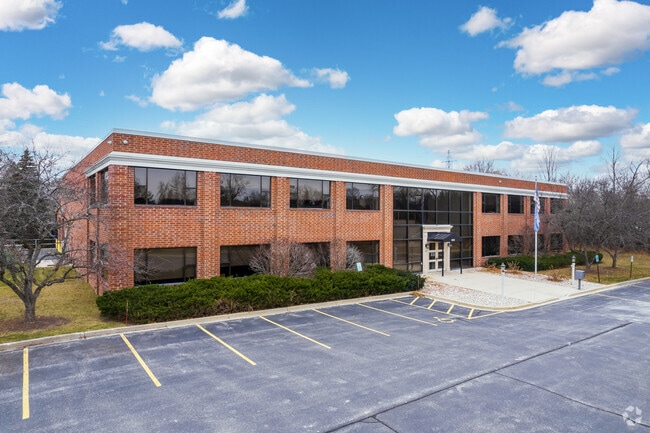
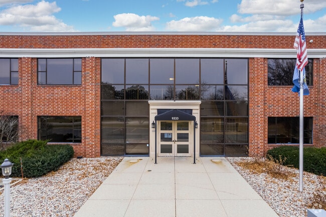
Property Record
9333 N 49Th St, Milwaukee, WI 53223
NEARBY LISTINGS FOR SALE OR LEASE
Property Detail
9333 N 49Th St
Milwaukee-Waukesha-West Allis, WI
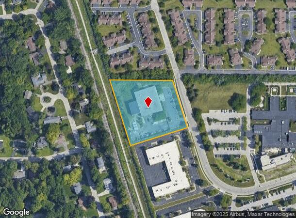
Cert Surv Map 4902
010-0150-003
00000 N 49TH ST CERTIFIED SURVEY MAP NO 4902 NE 2 8 21 LOT 1
Commercialnec
Milwaukee
X
Wisconsin
55089C0253G
1
2024
2.82 AC
2024
Milwaukee NW
050103
Milwaukee/Madison
DEMOGRAPHICS near 9333 N 49Th St
1 Mile
3 Mile
5 Mile
2024 Total Population
5,861
43,094
125,080
2029 Population
5,787
43,089
124,492
Pop Growth 2024-2029
(1.26%)
(0.01%)
(0.47%)
Average Age
43
42
40
2024 Total Households
2,633
18,333
49,920
HH Growth 2024-2029
(1.37%)
(0.09%)
(0.53%)
Median Household Inc
$84,712
$69,000
$69,348
Avg Household Size
2.20
2.30
2.40
2024 Avg HH Vehicles
2.00
2.00
2.00
Median Home Value
$230,682
$261,149
$267,781
Median Year Built
1971
1973
1968
Nearby Places
Map Layers
Map Styles
 Street
 Aerial
- Restaurants
- Banks
- Shops
- Fitness
- Groceries
PUBLIC TRANSPORTATION
AIRPORT
General Mitchell International
DRIVE
WALK
Distance
General Mitchell International
34 min
20.2 mi
Freight Ports
Port Milwaukee
DRIVE
WALK
Distance
Port Milwaukee
27 min
16.1 mi
SALE & LEASE HISTORY
LISTING DATE
SALE/LEASE

Sep 01, 2020
For Sale
Aug 24, 2021
For Lease
Aug 23, 2021
For Lease
Nearby Properties
Address
Land Use
TOTAL SIZE
Lot Size
Zoning
Address
Land Use
TOTAL SIZE
Lot Size
Zoning
Address
Land Use
TOTAL SIZE
Lot Size
Zoning
Address
Land Use
TOTAL SIZE
Lot Size
Zoning
Address
Land Use
TOTAL SIZE
Lot Size
Zoning
Address
Land Use
TOTAL SIZE
Lot Size
Zoning
6.63 AC
Address
Land Use
TOTAL SIZE
Lot Size
Zoning
72,824 SF
11.57 AC
Address
Land Use
TOTAL SIZE
Lot Size
Zoning
391,696 SF
36.33 AC
PD
Address
Land Use
TOTAL SIZE
Lot Size
Zoning
47.49 AC
Address
Land Use
TOTAL SIZE
Lot Size
Zoning
21.58 AC
RESIDENTIA
Address
Land Use
TOTAL SIZE
Lot Size
Zoning
35.05 AC
Address
Land Use
TOTAL SIZE
Lot Size
Zoning
4.03 AC
Address
Land Use
TOTAL SIZE
Lot Size
Zoning
298,666 SF
5.09 AC
PD
Address
Land Use
TOTAL SIZE
Lot Size
Zoning
Address
Land Use
TOTAL SIZE
Lot Size
Zoning
2.50 AC
Address
Land Use
TOTAL SIZE
Lot Size
Zoning
4.70 AC
Address
Land Use
TOTAL SIZE
Lot Size
Zoning
12.70 AC
RESIDENTIA
Address
Land Use
TOTAL SIZE
Lot Size
Zoning
2.20 AC
Address
Land Use
TOTAL SIZE
Lot Size
Zoning
19.40 AC
Address
Land Use
TOTAL SIZE
Lot Size
Zoning
4.26 AC
Address
Land Use
TOTAL SIZE
Lot Size
Zoning
25.77 AC
Address
Land Use
TOTAL SIZE
Lot Size
Zoning
Address
Land Use
TOTAL SIZE
Lot Size
Zoning
Address
Land Use
TOTAL SIZE
Lot Size
Zoning
10.98 AC
Address
Land Use
TOTAL SIZE
Lot Size
Zoning
297,894 SF
19.67 AC
IL1
Address
Land Use
TOTAL SIZE
Lot Size
Zoning
6.77 AC
Address
Land Use
TOTAL SIZE
Lot Size
Zoning
173,090 SF
15.83 AC
RB1
Address
Land Use
TOTAL SIZE
Lot Size
Zoning
Address
Land Use
TOTAL SIZE
Lot Size
Zoning
116,862 SF
14.39 AC
RM1
Address
Land Use
TOTAL SIZE
Lot Size
Zoning
13.08 AC
Address
Land Use
TOTAL SIZE
Lot Size
Zoning
11.26 AC
The World's #1 Commercial Real Estate Marketplace
Connect with us
© 2025 CoStar Group
The information above has been obtained from sources believed reliable. While we do not doubt its accuracy we have not verified it and make no guarantee, warranty or representation about it. It is your responsibility to independently confirm its accuracy and completeness. Any projections, opinions, assumptions, or estimates used are for example only and do not represent the current or future performance of the property. The value of this transaction to you depends on tax and other factors which should be evaluated by your tax, financial, and legal advisors. You and your advisors should conduct a careful, independent investigation of the property to determine to your satisfaction the suitability of the property for your needs.