Property Record
9333 N Time Oil Rd, Portland, OR 97203
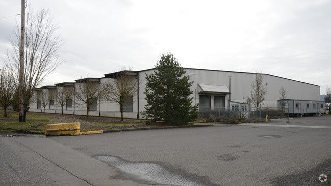


Property Detail
9333 N Time Oil Rd
R123701
BURGARD INDUSTRIAL PARK, LOT 10, INC UND INT TRACT C
Industrialgeneral
Multnomah
IH
Oregon
AE The base floodplain where base flood elevations are provided. AE Zones are now used on new format FIRMs instead of A1-A30 Zones.
10
2025
13.62 AC
2025
Rivergate
004104
Portland
75,840 SF
Portland-Vancouver-Hillsboro, OR-WA
NEARBY LISTINGS FOR SALE OR LEASE
DEMOGRAPHICS near 9333 N Time Oil Rd
1 mile
3 mile
5 mile
2025 Total Population
42
20,726
82,692
2030 Population
41
20,408
83,131
Pop Growth 2025-2030
(2.38%)
(1.53%)
+ 0.53%
Average Age
38
39
38
2025 Total Households
15
8,721
31,560
HH Growth 2025-2030
(6.67%)
(1.70%)
+ 0.62%
Median Household Inc
$63,750
$79,986
$107,451
Avg Household Size
2.20
2.30
2.50
2025 Avg HH Vehicles
2.00
2.00
2.00
Median Home Value
$425,000
$477,889
$614,036
Median Year Built
1975
1965
1984
Nearby Places
Map Layers
Map Styles
 Street
 Aerial
Transit
 Traffic
 Biking
Places
Listings with unknown addresses are not visible on the map
- Restaurants
- Banks
- Shops
- Fitness
- Groceries
SALE & LEASE HISTORY
LISTING DATE
SALE/LEASE

Feb 20, 2025
For Lease
Nearby Properties
Address
Land Use
TOTAL SIZE
Lot Size
Zoning
Address
Land Use
TOTAL SIZE
Lot Size
Zoning
546,069 SF
142 AC
IH
Address
Land Use
TOTAL SIZE
Lot Size
Zoning
890,408 SF
22.48 AC
IH
Address
Land Use
TOTAL SIZE
Lot Size
Zoning
262,045 SF
17.10 AC
R5
Address
Land Use
TOTAL SIZE
Lot Size
Zoning
Address
Land Use
TOTAL SIZE
Lot Size
Zoning
Address
Land Use
TOTAL SIZE
Lot Size
Zoning
335.31 AC
OS
Address
Land Use
TOTAL SIZE
Lot Size
Zoning
48.39 AC
NULL
Address
Land Use
TOTAL SIZE
Lot Size
Zoning
918,400 SF
48.13 AC
IH
Address
Land Use
TOTAL SIZE
Lot Size
Zoning
75.20 AC
IH
Address
Land Use
TOTAL SIZE
Lot Size
Zoning
Address
Land Use
TOTAL SIZE
Lot Size
Zoning
5,045,000 SF
116.53 AC
IH
Address
Land Use
TOTAL SIZE
Lot Size
Zoning
Address
Land Use
TOTAL SIZE
Lot Size
Zoning
100 SF
82.93 AC
IH
Address
Land Use
TOTAL SIZE
Lot Size
Zoning
37,770 SF
6.90 AC
EG2
Address
Land Use
TOTAL SIZE
Lot Size
Zoning
313,214 SF
NULL
Address
Land Use
TOTAL SIZE
Lot Size
Zoning
5,499,311 SF
40.90 AC
IH
Address
Land Use
TOTAL SIZE
Lot Size
Zoning
200 SF
50.40 AC
IH
Address
Land Use
TOTAL SIZE
Lot Size
Zoning
523,196 SF
21.97 AC
IHH
Address
Land Use
TOTAL SIZE
Lot Size
Zoning
425,395 SF
16.65 AC
IHH
Address
Land Use
TOTAL SIZE
Lot Size
Zoning
309,393 SF
14.87 AC
IH
Address
Land Use
TOTAL SIZE
Lot Size
Zoning
459,662 SF
19.41 AC
IHH
Address
Land Use
TOTAL SIZE
Lot Size
Zoning
385,275 SF
25.29 AC
IH
Address
Land Use
TOTAL SIZE
Lot Size
Zoning
573,020 SF
27.30 AC
IH
Address
Land Use
TOTAL SIZE
Lot Size
Zoning
15 AC
IHH
Address
Land Use
TOTAL SIZE
Lot Size
Zoning
606,639 SF
27.62 AC
IH
Address
Land Use
TOTAL SIZE
Lot Size
Zoning
258.16 AC
OS
Address
Land Use
TOTAL SIZE
Lot Size
Zoning
137,784 SF
8.36 AC
RM1
Address
Land Use
TOTAL SIZE
Lot Size
Zoning
438,700 SF
21.30 AC
IH
Address
Land Use
TOTAL SIZE
Lot Size
Zoning
325,908 SF
17.61 AC
IHH
Address
Land Use
TOTAL SIZE
Lot Size
Zoning
491,262 SF
24.49 AC
IH
The World's #1 Commercial Real Estate Marketplace
Connect with us
© 2026 CoStar Group
The information above has been obtained from sources believed reliable. While we do not doubt its accuracy we have not verified it and make no guarantee, warranty or representation about it. It is your responsibility to independently confirm its accuracy and completeness. Any projections, opinions, assumptions, or estimates used are for example only and do not represent the current or future performance of the property. The value of this transaction to you depends on tax and other factors which should be evaluated by your tax, financial, and legal advisors. You and your advisors should conduct a careful, independent investigation of the property to determine to your satisfaction the suitability of the property for your needs.