Property Record
9340 Deschutes Rd, Palo Cedro, CA 96073
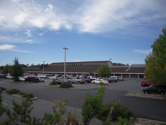


Property Detail
9340 Deschutes Rd
059-080-053-000
SHASTA
Supermarket
California
B and X Area of moderate flood hazard, usually the area between the limits of the 100-year and 500-year floods.
9.03 AC
2024
Redding/Chico
2025
Other Market Areas
011900
Redding, CA
89,471 SF
NEARBY LISTINGS FOR SALE OR LEASE
-
-
View all Palo Cedro listings for lease on LoopNet.com
DEMOGRAPHICS near 9340 Deschutes Rd
1 mile
3 mile
5 mile
2025 Total Population
886
4,889
22,331
2030 Population
851
4,649
22,002
Pop Growth 2025-2030
(3.95%)
(4.91%)
(1.47%)
Average Age
45
45
42
2025 Total Households
319
1,839
8,228
HH Growth 2025-2030
(4.08%)
(4.95%)
(1.52%)
Median Household Inc
$136,290
$126,126
$104,640
Avg Household Size
2.70
2.60
2.60
2025 Avg HH Vehicles
3.00
3.00
2.00
Median Home Value
$604,412
$559,975
$458,256
Median Year Built
1977
1981
1986
Nearby Places
Map Layers
Map Styles
 Street
 Aerial
Transit
 Traffic
 Biking
Places
Listings with unknown addresses are not visible on the map
- Restaurants
- Banks
- Shops
- Fitness
- Groceries
PUBLIC TRANSPORTATION
COMMUTER RAIL
Redding Amtrak (Coast Starlight - Amtrak)
Drive
Walk
Distance
Redding Amtrak (Coast Starlight - Amtrak)
12 min
9.4 mi
AIRPORT
Redding Regional
Drive
Walk
Distance
Redding Regional
11 min
7.6 mi
Freight Ports
Port of Richmond
Drive
Walk
Distance
Port of Richmond
235 min
205.7 mi
SALE & LEASE HISTORY
LISTING DATE
SALE/LEASE

Sep 25, 2016
For Lease
Nearby Properties
Address
Land Use
TOTAL SIZE
Lot Size
Zoning
Address
Land Use
TOTAL SIZE
Lot Size
Zoning
40.27 AC
R-R
Address
Land Use
TOTAL SIZE
Lot Size
Zoning
17,214 SF
1.63 AC
Address
Land Use
TOTAL SIZE
Lot Size
Zoning
3.35 AC
C-2
Address
Land Use
TOTAL SIZE
Lot Size
Zoning
39,716 SF
2.46 AC
Address
Land Use
TOTAL SIZE
Lot Size
Zoning
23,500 SF
2.39 AC
C-M
Address
Land Use
TOTAL SIZE
Lot Size
Zoning
1 AC
C-2
Address
Land Use
TOTAL SIZE
Lot Size
Zoning
10.10 AC
R-R-BA-3
Address
Land Use
TOTAL SIZE
Lot Size
Zoning
3,184 SF
1.10 AC
C-2
Address
Land Use
TOTAL SIZE
Lot Size
Zoning
4,032 SF
15.16 AC
Address
Land Use
TOTAL SIZE
Lot Size
Zoning
2.02 AC
C-M
Address
Land Use
TOTAL SIZE
Lot Size
Zoning
11,000 SF
0.82 AC
C-2
Address
Land Use
TOTAL SIZE
Lot Size
Zoning
5 AC
R-L
Address
Land Use
TOTAL SIZE
Lot Size
Zoning
4.05 AC
Address
Land Use
TOTAL SIZE
Lot Size
Zoning
1.96 AC
C-2
Address
Land Use
TOTAL SIZE
Lot Size
Zoning
4,662 SF
0.55 AC
Address
Land Use
TOTAL SIZE
Lot Size
Zoning
24.48 AC
Address
Land Use
TOTAL SIZE
Lot Size
Zoning
2,288 SF
0.86 AC
Address
Land Use
TOTAL SIZE
Lot Size
Zoning
2,288 SF
0.86 AC
Address
Land Use
TOTAL SIZE
Lot Size
Zoning
12,000 SF
2.28 AC
C-2
Address
Land Use
TOTAL SIZE
Lot Size
Zoning
6,158 SF
2.38 AC
C-M-DR
Address
Land Use
TOTAL SIZE
Lot Size
Zoning
8,400 SF
1.02 AC
C-2
Address
Land Use
TOTAL SIZE
Lot Size
Zoning
2,080 SF
0.33 AC
C-2
Address
Land Use
TOTAL SIZE
Lot Size
Zoning
10 AC
R-R
Address
Land Use
TOTAL SIZE
Lot Size
Zoning
0.88 AC
Address
Land Use
TOTAL SIZE
Lot Size
Zoning
9,342 SF
2.35 AC
Address
Land Use
TOTAL SIZE
Lot Size
Zoning
8,100 SF
0.81 AC
Address
Land Use
TOTAL SIZE
Lot Size
Zoning
3,091 SF
24.69 AC
OS
Address
Land Use
TOTAL SIZE
Lot Size
Zoning
2,288 SF
0.86 AC
The World's #1 Commercial Real Estate Marketplace
Connect with us
© 2026 CoStar Group
The information above has been obtained from sources believed reliable. While we do not doubt its accuracy we have not verified it and make no guarantee, warranty or representation about it. It is your responsibility to independently confirm its accuracy and completeness. Any projections, opinions, assumptions, or estimates used are for example only and do not represent the current or future performance of the property. The value of this transaction to you depends on tax and other factors which should be evaluated by your tax, financial, and legal advisors. You and your advisors should conduct a careful, independent investigation of the property to determine to your satisfaction the suitability of the property for your needs.