Property Record
9340 Marker Dr, Cincinnati, OH 45251
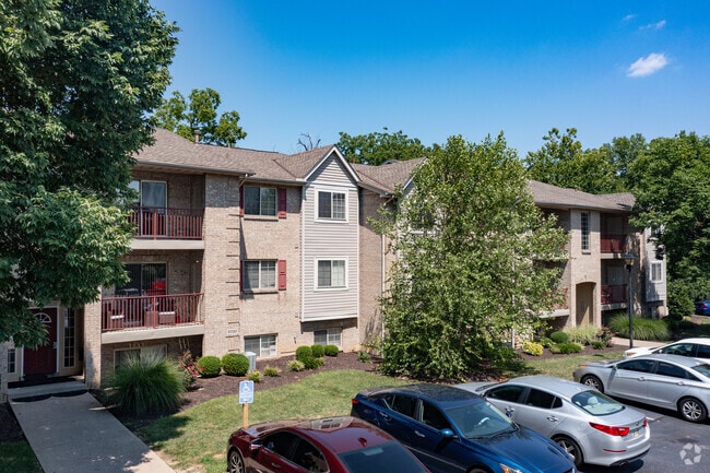

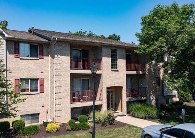
Property Detail
9340 Marker Dr
Cincinnati, OH-KY-IN
COMMOMS CIR 3.78 ACS LOTS 2-3 OF NORTHGATE COMMONS R1 T2 S9
510-0102-1296
Hamilton
Apartment
Ohio
B and X Area of moderate flood hazard, usually the area between the limits of the 100-year and 500-year floods.
2-3
2025
3.78 AC
2025
Northbrook
020741
Cincinnati/Dayton
NEARBY LISTINGS FOR SALE OR LEASE
DEMOGRAPHICS near 9340 Marker Dr
1 mile
3 mile
5 mile
2025 Total Population
13,339
74,991
166,085
2030 Population
13,409
75,375
167,209
Pop Growth 2025-2030
+ 0.52%
+ 0.51%
+ 0.68%
Average Age
39
40
41
2025 Total Households
5,109
29,825
66,562
HH Growth 2025-2030
+ 0.45%
+ 0.45%
+ 0.62%
Median Household Inc
$66,324
$63,696
$67,219
Avg Household Size
2.50
2.40
2.40
2025 Avg HH Vehicles
2.00
2.00
2.00
Median Home Value
$172,793
$181,668
$203,030
Median Year Built
1969
1965
1966
Nearby Places
Map Layers
Map Styles
 Street
 Aerial
Layers
 Traffic
 Biking
Places
Listings with unknown addresses are not visible on the map
- Restaurants
- Banks
- Shops
- Fitness
- Groceries
PUBLIC TRANSPORTATION
AIRPORT
Cincinnati/Northern Kentucky International
Drive
Walk
Distance
Cincinnati/Northern Kentucky International
48 min
25.1 mi
Freight Ports
Port of Toledo
Drive
Walk
Distance
Port of Toledo
236 min
201.5 mi
Nearby Properties
Address
Land Use
TOTAL SIZE
Lot Size
Zoning
Address
Land Use
TOTAL SIZE
Lot Size
Zoning
Address
Land Use
TOTAL SIZE
Lot Size
Zoning
24.69 AC
Address
Land Use
TOTAL SIZE
Lot Size
Zoning
44.58 AC
Address
Land Use
TOTAL SIZE
Lot Size
Zoning
29.78 AC
Address
Land Use
TOTAL SIZE
Lot Size
Zoning
5,984 SF
15.91 AC
Address
Land Use
TOTAL SIZE
Lot Size
Zoning
30.43 AC
Address
Land Use
TOTAL SIZE
Lot Size
Zoning
41,564 SF
13.21 AC
Address
Land Use
TOTAL SIZE
Lot Size
Zoning
59,744 SF
31.77 AC
Address
Land Use
TOTAL SIZE
Lot Size
Zoning
11.65 AC
Address
Land Use
TOTAL SIZE
Lot Size
Zoning
103.18 AC
R1A
Address
Land Use
TOTAL SIZE
Lot Size
Zoning
52,138 SF
17.43 AC
Address
Land Use
TOTAL SIZE
Lot Size
Zoning
50.02 AC
Address
Land Use
TOTAL SIZE
Lot Size
Zoning
14.19 AC
Address
Land Use
TOTAL SIZE
Lot Size
Zoning
1,302 SF
11.62 AC
Address
Land Use
TOTAL SIZE
Lot Size
Zoning
4,800 SF
7.20 AC
Address
Land Use
TOTAL SIZE
Lot Size
Zoning
60.59 AC
Address
Land Use
TOTAL SIZE
Lot Size
Zoning
Address
Land Use
TOTAL SIZE
Lot Size
Zoning
27.60 AC
Address
Land Use
TOTAL SIZE
Lot Size
Zoning
28.25 AC
Address
Land Use
TOTAL SIZE
Lot Size
Zoning
9,982 SF
36.33 AC
Address
Land Use
TOTAL SIZE
Lot Size
Zoning
Address
Land Use
TOTAL SIZE
Lot Size
Zoning
166,800 SF
15.25 AC
Address
Land Use
TOTAL SIZE
Lot Size
Zoning
Address
Land Use
TOTAL SIZE
Lot Size
Zoning
3,996 SF
14.27 AC
Address
Land Use
TOTAL SIZE
Lot Size
Zoning
Address
Land Use
TOTAL SIZE
Lot Size
Zoning
125,384 SF
13.68 AC
Address
Land Use
TOTAL SIZE
Lot Size
Zoning
3,000 SF
29.22 AC
Address
Land Use
TOTAL SIZE
Lot Size
Zoning
123,361 SF
15.98 AC
Address
Land Use
TOTAL SIZE
Lot Size
Zoning
12,606 SF
6.30 AC
Address
Land Use
TOTAL SIZE
Lot Size
Zoning
360 SF
362.04 AC
R1A
The World's #1 Commercial Real Estate Marketplace
Connect with us
© 2026 CoStar Group
The information above has been obtained from sources believed reliable. While we do not doubt its accuracy we have not verified it and make no guarantee, warranty or representation about it. It is your responsibility to independently confirm its accuracy and completeness. Any projections, opinions, assumptions, or estimates used are for example only and do not represent the current or future performance of the property. The value of this transaction to you depends on tax and other factors which should be evaluated by your tax, financial, and legal advisors. You and your advisors should conduct a careful, independent investigation of the property to determine to your satisfaction the suitability of the property for your needs.