Property Record
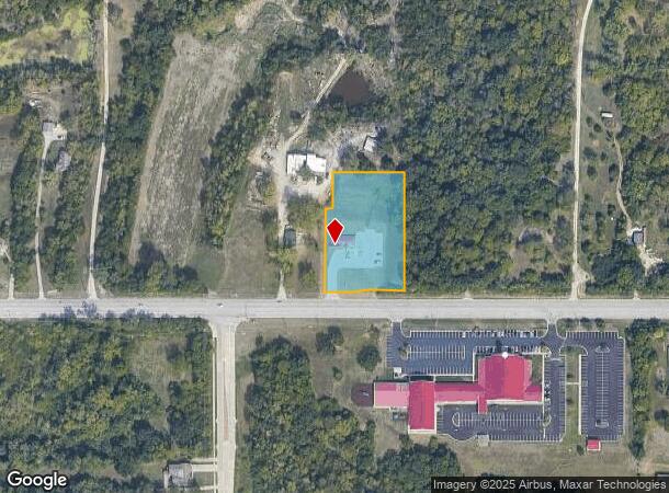
9340 Parallel Pky, Kansas City, KS 66112
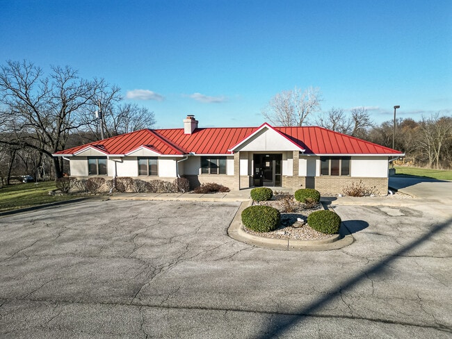
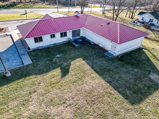
This Property Is For Sale
NEARBY LISTINGS FOR SALE OR LEASE
Property Detail
9340 Parallel Pky
938329
SEC-36 TWP-10 RNG-23, S36, T10, R23, ACRES 1.570000, 113-1 BEG 1774.18FT W OF SE COR; W 220FT, N 280FT, E 22FT, N 100FT, E 198FT, S 380FT TO POB CONTG 1.8714AC M/L
Officebuilding
Wyandotte
X
Kansas
20103C0275G
29
2024
1.60 AC
2024
Kansas City KS
044704
Kansas City
2,536 SF
Kansas City, MO-KS
DEMOGRAPHICS near 9340 Parallel Pky
1 Mile
3 Mile
5 Mile
2024 Total Population
1,540
28,232
59,760
2029 Population
1,568
28,576
60,488
Pop Growth 2024-2029
+ 1.82%
+ 1.22%
+ 1.22%
Average Age
44
40
39
2024 Total Households
598
10,893
22,561
HH Growth 2024-2029
+ 2.01%
+ 1.35%
+ 1.31%
Median Household Inc
$103,472
$78,663
$76,519
Avg Household Size
2.50
2.50
2.60
2024 Avg HH Vehicles
2.00
2.00
2.00
Median Home Value
$254,398
$237,379
$226,427
Median Year Built
1982
1974
1974
Nearby Places
Map Layers
Map Styles
 Street
 Aerial
- Restaurants
- Banks
- Shops
- Fitness
- Groceries
PUBLIC TRANSPORTATION
AIRPORT
Kansas City International
DRIVE
WALK
Distance
Kansas City International
28 min
22.8 mi
Freight Ports
Tulsa Port Of Catoosa
DRIVE
WALK
Distance
Tulsa Port Of Catoosa
270 min
241.1 mi
Nearby Properties
Address
Land Use
TOTAL SIZE
Lot Size
Zoning
Address
Land Use
TOTAL SIZE
Lot Size
Zoning
466.24 AC
Address
Land Use
TOTAL SIZE
Lot Size
Zoning
103,299 SF
13.41 AC
Address
Land Use
TOTAL SIZE
Lot Size
Zoning
122,784 SF
13.05 AC
Address
Land Use
TOTAL SIZE
Lot Size
Zoning
141,921 SF
16.88 AC
Address
Land Use
TOTAL SIZE
Lot Size
Zoning
700,029 SF
50.11 AC
Address
Land Use
TOTAL SIZE
Lot Size
Zoning
309,440 SF
120.73 AC
KR1
Address
Land Use
TOTAL SIZE
Lot Size
Zoning
176.36 AC
Address
Land Use
TOTAL SIZE
Lot Size
Zoning
51,739 SF
46.71 AC
Address
Land Use
TOTAL SIZE
Lot Size
Zoning
224,020 SF
24.72 AC
KR1
Address
Land Use
TOTAL SIZE
Lot Size
Zoning
75,027 SF
13.51 AC
Address
Land Use
TOTAL SIZE
Lot Size
Zoning
67,830 SF
7.88 AC
Address
Land Use
TOTAL SIZE
Lot Size
Zoning
268,951 SF
63.35 AC
Address
Land Use
TOTAL SIZE
Lot Size
Zoning
1,099,964 SF
115.80 AC
Address
Land Use
TOTAL SIZE
Lot Size
Zoning
16,603 SF
133.44 AC
Address
Land Use
TOTAL SIZE
Lot Size
Zoning
66.54 AC
Address
Land Use
TOTAL SIZE
Lot Size
Zoning
48,278 SF
14.62 AC
Address
Land Use
TOTAL SIZE
Lot Size
Zoning
108,385 SF
22.86 AC
KAG
Address
Land Use
TOTAL SIZE
Lot Size
Zoning
139,495 SF
35.01 AC
KR1
Address
Land Use
TOTAL SIZE
Lot Size
Zoning
186,293 SF
63.45 AC
Address
Land Use
TOTAL SIZE
Lot Size
Zoning
96,144 SF
38.53 AC
Address
Land Use
TOTAL SIZE
Lot Size
Zoning
95,844 SF
3.91 AC
Address
Land Use
TOTAL SIZE
Lot Size
Zoning
15,131 SF
1,508.17 AC
Address
Land Use
TOTAL SIZE
Lot Size
Zoning
40,016 SF
5.20 AC
Address
Land Use
TOTAL SIZE
Lot Size
Zoning
116,455 SF
16.49 AC
Address
Land Use
TOTAL SIZE
Lot Size
Zoning
39,012 SF
13.38 AC
Address
Land Use
TOTAL SIZE
Lot Size
Zoning
57,384 SF
18.81 AC
CPO
Address
Land Use
TOTAL SIZE
Lot Size
Zoning
1,036,732 SF
25.08 AC
KC1
Address
Land Use
TOTAL SIZE
Lot Size
Zoning
19,392 SF
2.77 AC
KCP1
Address
Land Use
TOTAL SIZE
Lot Size
Zoning
239,205 SF
17.52 AC
Address
Land Use
TOTAL SIZE
Lot Size
Zoning
1,036,732 SF
45.64 AC
KC1
The World's #1 Commercial Real Estate Marketplace
Connect with us
© 2025 CoStar Group
The information above has been obtained from sources believed reliable. While we do not doubt its accuracy we have not verified it and make no guarantee, warranty or representation about it. It is your responsibility to independently confirm its accuracy and completeness. Any projections, opinions, assumptions, or estimates used are for example only and do not represent the current or future performance of the property. The value of this transaction to you depends on tax and other factors which should be evaluated by your tax, financial, and legal advisors. You and your advisors should conduct a careful, independent investigation of the property to determine to your satisfaction the suitability of the property for your needs.