Property Record
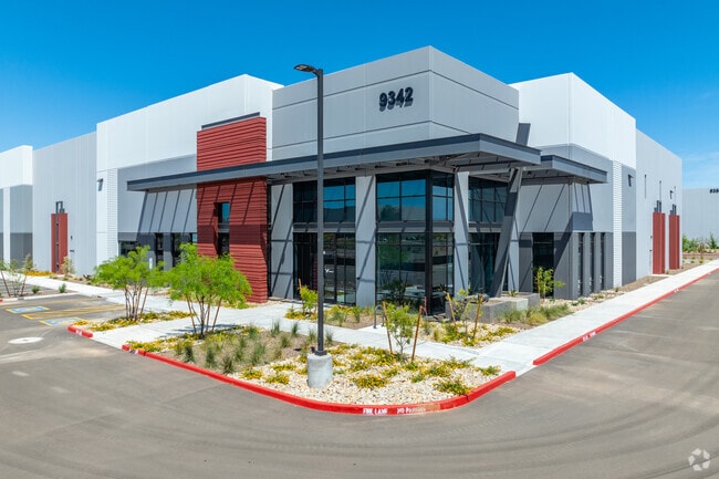
9342 E Elliot Rd, Mesa, AZ 85212


Property Detail
9342 E Elliot Rd
304-04-925
FIRST MESA COMMERCE PARK PHASE 1 AMD MCR 1167-45
Commercialacreage
MARICOPA
I-1
Arizona
C and X Area of minimal flood hazard, usually depicted on FIRMs as above the 500-year flood level.
3
2025
13.97 AC
2025
Chandler N/Gilbert
422643
Phoenix
209,811 SF
Phoenix-Mesa-Chandler, AZ
NEARBY LISTINGS FOR SALE OR LEASE
DEMOGRAPHICS near 9342 E Elliot Rd
1 mile
3 mile
5 mile
2024 Total Population
4,470
86,536
205,897
2029 Population
4,866
95,152
227,051
Pop Growth 2024-2029
+ 8.86%
+ 9.96%
+ 10.27%
Average Age
34
40
40
2024 Total Households
1,421
30,047
75,457
HH Growth 2024-2029
+ 8.73%
+ 10.04%
+ 10.62%
Median Household Inc
$96,693
$98,065
$79,789
Avg Household Size
3.10
2.80
2.70
2024 Avg HH Vehicles
2.00
2.00
2.00
Median Home Value
$379,304
$398,955
$359,157
Median Year Built
2002
2005
2000
Nearby Places
Map Layers
Map Styles
 Street
 Aerial
Transit
 Traffic
 Biking
Places
Listings with unknown addresses are not visible on the map
- Restaurants
- Banks
- Shops
- Fitness
- Groceries
PUBLIC TRANSPORTATION
AIRPORT
Phoenix-Mesa Gateway
Drive
Walk
Distance
Phoenix-Mesa Gateway
13 min
6.8 mi
Phoenix Sky Harbor International
Drive
Walk
Distance
Phoenix Sky Harbor International
38 min
27.5 mi
SALE & LEASE HISTORY
LISTING DATE
SALE/LEASE

Feb 07, 2022
For Lease
Nearby Properties
Address
Land Use
TOTAL SIZE
Lot Size
Zoning
Address
Land Use
TOTAL SIZE
Lot Size
Zoning
184.86 AC
Address
Land Use
TOTAL SIZE
Lot Size
Zoning
108,297 SF
102.46 AC
PS
Address
Land Use
TOTAL SIZE
Lot Size
Zoning
93.03 AC
Address
Land Use
TOTAL SIZE
Lot Size
Zoning
484,906 SF
199.48 AC
Address
Land Use
TOTAL SIZE
Lot Size
Zoning
1,195,173 SF
71.41 AC
Address
Land Use
TOTAL SIZE
Lot Size
Zoning
16.38 AC
Address
Land Use
TOTAL SIZE
Lot Size
Zoning
1,355,382 SF
83.17 AC
PAD
Address
Land Use
TOTAL SIZE
Lot Size
Zoning
467,727 SF
104.86 AC
AG
Address
Land Use
TOTAL SIZE
Lot Size
Zoning
454,704 SF
101.68 AC
AG
Address
Land Use
TOTAL SIZE
Lot Size
Zoning
615,202 SF
35.88 AC
AG
Address
Land Use
TOTAL SIZE
Lot Size
Zoning
524,905 SF
40.33 AC
Address
Land Use
TOTAL SIZE
Lot Size
Zoning
15.78 AC
Address
Land Use
TOTAL SIZE
Lot Size
Zoning
18.36 AC
Address
Land Use
TOTAL SIZE
Lot Size
Zoning
200,976 SF
25.04 AC
PC
Address
Land Use
TOTAL SIZE
Lot Size
Zoning
12.99 AC
Address
Land Use
TOTAL SIZE
Lot Size
Zoning
449,435 SF
26.87 AC
LI
Address
Land Use
TOTAL SIZE
Lot Size
Zoning
390,917 SF
15.82 AC
RM4
Address
Land Use
TOTAL SIZE
Lot Size
Zoning
779,546 SF
53.20 AC
LI
Address
Land Use
TOTAL SIZE
Lot Size
Zoning
965,386 SF
60.57 AC
Address
Land Use
TOTAL SIZE
Lot Size
Zoning
94,701 SF
7.89 AC
LC
Address
Land Use
TOTAL SIZE
Lot Size
Zoning
4.77 AC
LC
Address
Land Use
TOTAL SIZE
Lot Size
Zoning
14.77 AC
I-1
Address
Land Use
TOTAL SIZE
Lot Size
Zoning
281,929 SF
12.07 AC
Address
Land Use
TOTAL SIZE
Lot Size
Zoning
152,549 SF
60 AC
PC
Address
Land Use
TOTAL SIZE
Lot Size
Zoning
292,665 SF
15.26 AC
PC
Address
Land Use
TOTAL SIZE
Lot Size
Zoning
961,432 SF
63.41 AC
Address
Land Use
TOTAL SIZE
Lot Size
Zoning
10.63 AC
Address
Land Use
TOTAL SIZE
Lot Size
Zoning
229,934 SF
15.55 AC
I-1
Address
Land Use
TOTAL SIZE
Lot Size
Zoning
218,680 SF
8.50 AC
PC
The World's #1 Commercial Real Estate Marketplace
Connect with us
© 2026 CoStar Group
The information above has been obtained from sources believed reliable. While we do not doubt its accuracy we have not verified it and make no guarantee, warranty or representation about it. It is your responsibility to independently confirm its accuracy and completeness. Any projections, opinions, assumptions, or estimates used are for example only and do not represent the current or future performance of the property. The value of this transaction to you depends on tax and other factors which should be evaluated by your tax, financial, and legal advisors. You and your advisors should conduct a careful, independent investigation of the property to determine to your satisfaction the suitability of the property for your needs.