Property Record
9348 Columbia Hwy, Leesville, SC 29070
NEARBY LISTINGS FOR SALE OR LEASE
-
-
View all Leesville listings for sale on LoopNet.com
Property Detail
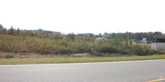
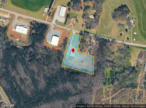
9348 Columbia Hwy
196-00-00-158
DEED REF 941-147 PLAT BK CAB A SL 62-9
Commercialnec
Saluda
X
South Carolina
45063C0070J
3 AC
2025
Saluda County
2024
Columbia
021404
Columbia, SC
3,600 SF
DEMOGRAPHICS near 9348 Columbia Hwy
1 Mile
3 Mile
5 Mile
2024 Total Population
159
1,545
5,594
2029 Population
154
1,556
5,821
Pop Growth 2024-2029
(3.14%)
+ 0.71%
+ 4.06%
Average Age
47
49
49
2024 Total Households
64
690
2,488
HH Growth 2024-2029
(3.13%)
+ 0.72%
+ 4.02%
Median Household Inc
$68,333
$70,634
$66,731
Avg Household Size
2.30
2.20
2.20
2024 Avg HH Vehicles
3.00
2.00
2.00
Median Home Value
$171,874
$241,447
$253,222
Median Year Built
1987
1994
1994
Nearby Places
- Restaurants
- Banks
- Shops
- Fitness
- Groceries
PUBLIC TRANSPORTATION
AIRPORT
Columbia Metro
DRIVE
WALK
Distance
Columbia Metro
54 min
30.5 mi
Freight Ports
North Charleston Terminal
DRIVE
WALK
Distance
North Charleston Terminal
155 min
128.4 mi
Nearby Properties
Address
Land Use
TOTAL SIZE
Lot Size
Zoning
Address
Land Use
TOTAL SIZE
Lot Size
Zoning
1,735 SF
0.32 AC
Address
Land Use
TOTAL SIZE
Lot Size
Zoning
3,126 SF
0.83 AC
Address
Land Use
TOTAL SIZE
Lot Size
Zoning
2,005 SF
Address
Land Use
TOTAL SIZE
Lot Size
Zoning
1,664 SF
0.80 AC
Address
Land Use
TOTAL SIZE
Lot Size
Zoning
3,290 SF
0.96 AC
Address
Land Use
TOTAL SIZE
Lot Size
Zoning
1,530 SF
1.40 AC
Address
Land Use
TOTAL SIZE
Lot Size
Zoning
10,532 SF
1.90 AC
Address
Land Use
TOTAL SIZE
Lot Size
Zoning
2,107 SF
5.10 AC
Address
Land Use
TOTAL SIZE
Lot Size
Zoning
12,604 SF
2.30 AC
Address
Land Use
TOTAL SIZE
Lot Size
Zoning
64,646,464 SF
22 AC
Address
Land Use
TOTAL SIZE
Lot Size
Zoning
4,351 SF
1.90 AC
Address
Land Use
TOTAL SIZE
Lot Size
Zoning
7.10 AC
Address
Land Use
TOTAL SIZE
Lot Size
Zoning
3,336 SF
13.25 AC
Address
Land Use
TOTAL SIZE
Lot Size
Zoning
1,816 SF
1 AC
Address
Land Use
TOTAL SIZE
Lot Size
Zoning
1,674 SF
9.05 AC
Address
Land Use
TOTAL SIZE
Lot Size
Zoning
9.03 AC
Address
Land Use
TOTAL SIZE
Lot Size
Zoning
9,146 SF
2 AC
Address
Land Use
TOTAL SIZE
Lot Size
Zoning
0.38 AC
Address
Land Use
TOTAL SIZE
Lot Size
Zoning
672 SF
1.77 AC
Address
Land Use
TOTAL SIZE
Lot Size
Zoning
2,248 SF
1.20 AC
Address
Land Use
TOTAL SIZE
Lot Size
Zoning
Address
Land Use
TOTAL SIZE
Lot Size
Zoning
6,400 SF
6.24 AC
Address
Land Use
TOTAL SIZE
Lot Size
Zoning
1,998 SF
2.70 AC
Address
Land Use
TOTAL SIZE
Lot Size
Zoning
Address
Land Use
TOTAL SIZE
Lot Size
Zoning
Address
Land Use
TOTAL SIZE
Lot Size
Zoning
Address
Land Use
TOTAL SIZE
Lot Size
Zoning
Address
Land Use
TOTAL SIZE
Lot Size
Zoning
Address
Land Use
TOTAL SIZE
Lot Size
Zoning
Address
Land Use
TOTAL SIZE
Lot Size
Zoning
The World's #1 Commercial Real Estate Marketplace
Connect with us
© 2025 CoStar Group
The information above has been obtained from sources believed reliable. While we do not doubt its accuracy we have not verified it and make no guarantee, warranty or representation about it. It is your responsibility to independently confirm its accuracy and completeness. Any projections, opinions, assumptions, or estimates used are for example only and do not represent the current or future performance of the property. The value of this transaction to you depends on tax and other factors which should be evaluated by your tax, financial, and legal advisors. You and your advisors should conduct a careful, independent investigation of the property to determine to your satisfaction the suitability of the property for your needs.