Property Record
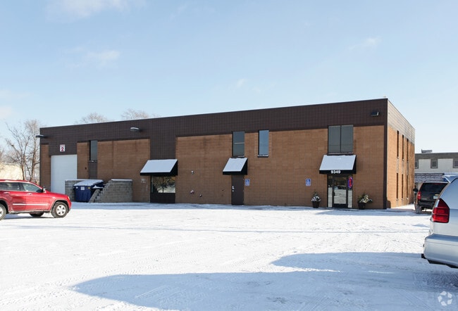
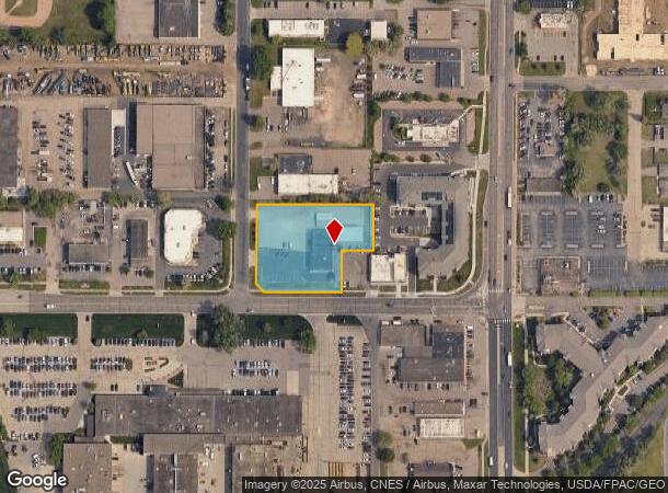
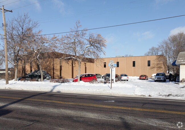
9349 Bryant Ave S, Minneapolis, MN 55420
NEARBY LISTINGS FOR SALE OR LEASE
Property Detail
9349 Bryant Ave S
Minneapolis-St. Paul-Bloomington, MN-WI
Bloomington Rental Addn
09-027-24-44-0048
LOT 001 BLOCK 001 T BLOOMINGTON RENTAL ADDN IRREGULAR
Industrialgeneral
Hennepin
X
Minnesota
27053C0458F
1
2024
1.33 AC
2024
Southdale
125500
Minneapolis/St Paul
8,250 SF
DEMOGRAPHICS near 9349 Bryant Ave S
1 Mile
3 Mile
5 Mile
2024 Total Population
8,954
77,557
212,459
2029 Population
8,774
76,110
211,042
Pop Growth 2024-2029
(2.01%)
(1.87%)
(0.67%)
Average Age
41
42
41
2024 Total Households
3,804
32,743
90,413
HH Growth 2024-2029
(2.10%)
(1.99%)
(0.66%)
Median Household Inc
$60,197
$73,362
$82,227
Avg Household Size
2.20
2.20
2.30
2024 Avg HH Vehicles
2.00
2.00
2.00
Median Home Value
$264,474
$288,123
$315,989
Median Year Built
1964
1964
1970
Nearby Places
Map Layers
Map Styles
 Street
 Aerial
- Restaurants
- Banks
- Shops
- Fitness
- Groceries
PUBLIC TRANSPORTATION
AIRPORT
Minneapolis-St Paul International/Wold-Chamberlain
DRIVE
WALK
Distance
Minneapolis-St Paul International/Wold-Chamberlain
13 min
7.4 mi
Freight Ports
Port Milwaukee
DRIVE
WALK
Distance
Port Milwaukee
381 min
344.5 mi
Nearby Properties
Address
Land Use
TOTAL SIZE
Lot Size
Zoning
Address
Land Use
TOTAL SIZE
Lot Size
Zoning
1,233,880 SF
63.49 AC
Address
Land Use
TOTAL SIZE
Lot Size
Zoning
1,341.19 AC
Address
Land Use
TOTAL SIZE
Lot Size
Zoning
21.50 AC
Address
Land Use
TOTAL SIZE
Lot Size
Zoning
154,216 SF
0.81 AC
GLC3*
Address
Land Use
TOTAL SIZE
Lot Size
Zoning
35.28 AC
Address
Land Use
TOTAL SIZE
Lot Size
Zoning
78,800 SF
2.12 AC
Address
Land Use
TOTAL SIZE
Lot Size
Zoning
435,796 SF
36.44 AC
Address
Land Use
TOTAL SIZE
Lot Size
Zoning
4.20 AC
Address
Land Use
TOTAL SIZE
Lot Size
Zoning
129,658 SF
13.52 AC
Address
Land Use
TOTAL SIZE
Lot Size
Zoning
98,676 SF
8.77 AC
Address
Land Use
TOTAL SIZE
Lot Size
Zoning
105,658 SF
18.80 AC
Address
Land Use
TOTAL SIZE
Lot Size
Zoning
Address
Land Use
TOTAL SIZE
Lot Size
Zoning
114,617 SF
17.68 AC
Address
Land Use
TOTAL SIZE
Lot Size
Zoning
122,021 SF
21.74 AC
Address
Land Use
TOTAL SIZE
Lot Size
Zoning
60,320 SF
11.50 AC
Address
Land Use
TOTAL SIZE
Lot Size
Zoning
22,393 SF
4.12 AC
Address
Land Use
TOTAL SIZE
Lot Size
Zoning
137,728 SF
11.31 AC
Address
Land Use
TOTAL SIZE
Lot Size
Zoning
Address
Land Use
TOTAL SIZE
Lot Size
Zoning
6.87 AC
Address
Land Use
TOTAL SIZE
Lot Size
Zoning
142,229 SF
26.61 AC
Address
Land Use
TOTAL SIZE
Lot Size
Zoning
12.88 AC
Address
Land Use
TOTAL SIZE
Lot Size
Zoning
32,748 SF
2.24 AC
Address
Land Use
TOTAL SIZE
Lot Size
Zoning
19,441 SF
1.37 AC
Address
Land Use
TOTAL SIZE
Lot Size
Zoning
42,338 SF
5.15 AC
Address
Land Use
TOTAL SIZE
Lot Size
Zoning
66,845 SF
6.44 AC
MDD6
Address
Land Use
TOTAL SIZE
Lot Size
Zoning
5.83 AC
Address
Land Use
TOTAL SIZE
Lot Size
Zoning
52,316 SF
3.56 AC
MDD6
Address
Land Use
TOTAL SIZE
Lot Size
Zoning
69,556 SF
6.50 AC
MDD6
Address
Land Use
TOTAL SIZE
Lot Size
Zoning
52,316 SF
4.81 AC
MDD6
Address
Land Use
TOTAL SIZE
Lot Size
Zoning
4.20 AC
The World's #1 Commercial Real Estate Marketplace
Connect with us
© 2025 CoStar Group
The information above has been obtained from sources believed reliable. While we do not doubt its accuracy we have not verified it and make no guarantee, warranty or representation about it. It is your responsibility to independently confirm its accuracy and completeness. Any projections, opinions, assumptions, or estimates used are for example only and do not represent the current or future performance of the property. The value of this transaction to you depends on tax and other factors which should be evaluated by your tax, financial, and legal advisors. You and your advisors should conduct a careful, independent investigation of the property to determine to your satisfaction the suitability of the property for your needs.