Property Record
9353 Garland Rd, Dallas, TX 75218

NEARBY LISTINGS FOR SALE OR LEASE
-
-
View all Dallas listings for sale on LoopNet.com
Property Detail
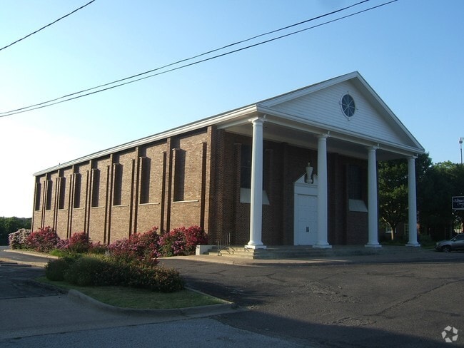
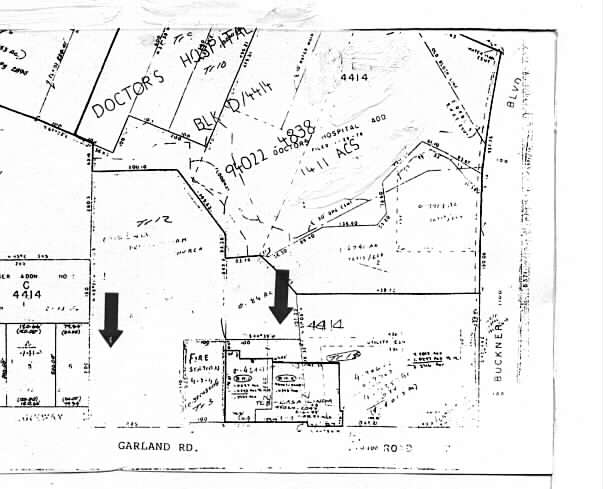
9353 Garland Rd
Dallas-Fort Worth-Arlington, TX
Church Key
00000322447000000
CHURCH KEY BLK G/4414 LT 1 ACS 3.962 INT202200272497 DD10172022 CO-DC 4414 00G 00100 7DA4414 00G
Apartment
Dallas
X
Texas
48113C0355K
1
2024
3.96 AC
2025
White Rock
008101
Dallas/Ft Worth
247,421 SF
DEMOGRAPHICS near 9353 Garland Rd
1 Mile
3 Mile
5 Mile
2024 Total Population
9,625
123,291
398,643
2029 Population
9,643
121,993
396,610
Pop Growth 2024-2029
+ 0.19%
(1.05%)
(0.51%)
Average Age
42
38
36
2024 Total Households
4,532
48,064
161,159
HH Growth 2024-2029
+ 0.07%
(1.20%)
(0.46%)
Median Household Inc
$74,308
$68,491
$61,298
Avg Household Size
2.10
2.50
2.40
2024 Avg HH Vehicles
2.00
2.00
2.00
Median Home Value
$414,430
$354,564
$328,951
Median Year Built
1965
1965
1974
Nearby Places
Map Layers
Map Styles
 Street
 Aerial
- Restaurants
- Banks
- Shops
- Fitness
- Groceries
PUBLIC TRANSPORTATION
COMMUTER RAIL
DRIVE
WALK
Distance
16 min
8.5 mi
AIRPORT
Dallas Love Field
DRIVE
WALK
Distance
Dallas Love Field
23 min
10.6 mi
Dallas-Fort Worth International
DRIVE
WALK
Distance
Dallas-Fort Worth International
39 min
30.1 mi
Nearby Properties
Address
Land Use
TOTAL SIZE
Lot Size
Zoning
Address
Land Use
TOTAL SIZE
Lot Size
Zoning
372,564 SF
13.34 AC
Z164
Address
Land Use
TOTAL SIZE
Lot Size
Zoning
32,530 SF
0.02 AC
Z239
Address
Land Use
TOTAL SIZE
Lot Size
Zoning
392,842 SF
16.79 AC
Z164
Address
Land Use
TOTAL SIZE
Lot Size
Zoning
691,816 SF
19.50 AC
Z239
Address
Land Use
TOTAL SIZE
Lot Size
Zoning
368,350 SF
1.21 AC
Z59
Address
Land Use
TOTAL SIZE
Lot Size
Zoning
252,473 SF
7.28 AC
Z165
Address
Land Use
TOTAL SIZE
Lot Size
Zoning
391,774 SF
3.97 AC
Z239
Address
Land Use
TOTAL SIZE
Lot Size
Zoning
445,781 SF
4.57 AC
Z239
Address
Land Use
TOTAL SIZE
Lot Size
Zoning
245,023 SF
6.84 AC
Z164
Address
Land Use
TOTAL SIZE
Lot Size
Zoning
284,990 SF
24.80 AC
Z298
Address
Land Use
TOTAL SIZE
Lot Size
Zoning
509,014 SF
30.82 AC
Z31
Address
Land Use
TOTAL SIZE
Lot Size
Zoning
292,827 SF
13.81 AC
Z163
Address
Land Use
TOTAL SIZE
Lot Size
Zoning
349,156 SF
10.86 AC
Z59
Address
Land Use
TOTAL SIZE
Lot Size
Zoning
196,386 SF
7.24 AC
Z164
Address
Land Use
TOTAL SIZE
Lot Size
Zoning
195,495 SF
9.61 AC
Z298
Address
Land Use
TOTAL SIZE
Lot Size
Zoning
265,986 SF
13.75 AC
Z163
Address
Land Use
TOTAL SIZE
Lot Size
Zoning
167,340 SF
11.24 AC
Z59
Address
Land Use
TOTAL SIZE
Lot Size
Zoning
161,796 SF
14.84 AC
Z239
Address
Land Use
TOTAL SIZE
Lot Size
Zoning
244,575 SF
9.91 AC
Z164
Address
Land Use
TOTAL SIZE
Lot Size
Zoning
220,989 SF
12.94 AC
Z163
Address
Land Use
TOTAL SIZE
Lot Size
Zoning
174,353 SF
12.64 AC
Z248
Address
Land Use
TOTAL SIZE
Lot Size
Zoning
116,162 SF
228.26 AC
Z372
Address
Land Use
TOTAL SIZE
Lot Size
Zoning
171,348 SF
5.70 AC
Z164
Address
Land Use
TOTAL SIZE
Lot Size
Zoning
297,704 SF
13.74 AC
Z163
Address
Land Use
TOTAL SIZE
Lot Size
Zoning
289,172 SF
12.56 AC
Z164
Address
Land Use
TOTAL SIZE
Lot Size
Zoning
228,857 SF
21.91 AC
Z298
Address
Land Use
TOTAL SIZE
Lot Size
Zoning
110,708 SF
16.79 AC
Z298
Address
Land Use
TOTAL SIZE
Lot Size
Zoning
196,470 SF
9.64 AC
Z163
Address
Land Use
TOTAL SIZE
Lot Size
Zoning
175,380 SF
6.79 AC
Z164
The World's #1 Commercial Real Estate Marketplace
Connect with us
© 2025 CoStar Group
The information above has been obtained from sources believed reliable. While we do not doubt its accuracy we have not verified it and make no guarantee, warranty or representation about it. It is your responsibility to independently confirm its accuracy and completeness. Any projections, opinions, assumptions, or estimates used are for example only and do not represent the current or future performance of the property. The value of this transaction to you depends on tax and other factors which should be evaluated by your tax, financial, and legal advisors. You and your advisors should conduct a careful, independent investigation of the property to determine to your satisfaction the suitability of the property for your needs.