Property Record
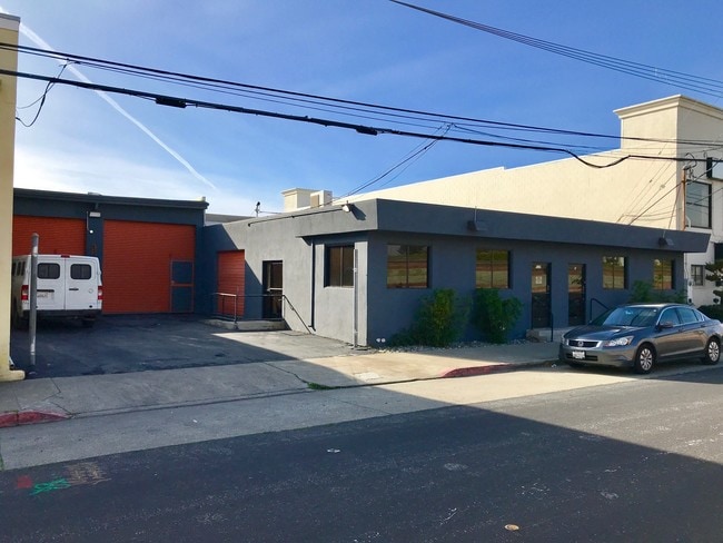
938 S Amphlett Blvd, San Mateo, CA 94402


Current Lease Availabilities
NEARBY LISTINGS FOR SALE OR LEASE
Property Detail
938 S Amphlett Blvd
San Francisco-Redwood City-South San Francisco, CA
East San Mateo
033-323-080
LOTS 20 21 BLOCK 23 SUB OF BLOCKS 20 TO 23 RESUB OF PTN OF RESUB BLKS 5 10 16 31 EAST SAN MATEO RSM 18/3 CITY OF SAN MATEO LESS PTN TO HWY
Industrialgeneral
San Mateo
X
California
06081C0158G
20
2024
0.23 AC
2025
San Mateo
606300
San Francisco
8,280 SF
DEMOGRAPHICS near 938 S Amphlett Blvd
1 Mile
3 Mile
5 Mile
2024 Total Population
31,076
143,367
231,906
2029 Population
29,691
137,271
221,468
Pop Growth 2024-2029
(4.46%)
(4.25%)
(4.50%)
Average Age
41
41
42
2024 Total Households
10,826
54,934
87,901
HH Growth 2024-2029
(4.62%)
(4.42%)
(4.70%)
Median Household Inc
$117,481
$143,995
$155,944
Avg Household Size
2.70
2.50
2.60
2024 Avg HH Vehicles
2.00
2.00
2.00
Median Home Value
$1,111,578
$1,119,078
$1,127,333
Median Year Built
1958
1968
1968
Nearby Places
Map Layers
Map Styles
 Street
 Aerial
- Restaurants
- Banks
- Shops
- Fitness
- Groceries
PUBLIC TRANSPORTATION
COMMUTER RAIL
San Mateo (Caltrain - Caltrain (Caltrain))
DRIVE
WALK
Distance
San Mateo (Caltrain - Caltrain (Caltrain))
4 min
1.1 mi
DRIVE
WALK
Distance
4 min
1.3 mi
AIRPORT
San Francisco International
DRIVE
WALK
Distance
San Francisco International
12 min
7.3 mi
Metro Oakland International
DRIVE
WALK
Distance
Metro Oakland International
34 min
25.7 mi
Norman Y Mineta San Jose International
DRIVE
WALK
Distance
Norman Y Mineta San Jose International
35 min
27.1 mi
Nearby Properties
Address
Land Use
TOTAL SIZE
Lot Size
Zoning
Address
Land Use
TOTAL SIZE
Lot Size
Zoning
1,068,445 SF
39.82 AC
Address
Land Use
TOTAL SIZE
Lot Size
Zoning
8.65 AC
Address
Land Use
TOTAL SIZE
Lot Size
Zoning
239,107 SF
2.37 AC
Address
Land Use
TOTAL SIZE
Lot Size
Zoning
354,800 SF
6 AC
Address
Land Use
TOTAL SIZE
Lot Size
Zoning
5.73 AC
Address
Land Use
TOTAL SIZE
Lot Size
Zoning
277,784 SF
10.85 AC
Address
Land Use
TOTAL SIZE
Lot Size
Zoning
215,318 SF
3.42 AC
Address
Land Use
TOTAL SIZE
Lot Size
Zoning
568,423 SF
16.07 AC
Address
Land Use
TOTAL SIZE
Lot Size
Zoning
311,952 SF
3.68 AC
Address
Land Use
TOTAL SIZE
Lot Size
Zoning
399,422 SF
5.94 AC
Address
Land Use
TOTAL SIZE
Lot Size
Zoning
260,547 SF
2.23 AC
Address
Land Use
TOTAL SIZE
Lot Size
Zoning
397,793 SF
10.48 AC
CL00C1
Address
Land Use
TOTAL SIZE
Lot Size
Zoning
295,000 SF
4.02 AC
Address
Land Use
TOTAL SIZE
Lot Size
Zoning
400,000 SF
4.39 AC
C10000
Address
Land Use
TOTAL SIZE
Lot Size
Zoning
417,200 SF
29.07 AC
R300PD
Address
Land Use
TOTAL SIZE
Lot Size
Zoning
219,318 SF
4.77 AC
Address
Land Use
TOTAL SIZE
Lot Size
Zoning
2,020 SF
2.64 AC
Address
Land Use
TOTAL SIZE
Lot Size
Zoning
337,459 SF
17.16 AC
EA0000
Address
Land Use
TOTAL SIZE
Lot Size
Zoning
547,306 SF
3.93 AC
Address
Land Use
TOTAL SIZE
Lot Size
Zoning
326,432 SF
10.27 AC
CL0C21
Address
Land Use
TOTAL SIZE
Lot Size
Zoning
245,260 SF
9.08 AC
Address
Land Use
TOTAL SIZE
Lot Size
Zoning
218,249 SF
2.15 AC
Address
Land Use
TOTAL SIZE
Lot Size
Zoning
150,806 SF
5.86 AC
Address
Land Use
TOTAL SIZE
Lot Size
Zoning
177,000 SF
6.24 AC
Address
Land Use
TOTAL SIZE
Lot Size
Zoning
395,010 SF
15.11 AC
R003S3
Address
Land Use
TOTAL SIZE
Lot Size
Zoning
Address
Land Use
TOTAL SIZE
Lot Size
Zoning
0.93 AC
CL00C2
Address
Land Use
TOTAL SIZE
Lot Size
Zoning
196,504 SF
1.98 AC
Address
Land Use
TOTAL SIZE
Lot Size
Zoning
192,054 SF
4.54 AC
Address
Land Use
TOTAL SIZE
Lot Size
Zoning
233,788 SF
3.35 AC
The World's #1 Commercial Real Estate Marketplace
Connect with us
© 2025 CoStar Group
The information above has been obtained from sources believed reliable. While we do not doubt its accuracy we have not verified it and make no guarantee, warranty or representation about it. It is your responsibility to independently confirm its accuracy and completeness. Any projections, opinions, assumptions, or estimates used are for example only and do not represent the current or future performance of the property. The value of this transaction to you depends on tax and other factors which should be evaluated by your tax, financial, and legal advisors. You and your advisors should conduct a careful, independent investigation of the property to determine to your satisfaction the suitability of the property for your needs.