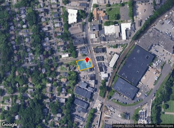
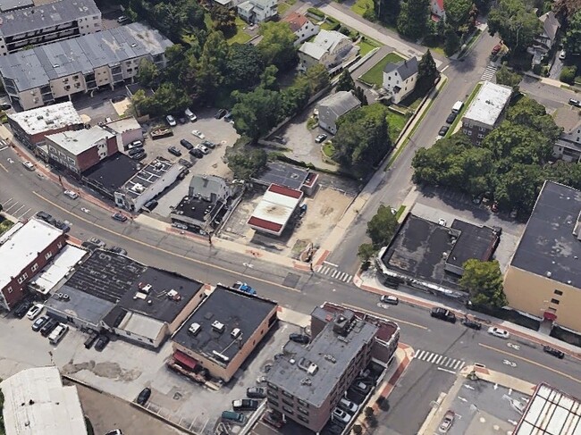
Property Record
936 Hope St, Stamford, CT 06907
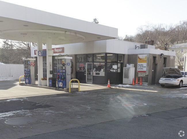
This Property Is For Sale
NEARBY LISTINGS FOR SALE OR LEASE
Property Detail
936 Hope St
Industrialgeneral
Fairfield
X
Connecticut
09001C0509F
0.30 AC
2025
Stamford
2025
Westchester/So Connecticut
020900
Bridgeport-Stamford-Norwalk, CT
1,507 SF
STAM-000002-000000-001715
DEMOGRAPHICS near 936 Hope St
1 Mile
3 Mile
5 Mile
2024 Total Population
13,595
107,747
219,224
2029 Population
13,677
108,480
220,322
Pop Growth 2024-2029
+ 0.60%
+ 0.68%
+ 0.50%
Average Age
39
39
39
2024 Total Households
5,003
41,817
82,916
HH Growth 2024-2029
+ 0.60%
+ 0.86%
+ 0.67%
Median Household Inc
$120,368
$111,766
$113,721
Avg Household Size
2.70
2.50
2.50
2024 Avg HH Vehicles
2.00
2.00
2.00
Median Home Value
$618,019
$653,823
$732,078
Median Year Built
1965
1967
1969
Nearby Places
Map Layers
Map Styles
 Street
 Aerial
- Restaurants
- Banks
- Shops
- Fitness
- Groceries
PUBLIC TRANSPORTATION
COMMUTER RAIL
Springdale Station (New Haven Line - Metro-North Commuter Railroad Company (Metro-North))
DRIVE
WALK
Distance
Springdale Station (New Haven Line - Metro-North Commuter Railroad Company (Metro-North))
0 min
5 min
0.3 mi
Springdale Mw Facility (New Canaan - Metro-North Railroad)
DRIVE
WALK
Distance
Springdale Mw Facility (New Canaan - Metro-North Railroad)
3 min
1.1 mi
AIRPORT
Westchester County
DRIVE
WALK
Distance
Westchester County
29 min
17.0 mi
LaGuardia
DRIVE
WALK
Distance
LaGuardia
55 min
36.2 mi
Freight Ports
Port of New Haven
DRIVE
WALK
Distance
Port of New Haven
57 min
40.1 mi
Nearby Properties
Address
Land Use
TOTAL SIZE
Lot Size
Zoning
Address
Land Use
TOTAL SIZE
Lot Size
Zoning
13.21 AC
CSCD
Address
Land Use
TOTAL SIZE
Lot Size
Zoning
8.91 AC
DC
Address
Land Use
TOTAL SIZE
Lot Size
Zoning
336,000 SF
40 AC
MU
Address
Land Use
TOTAL SIZE
Lot Size
Zoning
5.10 AC
MXD
Address
Land Use
TOTAL SIZE
Lot Size
Zoning
Address
Land Use
TOTAL SIZE
Lot Size
Zoning
4.13 AC
CC
Address
Land Use
TOTAL SIZE
Lot Size
Zoning
46,302 SF
23.50 AC
MG
Address
Land Use
TOTAL SIZE
Lot Size
Zoning
9.62 AC
MZN
Address
Land Use
TOTAL SIZE
Lot Size
Zoning
359,686 SF
1.67 AC
CCN
Address
Land Use
TOTAL SIZE
Lot Size
Zoning
377,754 SF
2.06 AC
PD
Address
Land Use
TOTAL SIZE
Lot Size
Zoning
32.68 AC
MD
Address
Land Use
TOTAL SIZE
Lot Size
Zoning
304,617 SF
CI
Address
Land Use
TOTAL SIZE
Lot Size
Zoning
304,345 SF
1.15 AC
PD
Address
Land Use
TOTAL SIZE
Lot Size
Zoning
308,621 SF
CI
Address
Land Use
TOTAL SIZE
Lot Size
Zoning
32.06 AC
DMR
Address
Land Use
TOTAL SIZE
Lot Size
Zoning
235,186 SF
1.29 AC
CG
Address
Land Use
TOTAL SIZE
Lot Size
Zoning
3.14 AC
RH
Address
Land Use
TOTAL SIZE
Lot Size
Zoning
243,000 SF
3.02 AC
CG
Address
Land Use
TOTAL SIZE
Lot Size
Zoning
334,905 SF
2.52 AC
MXD
Address
Land Use
TOTAL SIZE
Lot Size
Zoning
32.43 AC
RA1
Address
Land Use
TOTAL SIZE
Lot Size
Zoning
4.53 AC
RH
Address
Land Use
TOTAL SIZE
Lot Size
Zoning
5.18 AC
CC
Address
Land Use
TOTAL SIZE
Lot Size
Zoning
25.91 AC
MZN
Address
Land Use
TOTAL SIZE
Lot Size
Zoning
39,031 SF
451.38 AC
ADD
Address
Land Use
TOTAL SIZE
Lot Size
Zoning
322,812 SF
3.17 AC
MZN
Address
Land Use
TOTAL SIZE
Lot Size
Zoning
229,644 SF
3.12 AC
RH
Address
Land Use
TOTAL SIZE
Lot Size
Zoning
29.87 AC
R10
Address
Land Use
TOTAL SIZE
Lot Size
Zoning
236,713 SF
3.21 AC
RMF
Address
Land Use
TOTAL SIZE
Lot Size
Zoning
234,344 SF
3.24 AC
RH
Address
Land Use
TOTAL SIZE
Lot Size
Zoning
13.56 AC
R75
The World's #1 Commercial Real Estate Marketplace
Connect with us
© 2025 CoStar Group
The information above has been obtained from sources believed reliable. While we do not doubt its accuracy we have not verified it and make no guarantee, warranty or representation about it. It is your responsibility to independently confirm its accuracy and completeness. Any projections, opinions, assumptions, or estimates used are for example only and do not represent the current or future performance of the property. The value of this transaction to you depends on tax and other factors which should be evaluated by your tax, financial, and legal advisors. You and your advisors should conduct a careful, independent investigation of the property to determine to your satisfaction the suitability of the property for your needs.