Property Record
9360 Navarre Pky, Navarre, FL 32566


NEARBY LISTINGS FOR SALE OR LEASE
Property Detail
9360 Navarre Pky
14-2S-26-0000-00144-0000
COM AT NW COR OF SW4 TH S 1323 .88 FT TO SW CORN OF LOT 6 BLK D FOX DEN VILLAGES PHS III & POB THN S89*1312E 1319.48 FT TO NW COR OF LOT GG CRESCENT SHORES THN S0*3714W 664.05 FT THN N89*0930W 660.35 FT THN S0*4119W 640.33 FT TO N R/W OF HWY 98 THN N
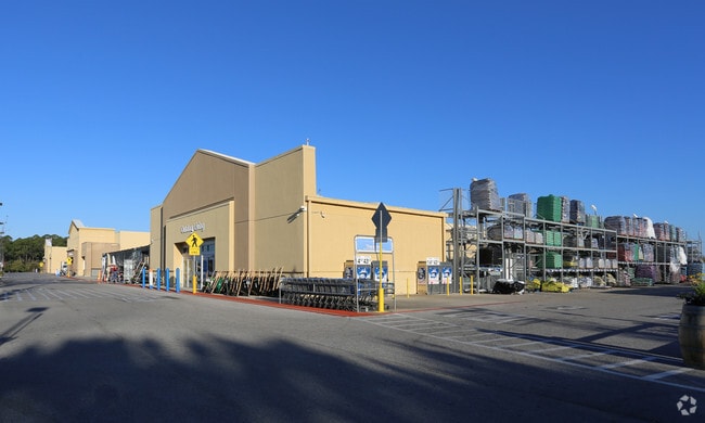
Storebuilding
Santa Rosa
X
Florida
12113C0587H
6
2024
22.80 AC
2025
Navarre
010827
Pensacola
248,857 SF
Pensacola-Ferry Pass-Brent, FL
DEMOGRAPHICS near 9360 Navarre Pky
1 Mile
3 Mile
5 Mile
2024 Total Population
5,617
21,298
37,315
2029 Population
6,491
24,330
42,652
Pop Growth 2024-2029
+ 15.56%
+ 14.24%
+ 14.30%
Average Age
38
38
39
2024 Total Households
2,091
7,897
14,268
HH Growth 2024-2029
+ 15.83%
+ 14.50%
+ 14.80%
Median Household Inc
$97,726
$91,428
$90,730
Avg Household Size
2.60
2.70
2.60
2024 Avg HH Vehicles
2.00
2.00
2.00
Median Home Value
$273,704
$282,142
$294,523
Median Year Built
1996
1996
1997
Nearby Places
Map Layers
Map Styles
 Street
 Aerial
- Restaurants
- Banks
- Shops
- Fitness
- Groceries
PUBLIC TRANSPORTATION
AIRPORT
Eglin AFB/Destin-Ft Walton Beach
DRIVE
WALK
Distance
Eglin AFB/Destin-Ft Walton Beach
48 min
24.3 mi
Pensacola International
DRIVE
WALK
Distance
Pensacola International
56 min
31.8 mi
Freight Ports
Port of Panama City
DRIVE
WALK
Distance
Port of Panama City
114 min
71.0 mi
Nearby Properties
Address
Land Use
TOTAL SIZE
Lot Size
Zoning
Address
Land Use
TOTAL SIZE
Lot Size
Zoning
44,985 SF
317.38 AC
NB-C
Address
Land Use
TOTAL SIZE
Lot Size
Zoning
244,004 SF
10.54 AC
HCD
Address
Land Use
TOTAL SIZE
Lot Size
Zoning
110,921 SF
9.65 AC
HCD
Address
Land Use
TOTAL SIZE
Lot Size
Zoning
82,582 SF
9.53 AC
HCD
Address
Land Use
TOTAL SIZE
Lot Size
Zoning
106,696 SF
15.59 AC
HCD
Address
Land Use
TOTAL SIZE
Lot Size
Zoning
7,800 SF
7.68 AC
R2
Address
Land Use
TOTAL SIZE
Lot Size
Zoning
77,417 SF
8.06 AC
HCD
Address
Land Use
TOTAL SIZE
Lot Size
Zoning
1,854 SF
45.75 AC
Address
Land Use
TOTAL SIZE
Lot Size
Zoning
97,214 SF
2.79 AC
HCD
Address
Land Use
TOTAL SIZE
Lot Size
Zoning
68,334 SF
4.45 AC
HCD
Address
Land Use
TOTAL SIZE
Lot Size
Zoning
48,055 SF
9.12 AC
HCD
Address
Land Use
TOTAL SIZE
Lot Size
Zoning
14,448 SF
17.20 AC
P
Address
Land Use
TOTAL SIZE
Lot Size
Zoning
4,655 SF
28.65 AC
HCD
Address
Land Use
TOTAL SIZE
Lot Size
Zoning
21,567 SF
5.56 AC
HCD
Address
Land Use
TOTAL SIZE
Lot Size
Zoning
4,975 SF
6.03 AC
HCD
Address
Land Use
TOTAL SIZE
Lot Size
Zoning
8,714 SF
7 AC
P2-HON
Address
Land Use
TOTAL SIZE
Lot Size
Zoning
45,672 SF
2.47 AC
PUD
Address
Land Use
TOTAL SIZE
Lot Size
Zoning
2,046 SF
0.79 AC
HCD
Address
Land Use
TOTAL SIZE
Lot Size
Zoning
37,436 SF
4.79 AC
R3
Address
Land Use
TOTAL SIZE
Lot Size
Zoning
14,208 SF
4.53 AC
HCD
Address
Land Use
TOTAL SIZE
Lot Size
Zoning
36,749 SF
2.75 AC
HCD
Address
Land Use
TOTAL SIZE
Lot Size
Zoning
26,192 SF
3.82 AC
HCD
Address
Land Use
TOTAL SIZE
Lot Size
Zoning
40,544 SF
2.26 AC
HCD
Address
Land Use
TOTAL SIZE
Lot Size
Zoning
24,025 SF
2.66 AC
HCD
Address
Land Use
TOTAL SIZE
Lot Size
Zoning
38,588 SF
4.82 AC
HCD
Address
Land Use
TOTAL SIZE
Lot Size
Zoning
32,808 SF
9.37 AC
HCD
Address
Land Use
TOTAL SIZE
Lot Size
Zoning
320.35 AC
Address
Land Use
TOTAL SIZE
Lot Size
Zoning
400 SF
4.01 AC
HCD
Address
Land Use
TOTAL SIZE
Lot Size
Zoning
16,151 SF
2.53 AC
HCD
The World's #1 Commercial Real Estate Marketplace
Connect with us
© 2025 CoStar Group
The information above has been obtained from sources believed reliable. While we do not doubt its accuracy we have not verified it and make no guarantee, warranty or representation about it. It is your responsibility to independently confirm its accuracy and completeness. Any projections, opinions, assumptions, or estimates used are for example only and do not represent the current or future performance of the property. The value of this transaction to you depends on tax and other factors which should be evaluated by your tax, financial, and legal advisors. You and your advisors should conduct a careful, independent investigation of the property to determine to your satisfaction the suitability of the property for your needs.