Property Record
937 E Waterloo Rd E, Akron, OH 44306
Property Detail
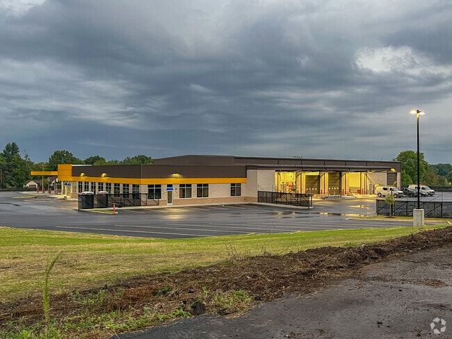
937 E Waterloo Rd E
Akron, OH
TR 11 N OF E WATERLOO RD
67-64223
SUMMIT
Commercialnec
Ohio
2024
44
2025
1.01 AC
503300
Akron
21,794 SF
Cleveland
NEARBY LISTINGS FOR SALE OR LEASE
DEMOGRAPHICS near 937 E Waterloo Rd E
1 mile
3 mile
5 mile
2024 Total Population
9,025
63,206
179,031
2029 Population
8,930
62,991
178,041
Pop Growth 2024-2029
(1.05%)
(0.34%)
(0.55%)
Average Age
37
39
40
2024 Total Households
3,895
26,858
76,903
HH Growth 2024-2029
(1.03%)
(0.41%)
(0.59%)
Median Household Inc
$40,130
$43,007
$43,737
Avg Household Size
2.30
2.30
2.20
2024 Avg HH Vehicles
1.00
2.00
2.00
Median Home Value
$84,839
$93,927
$106,374
Median Year Built
1963
1953
1955
Nearby Places
Map Layers
Map Styles
 Street
 Aerial
Transit
 Traffic
 Biking
Places
Listings with unknown addresses are not visible on the map
- Restaurants
- Banks
- Shops
- Fitness
- Groceries
PUBLIC TRANSPORTATION
COMMUTER RAIL
Akron Northside (National Park Scenic Railway - Cuyahoga Valley Scenic Railroad)
Drive
Walk
Distance
Akron Northside (National Park Scenic Railway - Cuyahoga Valley Scenic Railroad)
11 min
5.2 mi
Big Bend (National Park Scenic Railway - Cuyahoga Valley Scenic Railroad)
Drive
Walk
Distance
Big Bend (National Park Scenic Railway - Cuyahoga Valley Scenic Railroad)
19 min
8.5 mi
AIRPORT
Akron-Canton Regional
Drive
Walk
Distance
Akron-Canton Regional
17 min
11.6 mi
Freight Ports
Port of Toledo
Drive
Walk
Distance
Port of Toledo
165 min
139.4 mi
Nearby Properties
Address
Land Use
TOTAL SIZE
Lot Size
Zoning
Address
Land Use
TOTAL SIZE
Lot Size
Zoning
Address
Land Use
TOTAL SIZE
Lot Size
Zoning
225,751 SF
0.16 AC
Address
Land Use
TOTAL SIZE
Lot Size
Zoning
203,458 SF
10.41 AC
Address
Land Use
TOTAL SIZE
Lot Size
Zoning
9.19 AC
Address
Land Use
TOTAL SIZE
Lot Size
Zoning
Address
Land Use
TOTAL SIZE
Lot Size
Zoning
423,125 SF
5.57 AC
Address
Land Use
TOTAL SIZE
Lot Size
Zoning
57,369 SF
93.97 AC
Address
Land Use
TOTAL SIZE
Lot Size
Zoning
Address
Land Use
TOTAL SIZE
Lot Size
Zoning
227,634 SF
21.46 AC
Address
Land Use
TOTAL SIZE
Lot Size
Zoning
245,911 SF
14.48 AC
Address
Land Use
TOTAL SIZE
Lot Size
Zoning
142,848 SF
13.85 AC
Address
Land Use
TOTAL SIZE
Lot Size
Zoning
154,926 SF
12.38 AC
Address
Land Use
TOTAL SIZE
Lot Size
Zoning
196,767 SF
37.16 AC
Address
Land Use
TOTAL SIZE
Lot Size
Zoning
99,003 SF
20.10 AC
Address
Land Use
TOTAL SIZE
Lot Size
Zoning
639,478 SF
29.51 AC
Address
Land Use
TOTAL SIZE
Lot Size
Zoning
Address
Land Use
TOTAL SIZE
Lot Size
Zoning
270,860 SF
131.89 AC
Address
Land Use
TOTAL SIZE
Lot Size
Zoning
121,006 SF
6.09 AC
Address
Land Use
TOTAL SIZE
Lot Size
Zoning
22,977 SF
263.47 AC
Address
Land Use
TOTAL SIZE
Lot Size
Zoning
57,180 SF
6.67 AC
Address
Land Use
TOTAL SIZE
Lot Size
Zoning
Address
Land Use
TOTAL SIZE
Lot Size
Zoning
51,520 SF
2.70 AC
Address
Land Use
TOTAL SIZE
Lot Size
Zoning
52,640 SF
0.42 AC
Address
Land Use
TOTAL SIZE
Lot Size
Zoning
203,059 SF
55.62 AC
Address
Land Use
TOTAL SIZE
Lot Size
Zoning
49,712 SF
0.11 AC
Address
Land Use
TOTAL SIZE
Lot Size
Zoning
6.06 AC
Address
Land Use
TOTAL SIZE
Lot Size
Zoning
232,425 SF
13.37 AC
Address
Land Use
TOTAL SIZE
Lot Size
Zoning
258,686 SF
19.52 AC
Address
Land Use
TOTAL SIZE
Lot Size
Zoning
81,108 SF
3.86 AC
Address
Land Use
TOTAL SIZE
Lot Size
Zoning
65,436 SF
34.63 AC
The World's #1 Commercial Real Estate Marketplace
Connect with us
© 2026 CoStar Group
The information above has been obtained from sources believed reliable. While we do not doubt its accuracy we have not verified it and make no guarantee, warranty or representation about it. It is your responsibility to independently confirm its accuracy and completeness. Any projections, opinions, assumptions, or estimates used are for example only and do not represent the current or future performance of the property. The value of this transaction to you depends on tax and other factors which should be evaluated by your tax, financial, and legal advisors. You and your advisors should conduct a careful, independent investigation of the property to determine to your satisfaction the suitability of the property for your needs.