Property Record
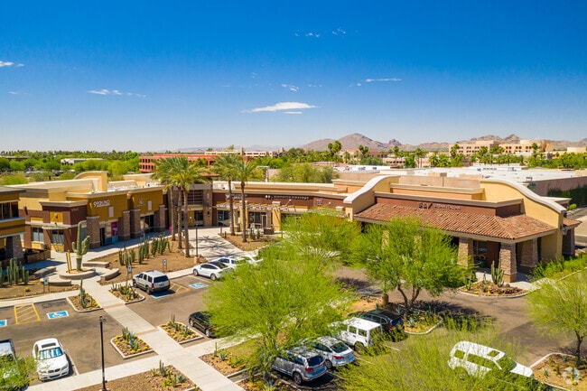
9375 E Shea Blvd, Scottsdale, AZ 85260


NEARBY LISTINGS FOR SALE OR LEASE
Property Detail
9375 E Shea Blvd
Phoenix-Mesa-Scottsdale, AZ
A POR OF NE4 SEC 30 DAF COM NE COR SD SEC TH W 1321.14F TH S 65F POB TH S 59D 59M W 346.13F TH W 200F TH N 664.19F TH E 500F TPOB P/F 22-0801569
217-36-001Q
Maricopa
Storesoffices
Arizona
2025
7.03 AC
2025
Central Scottsdale
216810
Phoenix
73,950 SF
DEMOGRAPHICS near 9375 E Shea Blvd
1 Mile
3 Mile
5 Mile
2024 Total Population
11,589
73,582
150,619
2029 Population
12,766
80,392
164,978
Pop Growth 2024-2029
+ 10.16%
+ 9.25%
+ 9.53%
Average Age
50
47
46
2024 Total Households
6,039
34,505
68,594
HH Growth 2024-2029
+ 10.58%
+ 9.43%
+ 9.78%
Median Household Inc
$89,236
$101,120
$110,125
Avg Household Size
1.80
2.10
2.10
2024 Avg HH Vehicles
2.00
2.00
2.00
Median Home Value
$570,256
$667,920
$702,818
Median Year Built
1986
1987
1989
Nearby Places
Map Layers
Map Styles
 Street
 Aerial
- Restaurants
- Banks
- Shops
- Fitness
- Groceries
PUBLIC TRANSPORTATION
AIRPORT
Phoenix Sky Harbor International
DRIVE
WALK
Distance
Phoenix Sky Harbor International
26 min
18.2 mi
Phoenix-Mesa Gateway
DRIVE
WALK
Distance
Phoenix-Mesa Gateway
46 min
33.2 mi
Freight Ports
Port of San Diego
DRIVE
WALK
Distance
Port of San Diego
421 min
383.7 mi
SALE & LEASE HISTORY
LISTING DATE
SALE/LEASE

Sep 24, 2016
For Lease
Nearby Properties
Address
Land Use
TOTAL SIZE
Lot Size
Zoning
Address
Land Use
TOTAL SIZE
Lot Size
Zoning
500,010 SF
4.52 AC
PF
Address
Land Use
TOTAL SIZE
Lot Size
Zoning
6.71 AC
PAD
Address
Land Use
TOTAL SIZE
Lot Size
Zoning
623,263 SF
27.34 AC
M-H
Address
Land Use
TOTAL SIZE
Lot Size
Zoning
7,803 SF
2.31 AC
I-P
Address
Land Use
TOTAL SIZE
Lot Size
Zoning
533,288 SF
18.61 AC
I-P
Address
Land Use
TOTAL SIZE
Lot Size
Zoning
824,672 SF
11.52 AC
Address
Land Use
TOTAL SIZE
Lot Size
Zoning
124,656 SF
160 AC
R-35
Address
Land Use
TOTAL SIZE
Lot Size
Zoning
380,106 SF
38.10 AC
C-T
Address
Land Use
TOTAL SIZE
Lot Size
Zoning
355,757 SF
32.44 AC
C-R
Address
Land Use
TOTAL SIZE
Lot Size
Zoning
734,506 SF
7.75 AC
C-T
Address
Land Use
TOTAL SIZE
Lot Size
Zoning
542,795 SF
5.56 AC
PCP
Address
Land Use
TOTAL SIZE
Lot Size
Zoning
515,127 SF
7.57 AC
C-T
Address
Land Use
TOTAL SIZE
Lot Size
Zoning
250,415 SF
21 AC
I-P
Address
Land Use
TOTAL SIZE
Lot Size
Zoning
423,600 SF
5.13 AC
I1
Address
Land Use
TOTAL SIZE
Lot Size
Zoning
163,075 SF
17.77 AC
C-R
Address
Land Use
TOTAL SIZE
Lot Size
Zoning
353,691 SF
16.18 AC
M-H
Address
Land Use
TOTAL SIZE
Lot Size
Zoning
345,713 SF
18.25 AC
M-H
Address
Land Use
TOTAL SIZE
Lot Size
Zoning
138,984 SF
14.30 AC
C-C
Address
Land Use
TOTAL SIZE
Lot Size
Zoning
247,810 SF
29.27 AC
Address
Land Use
TOTAL SIZE
Lot Size
Zoning
20,355 SF
38.96 AC
M-H
Address
Land Use
TOTAL SIZE
Lot Size
Zoning
270,059 SF
10.61 AC
M-H
Address
Land Use
TOTAL SIZE
Lot Size
Zoning
290,758 SF
5.11 AC
C-C
Address
Land Use
TOTAL SIZE
Lot Size
Zoning
240,248 SF
4.67 AC
C-T
Address
Land Use
TOTAL SIZE
Lot Size
Zoning
321,782 SF
7.62 AC
M-H
Address
Land Use
TOTAL SIZE
Lot Size
Zoning
283,212 SF
5.38 AC
Address
Land Use
TOTAL SIZE
Lot Size
Zoning
360,143 SF
11.88 AC
C-C
Address
Land Use
TOTAL SIZE
Lot Size
Zoning
144,102 SF
18.45 AC
R-18
Address
Land Use
TOTAL SIZE
Lot Size
Zoning
339,020 SF
15.13 AC
M-H
Address
Land Use
TOTAL SIZE
Lot Size
Zoning
256,962 SF
5.20 AC
PF
Address
Land Use
TOTAL SIZE
Lot Size
Zoning
241,967 SF
6.85 AC
The World's #1 Commercial Real Estate Marketplace
Connect with us
© 2025 CoStar Group
The information above has been obtained from sources believed reliable. While we do not doubt its accuracy we have not verified it and make no guarantee, warranty or representation about it. It is your responsibility to independently confirm its accuracy and completeness. Any projections, opinions, assumptions, or estimates used are for example only and do not represent the current or future performance of the property. The value of this transaction to you depends on tax and other factors which should be evaluated by your tax, financial, and legal advisors. You and your advisors should conduct a careful, independent investigation of the property to determine to your satisfaction the suitability of the property for your needs.