Property Record
938 Montauk Hwy, Water Mill, NY 11976
NEARBY LISTINGS FOR SALE OR LEASE
Property Detail
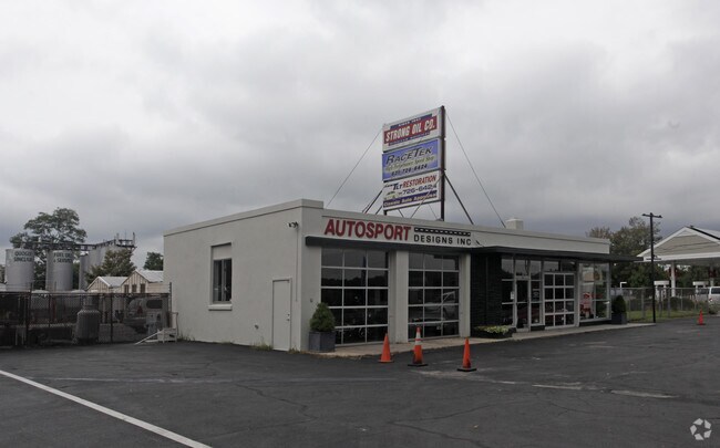
938 Montauk Hwy
0900-101-00-03-00-047-003
88-LD EQ +700088 CTR IM000 PER GMS
Vehiclerentalsvehiclesales
Suffolk
X
New York
36103C0536H
47
0
0.85 AC
2024
Eastern Suffolk
190712
Long Island (New York)
2,210 SF
Nassau County-Suffolk County, NY
DEMOGRAPHICS near 938 Montauk Hwy
1 Mile
3 Mile
5 Mile
2024 Total Population
1,085
11,280
28,355
2029 Population
1,176
11,930
29,856
Pop Growth 2024-2029
+ 8.39%
+ 5.76%
+ 5.29%
Average Age
46
45
45
2024 Total Households
410
4,366
10,889
HH Growth 2024-2029
+ 8.54%
+ 5.68%
+ 5.25%
Median Household Inc
$219,469
$160,572
$139,137
Avg Household Size
2.50
2.50
2.50
2024 Avg HH Vehicles
2.00
2.00
2.00
Median Home Value
$1,108,127
$1,100,112
$1,060,061
Median Year Built
1981
1981
1982
Nearby Places
Map Layers
Map Styles
 Street
 Aerial
- Restaurants
- Banks
- Shops
- Fitness
- Groceries
PUBLIC TRANSPORTATION
COMMUTER RAIL
Bridgehampton Station (Montauk Branch - Long Island Rail Road)
DRIVE
WALK
Distance
Bridgehampton Station (Montauk Branch - Long Island Rail Road)
7 min
2.9 mi
Southampton Station (Montauk Branch - Long Island Rail Road)
DRIVE
WALK
Distance
Southampton Station (Montauk Branch - Long Island Rail Road)
7 min
3.2 mi
Freight Ports
Port of New Haven
DRIVE
WALK
Distance
Port of New Haven
179 min
79.5 mi
Nearby Properties
Address
Land Use
TOTAL SIZE
Lot Size
Zoning
Address
Land Use
TOTAL SIZE
Lot Size
Zoning
182,225 SF
6.16 AC
VILLA
Address
Land Use
TOTAL SIZE
Lot Size
Zoning
138,725 SF
14.70 AC
SCB
Address
Land Use
TOTAL SIZE
Lot Size
Zoning
42 AC
VILLA
Address
Land Use
TOTAL SIZE
Lot Size
Zoning
69,043 SF
16.40 AC
SCB
Address
Land Use
TOTAL SIZE
Lot Size
Zoning
9,223 SF
11.22 AC
R60
Address
Land Use
TOTAL SIZE
Lot Size
Zoning
13,935 SF
4.07 AC
R80
Address
Land Use
TOTAL SIZE
Lot Size
Zoning
25,819 SF
2.85 AC
R80
Address
Land Use
TOTAL SIZE
Lot Size
Zoning
41,580 SF
4.21 AC
VILLA
Address
Land Use
TOTAL SIZE
Lot Size
Zoning
37,222 SF
13.77 AC
CR60
Address
Land Use
TOTAL SIZE
Lot Size
Zoning
6,516 SF
2.44 AC
R60
Address
Land Use
TOTAL SIZE
Lot Size
Zoning
12,145 SF
2.60 AC
CR60
Address
Land Use
TOTAL SIZE
Lot Size
Zoning
14,686 SF
1.98 AC
VILLA
Address
Land Use
TOTAL SIZE
Lot Size
Zoning
6.40 AC
VILLA
Address
Land Use
TOTAL SIZE
Lot Size
Zoning
65,835 SF
7.20 AC
VILLA
Address
Land Use
TOTAL SIZE
Lot Size
Zoning
5,358 SF
1.33 AC
R60
Address
Land Use
TOTAL SIZE
Lot Size
Zoning
9,372 SF
1.36 AC
R60
Address
Land Use
TOTAL SIZE
Lot Size
Zoning
73,470 SF
122.50 AC
OSC
Address
Land Use
TOTAL SIZE
Lot Size
Zoning
3,397 SF
1.24 AC
R60
Address
Land Use
TOTAL SIZE
Lot Size
Zoning
13,278 SF
1.49 AC
VILLA
Address
Land Use
TOTAL SIZE
Lot Size
Zoning
7,955 SF
203.49 AC
CR80
Address
Land Use
TOTAL SIZE
Lot Size
Zoning
2.66 AC
R80
Address
Land Use
TOTAL SIZE
Lot Size
Zoning
16 AC
R120
Address
Land Use
TOTAL SIZE
Lot Size
Zoning
3.60 AC
VILLA
Address
Land Use
TOTAL SIZE
Lot Size
Zoning
1.74 AC
R60
Address
Land Use
TOTAL SIZE
Lot Size
Zoning
6,304 SF
1.90 AC
R60
Address
Land Use
TOTAL SIZE
Lot Size
Zoning
30,322 SF
3.25 AC
VILLA
Address
Land Use
TOTAL SIZE
Lot Size
Zoning
16.07 AC
R80
Address
Land Use
TOTAL SIZE
Lot Size
Zoning
8.51 AC
LI40
Address
Land Use
TOTAL SIZE
Lot Size
Zoning
11,650 SF
3.10 AC
R80
Address
Land Use
TOTAL SIZE
Lot Size
Zoning
4 AC
R120
The World's #1 Commercial Real Estate Marketplace
Connect with us
© 2025 CoStar Group
The information above has been obtained from sources believed reliable. While we do not doubt its accuracy we have not verified it and make no guarantee, warranty or representation about it. It is your responsibility to independently confirm its accuracy and completeness. Any projections, opinions, assumptions, or estimates used are for example only and do not represent the current or future performance of the property. The value of this transaction to you depends on tax and other factors which should be evaluated by your tax, financial, and legal advisors. You and your advisors should conduct a careful, independent investigation of the property to determine to your satisfaction the suitability of the property for your needs.