Property Record
938 Thunderbolt Dr, Walterboro, SC 29488


Property Detail
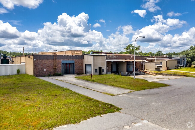
938 Thunderbolt Dr
Other Market Areas
COLLETON
132-00-00-020
South Carolina
Manufacturinglight
43.30 AC
B and X Area of moderate flood hazard, usually the area between the limits of the 100-year and 500-year floods.
I-95 Walterboro/Hardeeville
138,213 SF
NEARBY LISTINGS FOR SALE OR LEASE
DEMOGRAPHICS near 938 Thunderbolt Dr
1 mile
3 mile
5 mile
2025 Total Population
505
6,912
14,610
2030 Population
503
6,957
14,687
Pop Growth 2025-2030
(0.40%)
+ 0.65%
+ 0.53%
Average Age
39
41
41
2025 Total Households
187
2,681
5,775
HH Growth 2025-2030
(0.53%)
+ 0.56%
+ 0.36%
Median Household Inc
$32,916
$45,399
$47,481
Avg Household Size
2.50
2.40
2.40
2025 Avg HH Vehicles
1.00
2.00
2.00
Median Home Value
$57,142
$123,743
$151,686
Median Year Built
1988
1986
1982
Nearby Places
Map Layers
Map Styles
 Street
 Aerial
Layers
 Traffic
 Biking
Places
Listings with unknown addresses are not visible on the map
- Restaurants
- Banks
- Shops
- Fitness
- Groceries
PUBLIC TRANSPORTATION
AIRPORT
Charleston AFB/International
Drive
Walk
Distance
Charleston AFB/International
58 min
39.4 mi
SALE & LEASE HISTORY
LISTING DATE
SALE/LEASE

Nov 13, 2019
For Sale
May 23, 2020
For Lease
May 11, 2021
For Sale
Mar 02, 2021
For Lease
Jul 13, 2020
For Lease
Nearby Properties
Address
Land Use
TOTAL SIZE
Lot Size
Zoning
Address
Land Use
TOTAL SIZE
Lot Size
Zoning
96,635 SF
15 AC
UD
Address
Land Use
TOTAL SIZE
Lot Size
Zoning
200,549 SF
2.90 AC
Address
Land Use
TOTAL SIZE
Lot Size
Zoning
47,968 SF
4.70 AC
UD
Address
Land Use
TOTAL SIZE
Lot Size
Zoning
14,628 SF
2.20 AC
UD
Address
Land Use
TOTAL SIZE
Lot Size
Zoning
1,577 SF
5.60 AC
UD
Address
Land Use
TOTAL SIZE
Lot Size
Zoning
3,273 SF
1,539 AC
ID
Address
Land Use
TOTAL SIZE
Lot Size
Zoning
10,616 SF
1.73 AC
UD
Address
Land Use
TOTAL SIZE
Lot Size
Zoning
206,250 SF
33.20 AC
ID
Address
Land Use
TOTAL SIZE
Lot Size
Zoning
52,348 SF
0.70 AC
UD
Address
Land Use
TOTAL SIZE
Lot Size
Zoning
22,758 SF
3 AC
Address
Land Use
TOTAL SIZE
Lot Size
Zoning
15,400 SF
3.20 AC
UD
Address
Land Use
TOTAL SIZE
Lot Size
Zoning
10,080 SF
4.80 AC
UD
Address
Land Use
TOTAL SIZE
Lot Size
Zoning
86,169 SF
9 AC
UD
Address
Land Use
TOTAL SIZE
Lot Size
Zoning
10,125 SF
1.40 AC
UD
Address
Land Use
TOTAL SIZE
Lot Size
Zoning
5,384 SF
2.84 AC
UD
Address
Land Use
TOTAL SIZE
Lot Size
Zoning
17,460 SF
8.30 AC
Address
Land Use
TOTAL SIZE
Lot Size
Zoning
6,871 SF
1.20 AC
UD
Address
Land Use
TOTAL SIZE
Lot Size
Zoning
13,150 SF
12 AC
ID
Address
Land Use
TOTAL SIZE
Lot Size
Zoning
5,345 SF
1.30 AC
Address
Land Use
TOTAL SIZE
Lot Size
Zoning
61,430 SF
8.80 AC
Address
Land Use
TOTAL SIZE
Lot Size
Zoning
12,873 SF
9.20 AC
UD
Address
Land Use
TOTAL SIZE
Lot Size
Zoning
92,655 SF
10.10 AC
UD
Address
Land Use
TOTAL SIZE
Lot Size
Zoning
8,878 SF
1 AC
UD
Address
Land Use
TOTAL SIZE
Lot Size
Zoning
200,549 SF
11.50 AC
UD
Address
Land Use
TOTAL SIZE
Lot Size
Zoning
47,410 SF
10.90 AC
ID
Address
Land Use
TOTAL SIZE
Lot Size
Zoning
1,762 SF
1.10 AC
Address
Land Use
TOTAL SIZE
Lot Size
Zoning
10.40 AC
Address
Land Use
TOTAL SIZE
Lot Size
Zoning
110 AC
UD
Address
Land Use
TOTAL SIZE
Lot Size
Zoning
17,333 SF
6.50 AC
UD
The World's #1 Commercial Real Estate Marketplace
Connect with us
© 2026 CoStar Group
The information above has been obtained from sources believed reliable. While we do not doubt its accuracy we have not verified it and make no guarantee, warranty or representation about it. It is your responsibility to independently confirm its accuracy and completeness. Any projections, opinions, assumptions, or estimates used are for example only and do not represent the current or future performance of the property. The value of this transaction to you depends on tax and other factors which should be evaluated by your tax, financial, and legal advisors. You and your advisors should conduct a careful, independent investigation of the property to determine to your satisfaction the suitability of the property for your needs.