Property Record
939 24Th St, Kenner, LA 70062
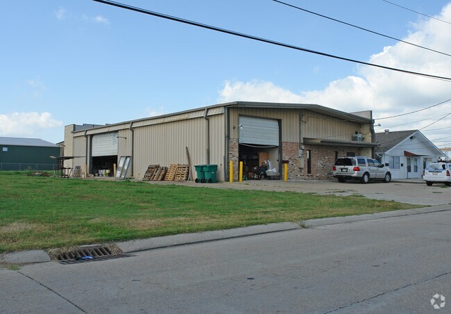

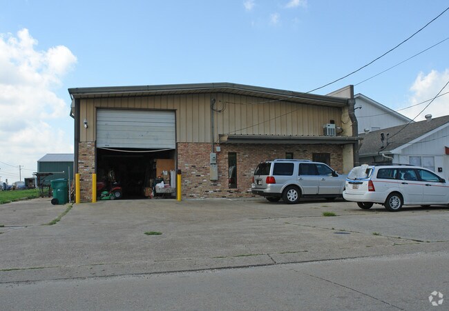
Property Detail
939 24Th St
New Orleans/Metairie/Kenner
LOT 8A SQ 89 SEC 4 BAINBRIDGE OFFICE & IND PK
New Orleans-Metairie, LA
Jefferson
0920009170
Louisiana
Miscpropertynotclassed
8a
2025
0.17 AC
2025
Kenner
020600
NEARBY LISTINGS FOR SALE OR LEASE
DEMOGRAPHICS near 939 24Th St
1 mile
3 mile
5 mile
2025 Total Population
8,374
97,884
173,271
2030 Population
8,297
96,800
170,537
Pop Growth 2025-2030
(0.92%)
(1.11%)
(1.58%)
Average Age
37
41
42
2025 Total Households
2,954
38,163
69,901
HH Growth 2025-2030
(1.05%)
(1.20%)
(1.69%)
Median Household Inc
$34,355
$63,603
$66,778
Avg Household Size
2.70
2.50
2.40
2025 Avg HH Vehicles
1.00
2.00
2.00
Median Home Value
$185,858
$256,623
$278,018
Median Year Built
1975
1973
1974
Nearby Places
Map Layers
Map Styles
 Street
 Aerial
Layers
 Traffic
 Biking
Places
Listings with unknown addresses are not visible on the map
- Restaurants
- Banks
- Shops
- Fitness
- Groceries
PUBLIC TRANSPORTATION
AIRPORT
Louis Armstrong New Orleans International
Drive
Walk
Distance
Louis Armstrong New Orleans International
5 min
1.8 mi
Nearby Properties
Address
Land Use
TOTAL SIZE
Lot Size
Zoning
Address
Land Use
TOTAL SIZE
Lot Size
Zoning
728 AC
R1A
Address
Land Use
TOTAL SIZE
Lot Size
Zoning
Address
Land Use
TOTAL SIZE
Lot Size
Zoning
13.64 AC
Address
Land Use
TOTAL SIZE
Lot Size
Zoning
0.09 AC
Address
Land Use
TOTAL SIZE
Lot Size
Zoning
19.90 AC
Address
Land Use
TOTAL SIZE
Lot Size
Zoning
0.12 AC
Address
Land Use
TOTAL SIZE
Lot Size
Zoning
9.74 AC
Address
Land Use
TOTAL SIZE
Lot Size
Zoning
Address
Land Use
TOTAL SIZE
Lot Size
Zoning
31.55 AC
R1A
Address
Land Use
TOTAL SIZE
Lot Size
Zoning
15.97 AC
Address
Land Use
TOTAL SIZE
Lot Size
Zoning
19.35 AC
R1A
Address
Land Use
TOTAL SIZE
Lot Size
Zoning
18.01 AC
Address
Land Use
TOTAL SIZE
Lot Size
Zoning
10.16 AC
Address
Land Use
TOTAL SIZE
Lot Size
Zoning
Address
Land Use
TOTAL SIZE
Lot Size
Zoning
0.15 AC
Address
Land Use
TOTAL SIZE
Lot Size
Zoning
0.13 AC
Address
Land Use
TOTAL SIZE
Lot Size
Zoning
12.69 AC
Address
Land Use
TOTAL SIZE
Lot Size
Zoning
1,295 SF
9.70 AC
R1A
Address
Land Use
TOTAL SIZE
Lot Size
Zoning
2.03 AC
Address
Land Use
TOTAL SIZE
Lot Size
Zoning
Address
Land Use
TOTAL SIZE
Lot Size
Zoning
14.95 AC
Address
Land Use
TOTAL SIZE
Lot Size
Zoning
Address
Land Use
TOTAL SIZE
Lot Size
Zoning
Address
Land Use
TOTAL SIZE
Lot Size
Zoning
0.14 AC
Address
Land Use
TOTAL SIZE
Lot Size
Zoning
0.18 AC
Address
Land Use
TOTAL SIZE
Lot Size
Zoning
25.77 AC
Address
Land Use
TOTAL SIZE
Lot Size
Zoning
22.92 AC
Address
Land Use
TOTAL SIZE
Lot Size
Zoning
Address
Land Use
TOTAL SIZE
Lot Size
Zoning
0.13 AC
Address
Land Use
TOTAL SIZE
Lot Size
Zoning
4.23 AC
The World's #1 Commercial Real Estate Marketplace
Connect with us
© 2026 CoStar Group
The information above has been obtained from sources believed reliable. While we do not doubt its accuracy we have not verified it and make no guarantee, warranty or representation about it. It is your responsibility to independently confirm its accuracy and completeness. Any projections, opinions, assumptions, or estimates used are for example only and do not represent the current or future performance of the property. The value of this transaction to you depends on tax and other factors which should be evaluated by your tax, financial, and legal advisors. You and your advisors should conduct a careful, independent investigation of the property to determine to your satisfaction the suitability of the property for your needs.