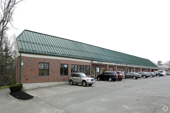
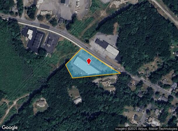
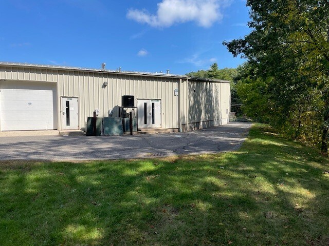
Property Record
939 Salem St, Groveland, MA 01834

Current Lease Availabilities
NEARBY LISTINGS FOR SALE OR LEASE
Property Detail
939 Salem St
Commercialcondominium
Essex
X
Massachusetts
25009C0232G
1
2025
Amesbury/Ipswich
2025
Boston
264100
Boston-Cambridge-Newton, MA-NH
5,126 SF
GROV-000049-000001-000001
DEMOGRAPHICS near 939 Salem St
1 Mile
3 Mile
5 Mile
2024 Total Population
2,343
18,760
69,148
2029 Population
2,332
18,634
68,433
Pop Growth 2024-2029
(0.47%)
(0.67%)
(1.03%)
Average Age
43
43
41
2024 Total Households
921
6,843
26,345
HH Growth 2024-2029
(0.65%)
(0.83%)
(1.11%)
Median Household Inc
$99,256
$128,242
$95,041
Avg Household Size
2.50
2.70
2.60
2024 Avg HH Vehicles
2.00
2.00
2.00
Median Home Value
$460,037
$490,622
$488,954
Median Year Built
1965
1969
1966
Nearby Places
- Restaurants
- Banks
- Shops
- Fitness
- Groceries
PUBLIC TRANSPORTATION
COMMUTER RAIL
Haverhill (Haverhill Line - Massachusetts Bay Transportation Authority Commuter Rail (Purple Line))
DRIVE
WALK
Distance
Haverhill (Haverhill Line - Massachusetts Bay Transportation Authority Commuter Rail (Purple Line))
10 min
5.6 mi
Bradford (Haverhill Line - Massachusetts Bay Transportation Authority Commuter Rail (Purple Line))
DRIVE
WALK
Distance
Bradford (Haverhill Line - Massachusetts Bay Transportation Authority Commuter Rail (Purple Line))
11 min
6.0 mi
AIRPORT
General Edward Lawrence Logan International
DRIVE
WALK
Distance
General Edward Lawrence Logan International
46 min
30.3 mi
Portsmouth International at Pease
DRIVE
WALK
Distance
Portsmouth International at Pease
45 min
30.8 mi
Manchester Boston Regional
DRIVE
WALK
Distance
Manchester Boston Regional
56 min
36.5 mi
Freight Ports
Port of Boston
DRIVE
WALK
Distance
Port of Boston
49 min
33.2 mi
Nearby Properties
Address
Land Use
TOTAL SIZE
Lot Size
Zoning
Address
Land Use
TOTAL SIZE
Lot Size
Zoning
38 AC
RB
Address
Land Use
TOTAL SIZE
Lot Size
Zoning
140,624 SF
26.21 AC
Address
Land Use
TOTAL SIZE
Lot Size
Zoning
53.50 AC
C
Address
Land Use
TOTAL SIZE
Lot Size
Zoning
92,931 SF
24.53 AC
RB
Address
Land Use
TOTAL SIZE
Lot Size
Zoning
159,058 SF
7.46 AC
Address
Land Use
TOTAL SIZE
Lot Size
Zoning
64,162 SF
47.95 AC
Address
Land Use
TOTAL SIZE
Lot Size
Zoning
4,818 SF
12.90 AC
Address
Land Use
TOTAL SIZE
Lot Size
Zoning
76,842 SF
12.38 AC
Address
Land Use
TOTAL SIZE
Lot Size
Zoning
19.90 AC
RB
Address
Land Use
TOTAL SIZE
Lot Size
Zoning
53,620 SF
14.40 AC
RB
Address
Land Use
TOTAL SIZE
Lot Size
Zoning
6.94 AC
Address
Land Use
TOTAL SIZE
Lot Size
Zoning
8,649 SF
47 AC
Address
Land Use
TOTAL SIZE
Lot Size
Zoning
46,280 SF
7.80 AC
Address
Land Use
TOTAL SIZE
Lot Size
Zoning
29,014 SF
4.45 AC
RB
Address
Land Use
TOTAL SIZE
Lot Size
Zoning
5 AC
RB
Address
Land Use
TOTAL SIZE
Lot Size
Zoning
64,898 SF
1.48 AC
Address
Land Use
TOTAL SIZE
Lot Size
Zoning
53,709 SF
5.81 AC
Address
Land Use
TOTAL SIZE
Lot Size
Zoning
8.23 AC
Address
Land Use
TOTAL SIZE
Lot Size
Zoning
118.81 AC
Address
Land Use
TOTAL SIZE
Lot Size
Zoning
13 AC
RB
Address
Land Use
TOTAL SIZE
Lot Size
Zoning
59,440 SF
8.65 AC
Address
Land Use
TOTAL SIZE
Lot Size
Zoning
21,245 SF
1.81 AC
Address
Land Use
TOTAL SIZE
Lot Size
Zoning
240 AC
RA
Address
Land Use
TOTAL SIZE
Lot Size
Zoning
55.15 AC
Address
Land Use
TOTAL SIZE
Lot Size
Zoning
25,371 SF
3.54 AC
Address
Land Use
TOTAL SIZE
Lot Size
Zoning
83,743 SF
6 AC
Address
Land Use
TOTAL SIZE
Lot Size
Zoning
49,730 SF
6.61 AC
Address
Land Use
TOTAL SIZE
Lot Size
Zoning
476.30 AC
RA
Address
Land Use
TOTAL SIZE
Lot Size
Zoning
2.16 AC
Address
Land Use
TOTAL SIZE
Lot Size
Zoning
24,965 SF
2.68 AC
The World's #1 Commercial Real Estate Marketplace
Connect with us
© 2025 CoStar Group
The information above has been obtained from sources believed reliable. While we do not doubt its accuracy we have not verified it and make no guarantee, warranty or representation about it. It is your responsibility to independently confirm its accuracy and completeness. Any projections, opinions, assumptions, or estimates used are for example only and do not represent the current or future performance of the property. The value of this transaction to you depends on tax and other factors which should be evaluated by your tax, financial, and legal advisors. You and your advisors should conduct a careful, independent investigation of the property to determine to your satisfaction the suitability of the property for your needs.