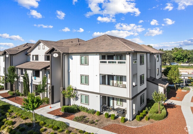
Property Record
9393 N St Rt 99 West Frontage Rd, Stockton, CA 95212
NEARBY LISTINGS FOR SALE OR LEASE
Property Detail
9393 N St Rt 99 West Frontage Rd
124-290-30
Lot Line Adjustment No 15 04
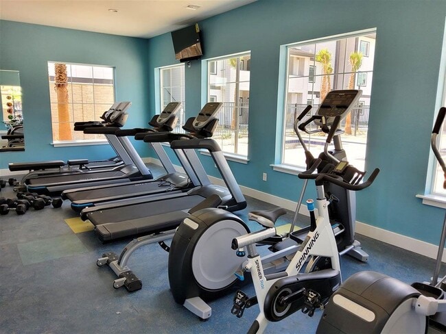
Apartment
16-FM PT OF 124-290-24/22 PER 15124584/585
X
San Joaquin
06077C0320F
California
2025
3.19 AC
2025
Valley Oak
003501
Stockton/Modesto
21,204 SF
Stockton-Lodi, CA
DEMOGRAPHICS near 9393 N St Rt 99 West Frontage Rd
1 Mile
3 Mile
5 Mile
2024 Total Population
17,783
72,591
195,982
2029 Population
18,923
76,571
206,823
Pop Growth 2024-2029
+ 6.41%
+ 5.48%
+ 5.53%
Average Age
37
36
37
2024 Total Households
4,772
20,529
60,616
HH Growth 2024-2029
+ 6.41%
+ 5.47%
+ 5.57%
Median Household Inc
$107,926
$72,881
$71,530
Avg Household Size
3.60
3.40
3.10
2024 Avg HH Vehicles
3.00
2.00
2.00
Median Home Value
$464,556
$390,586
$389,445
Median Year Built
2003
1986
1978
Nearby Places
Map Layers
Map Styles
 Street
 Aerial
- Restaurants
- Banks
- Shops
- Fitness
- Groceries
PUBLIC TRANSPORTATION
COMMUTER RAIL
Stockton (ACE Train - Altamont Commuter Express (ACE), Altamont Corridor Express - Altamont Commuter Express (ACE))
DRIVE
WALK
Distance
Stockton (ACE Train - Altamont Commuter Express (ACE), Altamont Corridor Express - Altamont Commuter Express (ACE))
11 min
7.1 mi
Stockton (San Joaquins - Amtrak)
DRIVE
WALK
Distance
Stockton (San Joaquins - Amtrak)
12 min
8.7 mi
AIRPORT
Stockton Metro
DRIVE
WALK
Distance
Stockton Metro
18 min
12.8 mi
Freight Ports
Port of Stockton
DRIVE
WALK
Distance
Port of Stockton
17 min
11.3 mi
Nearby Properties
Address
Land Use
TOTAL SIZE
Lot Size
Zoning
Address
Land Use
TOTAL SIZE
Lot Size
Zoning
105,083 SF
24.90 AC
O
Address
Land Use
TOTAL SIZE
Lot Size
Zoning
4,495 SF
11.76 AC
Address
Land Use
TOTAL SIZE
Lot Size
Zoning
9,750 SF
136.94 AC
AU20
Address
Land Use
TOTAL SIZE
Lot Size
Zoning
121,574 SF
5.49 AC
RHD
Address
Land Use
TOTAL SIZE
Lot Size
Zoning
207,540 SF
21.16 AC
Address
Land Use
TOTAL SIZE
Lot Size
Zoning
1,312 SF
7.44 AC
Address
Land Use
TOTAL SIZE
Lot Size
Zoning
90,142 SF
26.25 AC
Address
Land Use
TOTAL SIZE
Lot Size
Zoning
21,204 SF
3.13 AC
Address
Land Use
TOTAL SIZE
Lot Size
Zoning
107,184 SF
34.13 AC
Address
Land Use
TOTAL SIZE
Lot Size
Zoning
Address
Land Use
TOTAL SIZE
Lot Size
Zoning
51,892 SF
5.33 AC
Address
Land Use
TOTAL SIZE
Lot Size
Zoning
52,644 SF
2 AC
Address
Land Use
TOTAL SIZE
Lot Size
Zoning
5,458 SF
13.01 AC
Address
Land Use
TOTAL SIZE
Lot Size
Zoning
21,204 SF
3.52 AC
Address
Land Use
TOTAL SIZE
Lot Size
Zoning
117,320 SF
2.86 AC
Address
Land Use
TOTAL SIZE
Lot Size
Zoning
67,195 SF
5.30 AC
Address
Land Use
TOTAL SIZE
Lot Size
Zoning
102,190 SF
10.34 AC
Address
Land Use
TOTAL SIZE
Lot Size
Zoning
135,198 SF
13.37 AC
Address
Land Use
TOTAL SIZE
Lot Size
Zoning
95,838 SF
10.10 AC
Address
Land Use
TOTAL SIZE
Lot Size
Zoning
126,108 SF
12.43 AC
Address
Land Use
TOTAL SIZE
Lot Size
Zoning
28,000 SF
17.05 AC
RL
Address
Land Use
TOTAL SIZE
Lot Size
Zoning
38.34 AC
AU20
Address
Land Use
TOTAL SIZE
Lot Size
Zoning
73,733 SF
6.40 AC
GC
Address
Land Use
TOTAL SIZE
Lot Size
Zoning
46,336 SF
11.08 AC
Address
Land Use
TOTAL SIZE
Lot Size
Zoning
142,757 SF
9.84 AC
RHD
Address
Land Use
TOTAL SIZE
Lot Size
Zoning
41,508 SF
4.06 AC
Address
Land Use
TOTAL SIZE
Lot Size
Zoning
13,720 SF
10.85 AC
Address
Land Use
TOTAL SIZE
Lot Size
Zoning
87,170 SF
4.80 AC
Address
Land Use
TOTAL SIZE
Lot Size
Zoning
4.55 AC
CG
The World's #1 Commercial Real Estate Marketplace
Connect with us
© 2026 CoStar Group
The information above has been obtained from sources believed reliable. While we do not doubt its accuracy we have not verified it and make no guarantee, warranty or representation about it. It is your responsibility to independently confirm its accuracy and completeness. Any projections, opinions, assumptions, or estimates used are for example only and do not represent the current or future performance of the property. The value of this transaction to you depends on tax and other factors which should be evaluated by your tax, financial, and legal advisors. You and your advisors should conduct a careful, independent investigation of the property to determine to your satisfaction the suitability of the property for your needs.