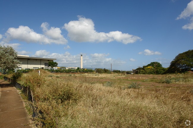
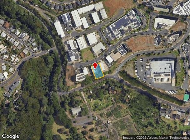
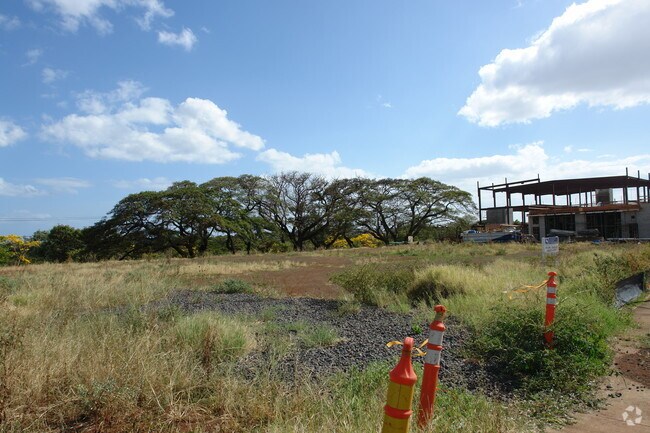
Property Record
94-481 Akoki St, Waipahu, HI 96797
NEARBY LISTINGS FOR SALE OR LEASE
Property Detail
94-481 Akoki St
Urban Honolulu, HI
A & B Indl File Plan 2317 Ph
1-9-4-166-037-0000
LOT 19 16,067 SF TOG/ESMT SUBJ/ESMT
Industrialgeneral
Honolulu
X
Hawaii
15003C0238G
19
2024
0.37 AC
2025
Leeward
008802
Hawaii
5,000 SF
DEMOGRAPHICS near 94-481 Akoki St
1 Mile
3 Mile
5 Mile
2024 Total Population
24,306
77,827
200,840
2029 Population
23,073
74,305
191,656
Pop Growth 2024-2029
(5.07%)
(4.53%)
(4.57%)
Average Age
40
40
40
2024 Total Households
5,851
21,884
59,437
HH Growth 2024-2029
(5.90%)
(5.33%)
(5.31%)
Median Household Inc
$77,923
$93,757
$104,463
Avg Household Size
3.60
3.30
3.20
2024 Avg HH Vehicles
2.00
2.00
2.00
Median Home Value
$710,199
$688,907
$705,801
Median Year Built
1975
1985
1984
Nearby Places
- Restaurants
- Banks
- Shops
- Fitness
- Groceries
PUBLIC TRANSPORTATION
TRANSIT/SUBWAY
Pouhala Waipahu Transit Center Station (SKYLINE - DTS)
DRIVE
WALK
Distance
Pouhala Waipahu Transit Center Station (SKYLINE - DTS)
2 min
15 min
0.8 mi
AIRPORT
Daniel K Inouye International
DRIVE
WALK
Distance
Daniel K Inouye International
17 min
10.6 mi
Freight Ports
Honolulu Harbor, Oahu
DRIVE
WALK
Distance
Honolulu Harbor, Oahu
25 min
14.7 mi
Nearby Properties
Address
Land Use
TOTAL SIZE
Lot Size
Zoning
Address
Land Use
TOTAL SIZE
Lot Size
Zoning
376,136 SF
32.06 AC
B-2
Address
Land Use
TOTAL SIZE
Lot Size
Zoning
227,309 SF
16.77 AC
B-2
Address
Land Use
TOTAL SIZE
Lot Size
Zoning
8,600 SF
479.12 AC
F-1
Address
Land Use
TOTAL SIZE
Lot Size
Zoning
82,948 SF
16.06 AC
AG-1
Address
Land Use
TOTAL SIZE
Lot Size
Zoning
260,997 SF
9.79 AC
I-2
Address
Land Use
TOTAL SIZE
Lot Size
Zoning
729,528 SF
6.43 AC
BMX-3
Address
Land Use
TOTAL SIZE
Lot Size
Zoning
147,922 SF
16 AC
BMX-3
Address
Land Use
TOTAL SIZE
Lot Size
Zoning
467,874 SF
15.30 AC
IMX-1
Address
Land Use
TOTAL SIZE
Lot Size
Zoning
102,877 SF
9.77 AC
B-2
Address
Land Use
TOTAL SIZE
Lot Size
Zoning
13.47 AC
AMX-2
Address
Land Use
TOTAL SIZE
Lot Size
Zoning
362,266 SF
11.23 AC
B-2
Address
Land Use
TOTAL SIZE
Lot Size
Zoning
133,284 SF
11.74 AC
BMX-3
Address
Land Use
TOTAL SIZE
Lot Size
Zoning
424,593 SF
8.73 AC
B-2
Address
Land Use
TOTAL SIZE
Lot Size
Zoning
157,460 SF
9.51 AC
BMX-3
Address
Land Use
TOTAL SIZE
Lot Size
Zoning
5.87 AC
IMX-1
Address
Land Use
TOTAL SIZE
Lot Size
Zoning
108,786 SF
7.09 AC
BMX-3
Address
Land Use
TOTAL SIZE
Lot Size
Zoning
5,278 SF
57.87 AC
P-2
Address
Land Use
TOTAL SIZE
Lot Size
Zoning
9.44 AC
IMX-1
Address
Land Use
TOTAL SIZE
Lot Size
Zoning
53.41 AC
A-2
Address
Land Use
TOTAL SIZE
Lot Size
Zoning
128,870 SF
6.28 AC
IMX-1
Address
Land Use
TOTAL SIZE
Lot Size
Zoning
45,606 SF
5.12 AC
BMX-3
Address
Land Use
TOTAL SIZE
Lot Size
Zoning
119,778 SF
4.55 AC
B-1
Address
Land Use
TOTAL SIZE
Lot Size
Zoning
116,556 SF
4.59 AC
I-2
Address
Land Use
TOTAL SIZE
Lot Size
Zoning
131,855 SF
14.48 AC
AG-1
Address
Land Use
TOTAL SIZE
Lot Size
Zoning
67.86 AC
A-2
Address
Land Use
TOTAL SIZE
Lot Size
Zoning
112,016 SF
4.28 AC
I-2
Address
Land Use
TOTAL SIZE
Lot Size
Zoning
7.81 AC
IMX-1
Address
Land Use
TOTAL SIZE
Lot Size
Zoning
68,487 SF
3.78 AC
R-5
Address
Land Use
TOTAL SIZE
Lot Size
Zoning
5.71 AC
A-2
Address
Land Use
TOTAL SIZE
Lot Size
Zoning
132,108 SF
4.37 AC
B-2
The World's #1 Commercial Real Estate Marketplace
Connect with us
© 2025 CoStar Group
The information above has been obtained from sources believed reliable. While we do not doubt its accuracy we have not verified it and make no guarantee, warranty or representation about it. It is your responsibility to independently confirm its accuracy and completeness. Any projections, opinions, assumptions, or estimates used are for example only and do not represent the current or future performance of the property. The value of this transaction to you depends on tax and other factors which should be evaluated by your tax, financial, and legal advisors. You and your advisors should conduct a careful, independent investigation of the property to determine to your satisfaction the suitability of the property for your needs.