No Photo
Property Record
94 E Kunia Rd, Waipahu, HI 96797
NEARBY LISTINGS FOR SALE OR LEASE
Property Detail
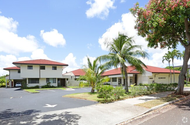
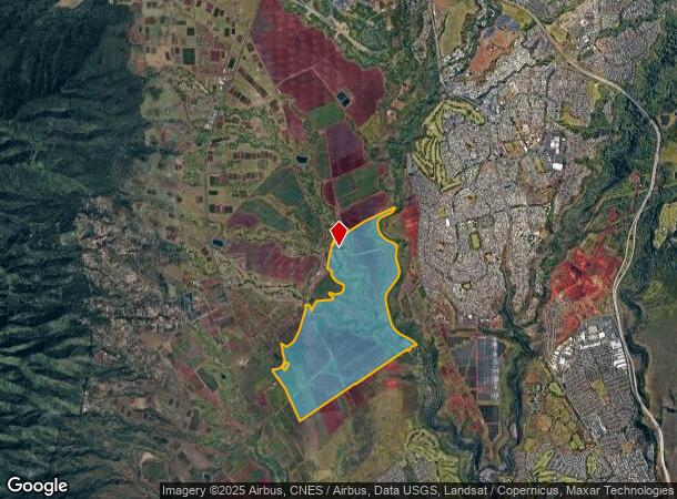
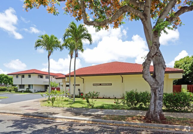
94 E Kunia Rd
Urban Honolulu, HI
Royal Kunia Phase Ii Increment 1
1-9-4-003-001-0000
POR OF LOT C LC AW 10474 AP 9 TO N. NAMAUU & AP1 MEHELE AW #4 TO LULUHIWALANI
Agriculturalland
Honolulu
D
Hawaii
15003C0220F
c
2024
881.69 AC
2025
Central Oahu
008952
Hawaii
DEMOGRAPHICS near 94 E Kunia Rd
1 Mile
3 Mile
5 Mile
2024 Total Population
893
62,651
149,565
2029 Population
821
59,203
143,370
Pop Growth 2024-2029
(8.06%)
(5.50%)
(4.14%)
Average Age
44
41
40
2024 Total Households
262
18,800
44,858
HH Growth 2024-2029
(9.16%)
(6.42%)
(4.89%)
Median Household Inc
$110,810
$106,527
$98,452
Avg Household Size
3.10
3.10
3.10
2024 Avg HH Vehicles
2.00
2.00
2.00
Median Home Value
$724,184
$691,377
$706,819
Median Year Built
1975
1981
1983
Nearby Places
Map Layers
Map Styles
 Street
 Aerial
- Restaurants
- Banks
- Shops
- Fitness
- Groceries
PUBLIC TRANSPORTATION
AIRPORT
Daniel K Inouye International
DRIVE
WALK
Distance
Daniel K Inouye International
34 min
16.1 mi
Freight Ports
Honolulu Harbor, Oahu
DRIVE
WALK
Distance
Honolulu Harbor, Oahu
42 min
20.3 mi
Nearby Properties
Address
Land Use
TOTAL SIZE
Lot Size
Zoning
Address
Land Use
TOTAL SIZE
Lot Size
Zoning
8,600 SF
479.12 AC
F-1
Address
Land Use
TOTAL SIZE
Lot Size
Zoning
196,140 SF
17.74 AC
B-2
Address
Land Use
TOTAL SIZE
Lot Size
Zoning
260,997 SF
9.79 AC
I-2
Address
Land Use
TOTAL SIZE
Lot Size
Zoning
467,874 SF
15.30 AC
IMX-1
Address
Land Use
TOTAL SIZE
Lot Size
Zoning
121,310 SF
10.97 AC
B-2
Address
Land Use
TOTAL SIZE
Lot Size
Zoning
38,400 SF
19.30 AC
AG-1
Address
Land Use
TOTAL SIZE
Lot Size
Zoning
129,731 SF
8.45 AC
B-2
Address
Land Use
TOTAL SIZE
Lot Size
Zoning
5.87 AC
IMX-1
Address
Land Use
TOTAL SIZE
Lot Size
Zoning
854.23 AC
AG-1
Address
Land Use
TOTAL SIZE
Lot Size
Zoning
128,870 SF
6.28 AC
IMX-1
Address
Land Use
TOTAL SIZE
Lot Size
Zoning
116,556 SF
4.59 AC
I-2
Address
Land Use
TOTAL SIZE
Lot Size
Zoning
112,016 SF
4.28 AC
I-2
Address
Land Use
TOTAL SIZE
Lot Size
Zoning
21,580 SF
4.77 AC
B-2
Address
Land Use
TOTAL SIZE
Lot Size
Zoning
102,880 SF
3.84 AC
I-2
Address
Land Use
TOTAL SIZE
Lot Size
Zoning
125,748 SF
2.94 AC
I-2
Address
Land Use
TOTAL SIZE
Lot Size
Zoning
70,807 SF
4.31 AC
B-2
Address
Land Use
TOTAL SIZE
Lot Size
Zoning
40,272 SF
4.81 AC
IMX-1
Address
Land Use
TOTAL SIZE
Lot Size
Zoning
81,477 SF
2.08 AC
I-2
Address
Land Use
TOTAL SIZE
Lot Size
Zoning
49,140 SF
1.33 AC
B-2
Address
Land Use
TOTAL SIZE
Lot Size
Zoning
72,481 SF
2.28 AC
I-2
Address
Land Use
TOTAL SIZE
Lot Size
Zoning
39,600 SF
3.03 AC
B-2
Address
Land Use
TOTAL SIZE
Lot Size
Zoning
69,616 SF
2.88 AC
I-2
Address
Land Use
TOTAL SIZE
Lot Size
Zoning
56,233 SF
1.78 AC
I-2
Address
Land Use
TOTAL SIZE
Lot Size
Zoning
49,767 SF
2.92 AC
IMX-1
Address
Land Use
TOTAL SIZE
Lot Size
Zoning
25,003 SF
1.59 AC
I-2
Address
Land Use
TOTAL SIZE
Lot Size
Zoning
79,520 SF
2.55 AC
I-2
Address
Land Use
TOTAL SIZE
Lot Size
Zoning
20,822 SF
163.38 AC
P-2
Address
Land Use
TOTAL SIZE
Lot Size
Zoning
15,341 SF
4.50 AC
B-2
Address
Land Use
TOTAL SIZE
Lot Size
Zoning
15,544 SF
1.99 AC
IMX-1
Address
Land Use
TOTAL SIZE
Lot Size
Zoning
44,253 SF
1.67 AC
I-2
The World's #1 Commercial Real Estate Marketplace
Connect with us
© 2026 CoStar Group
The information above has been obtained from sources believed reliable. While we do not doubt its accuracy we have not verified it and make no guarantee, warranty or representation about it. It is your responsibility to independently confirm its accuracy and completeness. Any projections, opinions, assumptions, or estimates used are for example only and do not represent the current or future performance of the property. The value of this transaction to you depends on tax and other factors which should be evaluated by your tax, financial, and legal advisors. You and your advisors should conduct a careful, independent investigation of the property to determine to your satisfaction the suitability of the property for your needs.