Property Record
94 Kunia Rd, Kunia, HI 96759
NEARBY LISTINGS FOR SALE OR LEASE
-
-
View all Kunia listings for sale on LoopNet.com
Property Detail
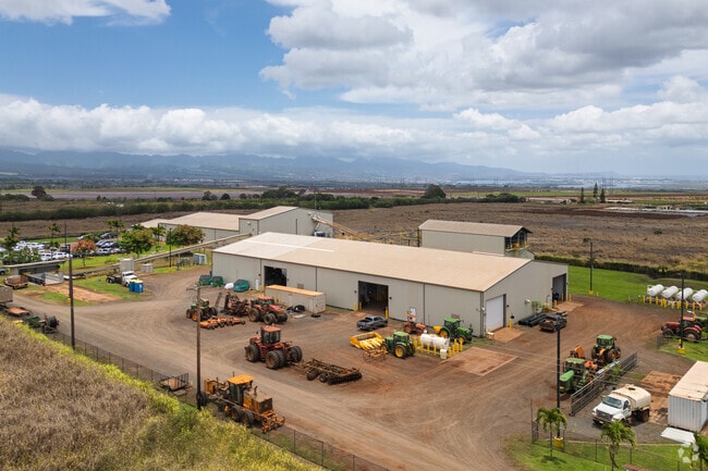
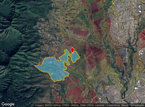
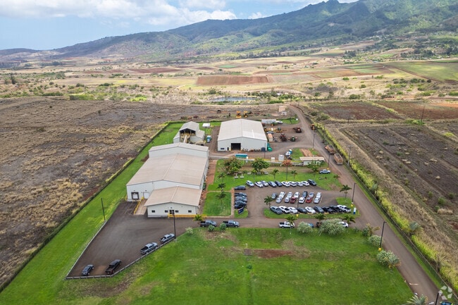
94 Kunia Rd
Urban Honolulu, HI
Map 06
1-9-2-004-003-0000
LOT M-9-A MAP 6 LCAPP 1069 19.296 AC TOG/ESMT
Agriculturalland
Honolulu
D
Hawaii
15003C0220F
m-9
2023
19.30 AC
2025
West Oahu
008627
Hawaii
38,400 SF
DEMOGRAPHICS near 94 Kunia Rd
1 Mile
3 Mile
5 Mile
2024 Total Population
0
22,132
126,148
2029 Population
0
20,674
121,008
Pop Growth 2024-2029
0.00%
(6.59%)
(4.07%)
Average Age
0
42
38
2024 Total Households
0
6,509
37,202
HH Growth 2024-2029
0.00%
(7.85%)
(4.86%)
Median Household Inc
$0
$117,303
$98,305
Avg Household Size
.00
3.20
3.20
2024 Avg HH Vehicles
.00
2.00
2.00
Median Home Value
$0
$730,090
$699,294
Median Year Built
0
1979
1985
Nearby Places
Map Layers
Map Styles
 Street
 Aerial
- Restaurants
- Banks
- Shops
- Fitness
- Groceries
PUBLIC TRANSPORTATION
AIRPORT
Daniel K Inouye International
DRIVE
WALK
Distance
Daniel K Inouye International
24 min
15.0 mi
Freight Ports
Honolulu Harbor, Oahu
DRIVE
WALK
Distance
Honolulu Harbor, Oahu
32 min
19.2 mi
Nearby Properties
Address
Land Use
TOTAL SIZE
Lot Size
Zoning
Address
Land Use
TOTAL SIZE
Lot Size
Zoning
8,600 SF
479.12 AC
F-1
Address
Land Use
TOTAL SIZE
Lot Size
Zoning
424,593 SF
8.73 AC
B-2
Address
Land Use
TOTAL SIZE
Lot Size
Zoning
854.23 AC
AG-1
Address
Land Use
TOTAL SIZE
Lot Size
Zoning
119,778 SF
4.55 AC
B-1
Address
Land Use
TOTAL SIZE
Lot Size
Zoning
132,108 SF
4.37 AC
B-2
Address
Land Use
TOTAL SIZE
Lot Size
Zoning
20,822 SF
163.38 AC
P-2
Address
Land Use
TOTAL SIZE
Lot Size
Zoning
15,341 SF
4.50 AC
B-2
Address
Land Use
TOTAL SIZE
Lot Size
Zoning
14,513 SF
165.22 AC
P-2
Address
Land Use
TOTAL SIZE
Lot Size
Zoning
175.77 AC
F-1
Address
Land Use
TOTAL SIZE
Lot Size
Zoning
161.02 AC
AG-1
Address
Land Use
TOTAL SIZE
Lot Size
Zoning
150 AC
AG-1
Address
Land Use
TOTAL SIZE
Lot Size
Zoning
23,701 SF
22.74 AC
A/63/80
Address
Land Use
TOTAL SIZE
Lot Size
Zoning
123.71 AC
I-1
Address
Land Use
TOTAL SIZE
Lot Size
Zoning
122.79 AC
F-1
Address
Land Use
TOTAL SIZE
Lot Size
Zoning
14,649 SF
136.04 AC
P-2
Address
Land Use
TOTAL SIZE
Lot Size
Zoning
116.02 AC
AG-1
Address
Land Use
TOTAL SIZE
Lot Size
Zoning
35,095 SF
0.85 AC
B-2
Address
Land Use
TOTAL SIZE
Lot Size
Zoning
3,592.78 AC
P-1
Address
Land Use
TOTAL SIZE
Lot Size
Zoning
74,715 SF
388.92 AC
AG-1
Address
Land Use
TOTAL SIZE
Lot Size
Zoning
7,269 SF
0.87 AC
B-2
Address
Land Use
TOTAL SIZE
Lot Size
Zoning
26,562 SF
0.65 AC
B-2
Address
Land Use
TOTAL SIZE
Lot Size
Zoning
132.26 AC
P-2
Address
Land Use
TOTAL SIZE
Lot Size
Zoning
9,120 SF
1.25 AC
B-1
Address
Land Use
TOTAL SIZE
Lot Size
Zoning
3,361 SF
0.76 AC
B-2
Address
Land Use
TOTAL SIZE
Lot Size
Zoning
2,160 SF
2,395.96 AC
AG-1
Address
Land Use
TOTAL SIZE
Lot Size
Zoning
3.06 AC
F-1
Address
Land Use
TOTAL SIZE
Lot Size
Zoning
50.15 AC
AG-1
Address
Land Use
TOTAL SIZE
Lot Size
Zoning
199,208 SF
8.05 AC
AG-1
Address
Land Use
TOTAL SIZE
Lot Size
Zoning
10,055 SF
F-1
The World's #1 Commercial Real Estate Marketplace
Connect with us
© 2026 CoStar Group
The information above has been obtained from sources believed reliable. While we do not doubt its accuracy we have not verified it and make no guarantee, warranty or representation about it. It is your responsibility to independently confirm its accuracy and completeness. Any projections, opinions, assumptions, or estimates used are for example only and do not represent the current or future performance of the property. The value of this transaction to you depends on tax and other factors which should be evaluated by your tax, financial, and legal advisors. You and your advisors should conduct a careful, independent investigation of the property to determine to your satisfaction the suitability of the property for your needs.