Property Record
94 Leoleo St, Waipahu, HI 96797
NEARBY LISTINGS FOR SALE OR LEASE
Property Detail
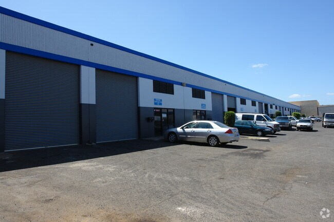
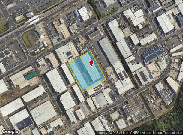
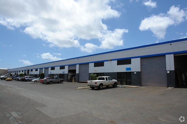
94 Leoleo St
Industrialgeneral
Honolulu
D
Hawaii
15003C0238G
2.92 AC
2024
Leeward
2025
Hawaii
008706
Urban Honolulu, HI
64,504 SF
1-9-4-048-062-0000
DEMOGRAPHICS near 94 Leoleo St
1 Mile
3 Mile
5 Mile
2024 Total Population
13,653
82,898
205,378
2029 Population
13,102
79,235
195,907
Pop Growth 2024-2029
(4.04%)
(4.42%)
(4.61%)
Average Age
37
39
39
2024 Total Households
3,287
22,425
59,083
HH Growth 2024-2029
(4.69%)
(5.04%)
(5.35%)
Median Household Inc
$80,615
$98,448
$105,388
Avg Household Size
3.80
3.40
3.20
2024 Avg HH Vehicles
2.00
2.00
2.00
Median Home Value
$656,103
$692,117
$711,154
Median Year Built
1970
1991
1988
Nearby Places
Map Layers
Map Styles
 Street
 Aerial
- Restaurants
- Banks
- Shops
- Fitness
- Groceries
PUBLIC TRANSPORTATION
AIRPORT
Daniel K Inouye International
DRIVE
WALK
Distance
Daniel K Inouye International
18 min
11.2 mi
Freight Ports
Honolulu Harbor, Oahu
DRIVE
WALK
Distance
Honolulu Harbor, Oahu
27 min
15.4 mi
Nearby Properties
Address
Land Use
TOTAL SIZE
Lot Size
Zoning
Address
Land Use
TOTAL SIZE
Lot Size
Zoning
310,432 SF
192.56 AC
BMX-3
Address
Land Use
TOTAL SIZE
Lot Size
Zoning
376,136 SF
32.06 AC
B-2
Address
Land Use
TOTAL SIZE
Lot Size
Zoning
227,309 SF
16.77 AC
B-2
Address
Land Use
TOTAL SIZE
Lot Size
Zoning
8,600 SF
479.12 AC
F-1
Address
Land Use
TOTAL SIZE
Lot Size
Zoning
82,948 SF
16.06 AC
AG-1
Address
Land Use
TOTAL SIZE
Lot Size
Zoning
229,396 SF
11.31 AC
BMX-3
Address
Land Use
TOTAL SIZE
Lot Size
Zoning
2,225 SF
19.72 AC
AG-1
Address
Land Use
TOTAL SIZE
Lot Size
Zoning
1,714 SF
200.33 AC
AG-1
Address
Land Use
TOTAL SIZE
Lot Size
Zoning
102,877 SF
9.77 AC
B-2
Address
Land Use
TOTAL SIZE
Lot Size
Zoning
13.47 AC
AMX-2
Address
Land Use
TOTAL SIZE
Lot Size
Zoning
424,593 SF
8.73 AC
B-2
Address
Land Use
TOTAL SIZE
Lot Size
Zoning
157,460 SF
9.51 AC
BMX-3
Address
Land Use
TOTAL SIZE
Lot Size
Zoning
91,808 SF
6.59 AC
BMX-3
Address
Land Use
TOTAL SIZE
Lot Size
Zoning
108,786 SF
7.09 AC
BMX-3
Address
Land Use
TOTAL SIZE
Lot Size
Zoning
5,278 SF
57.87 AC
P-2
Address
Land Use
TOTAL SIZE
Lot Size
Zoning
53.41 AC
P-2
Address
Land Use
TOTAL SIZE
Lot Size
Zoning
416.48 AC
F-1
Address
Land Use
TOTAL SIZE
Lot Size
Zoning
119,778 SF
4.55 AC
B-1
Address
Land Use
TOTAL SIZE
Lot Size
Zoning
131,855 SF
14.48 AC
AG-1
Address
Land Use
TOTAL SIZE
Lot Size
Zoning
67.86 AC
R-3.5
Address
Land Use
TOTAL SIZE
Lot Size
Zoning
68,487 SF
3.78 AC
R-5
Address
Land Use
TOTAL SIZE
Lot Size
Zoning
5.71 AC
A-2
Address
Land Use
TOTAL SIZE
Lot Size
Zoning
132,108 SF
4.37 AC
B-2
Address
Land Use
TOTAL SIZE
Lot Size
Zoning
57,170 SF
4.51 AC
BMX-3
Address
Land Use
TOTAL SIZE
Lot Size
Zoning
52,382 SF
3.13 AC
I-2
Address
Land Use
TOTAL SIZE
Lot Size
Zoning
51,740 SF
3 AC
I-1
Address
Land Use
TOTAL SIZE
Lot Size
Zoning
163,712 SF
3.90 AC
IMX-1
Address
Land Use
TOTAL SIZE
Lot Size
Zoning
62,351 SF
4.59 AC
B-1
Address
Land Use
TOTAL SIZE
Lot Size
Zoning
42,140 SF
0.45 AC
AG-1
Address
Land Use
TOTAL SIZE
Lot Size
Zoning
67,722 SF
6.54 AC
IMX-1
The World's #1 Commercial Real Estate Marketplace
Connect with us
© 2026 CoStar Group
The information above has been obtained from sources believed reliable. While we do not doubt its accuracy we have not verified it and make no guarantee, warranty or representation about it. It is your responsibility to independently confirm its accuracy and completeness. Any projections, opinions, assumptions, or estimates used are for example only and do not represent the current or future performance of the property. The value of this transaction to you depends on tax and other factors which should be evaluated by your tax, financial, and legal advisors. You and your advisors should conduct a careful, independent investigation of the property to determine to your satisfaction the suitability of the property for your needs.