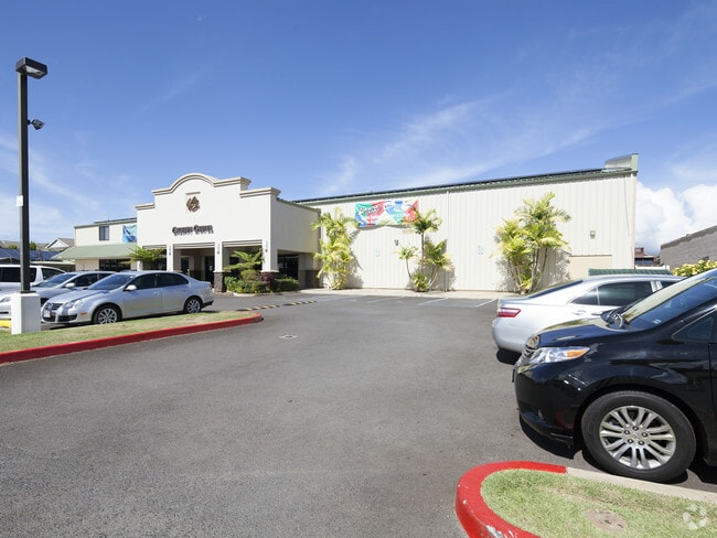
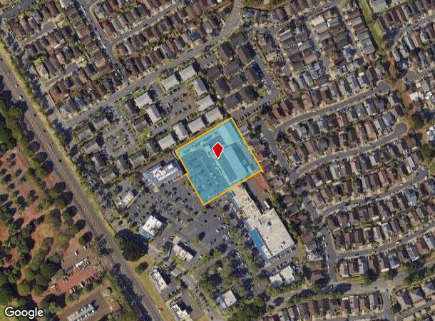
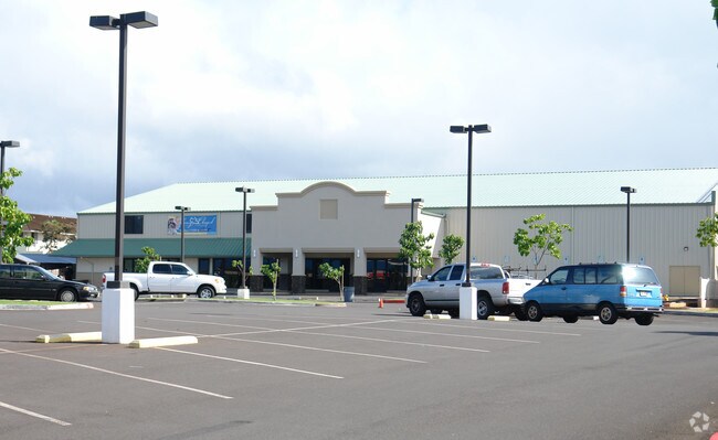
Property Record
94 Waipio Uka St, Waipahu, HI 96797
NEARBY LISTINGS FOR SALE OR LEASE
-
-
View all Waipahu listings for sale on LoopNet.com
Property Detail
94 Waipio Uka St
Urban Honolulu, HI
Map 1123
1-9-4-115-045-0000
LOT 17454 MAP 1123 LCAPP 1000 106,056 SF
Commercialnec
Honolulu
D
Hawaii
15003C0236G
17454
2024
2.44 AC
2025
Central Oahu
008948
Hawaii
35,733 SF
DEMOGRAPHICS near 94 Waipio Uka St
1 Mile
3 Mile
5 Mile
2024 Total Population
13,104
98,198
170,231
2029 Population
12,373
93,326
162,639
Pop Growth 2024-2029
(5.58%)
(4.96%)
(4.46%)
Average Age
42
42
41
2024 Total Households
4,679
28,458
52,770
HH Growth 2024-2029
(6.56%)
(5.89%)
(5.17%)
Median Household Inc
$98,982
$98,891
$101,554
Avg Household Size
2.70
3.20
3.00
2024 Avg HH Vehicles
2.00
2.00
2.00
Median Home Value
$618,408
$703,728
$695,677
Median Year Built
1987
1977
1980
Nearby Places
Map Layers
Map Styles
 Street
 Aerial
- Restaurants
- Banks
- Shops
- Fitness
- Groceries
PUBLIC TRANSPORTATION
AIRPORT
Daniel K Inouye International
DRIVE
WALK
Distance
Daniel K Inouye International
18 min
10.3 mi
Freight Ports
Honolulu Harbor, Oahu
DRIVE
WALK
Distance
Honolulu Harbor, Oahu
26 min
14.5 mi
Nearby Properties
Address
Land Use
TOTAL SIZE
Lot Size
Zoning
Address
Land Use
TOTAL SIZE
Lot Size
Zoning
376,136 SF
32.06 AC
B-2
Address
Land Use
TOTAL SIZE
Lot Size
Zoning
227,309 SF
16.77 AC
B-2
Address
Land Use
TOTAL SIZE
Lot Size
Zoning
8,600 SF
479.12 AC
F-1
Address
Land Use
TOTAL SIZE
Lot Size
Zoning
196,140 SF
17.74 AC
B-2
Address
Land Use
TOTAL SIZE
Lot Size
Zoning
260,997 SF
9.79 AC
I-2
Address
Land Use
TOTAL SIZE
Lot Size
Zoning
729,528 SF
6.43 AC
BMX-3
Address
Land Use
TOTAL SIZE
Lot Size
Zoning
147,922 SF
16 AC
BMX-3
Address
Land Use
TOTAL SIZE
Lot Size
Zoning
467,874 SF
15.30 AC
IMX-1
Address
Land Use
TOTAL SIZE
Lot Size
Zoning
121,310 SF
10.97 AC
B-2
Address
Land Use
TOTAL SIZE
Lot Size
Zoning
102,877 SF
9.77 AC
B-2
Address
Land Use
TOTAL SIZE
Lot Size
Zoning
362,266 SF
11.23 AC
B-2
Address
Land Use
TOTAL SIZE
Lot Size
Zoning
133,284 SF
11.74 AC
BMX-3
Address
Land Use
TOTAL SIZE
Lot Size
Zoning
424,593 SF
8.73 AC
B-2
Address
Land Use
TOTAL SIZE
Lot Size
Zoning
157,460 SF
9.51 AC
BMX-3
Address
Land Use
TOTAL SIZE
Lot Size
Zoning
15.25 AC
I-2
Address
Land Use
TOTAL SIZE
Lot Size
Zoning
256,238 SF
13.64 AC
I-2
Address
Land Use
TOTAL SIZE
Lot Size
Zoning
5.87 AC
IMX-1
Address
Land Use
TOTAL SIZE
Lot Size
Zoning
108,786 SF
7.09 AC
BMX-3
Address
Land Use
TOTAL SIZE
Lot Size
Zoning
5,278 SF
57.87 AC
P-2
Address
Land Use
TOTAL SIZE
Lot Size
Zoning
9.44 AC
IMX-1
Address
Land Use
TOTAL SIZE
Lot Size
Zoning
128,870 SF
6.28 AC
IMX-1
Address
Land Use
TOTAL SIZE
Lot Size
Zoning
45,606 SF
5.12 AC
BMX-3
Address
Land Use
TOTAL SIZE
Lot Size
Zoning
119,778 SF
4.55 AC
B-1
Address
Land Use
TOTAL SIZE
Lot Size
Zoning
116,556 SF
4.59 AC
I-2
Address
Land Use
TOTAL SIZE
Lot Size
Zoning
112,016 SF
4.28 AC
I-2
Address
Land Use
TOTAL SIZE
Lot Size
Zoning
21,580 SF
4.77 AC
B-2
Address
Land Use
TOTAL SIZE
Lot Size
Zoning
7.81 AC
IMX-1
Address
Land Use
TOTAL SIZE
Lot Size
Zoning
68,487 SF
3.78 AC
R-5
Address
Land Use
TOTAL SIZE
Lot Size
Zoning
132,108 SF
4.37 AC
B-2
Address
Land Use
TOTAL SIZE
Lot Size
Zoning
29,936 SF
3.27 AC
IMX-1
The World's #1 Commercial Real Estate Marketplace
Connect with us
© 2025 CoStar Group
The information above has been obtained from sources believed reliable. While we do not doubt its accuracy we have not verified it and make no guarantee, warranty or representation about it. It is your responsibility to independently confirm its accuracy and completeness. Any projections, opinions, assumptions, or estimates used are for example only and do not represent the current or future performance of the property. The value of this transaction to you depends on tax and other factors which should be evaluated by your tax, financial, and legal advisors. You and your advisors should conduct a careful, independent investigation of the property to determine to your satisfaction the suitability of the property for your needs.