Property Record
940 E Alfred St E, Lake Alfred, FL 33850
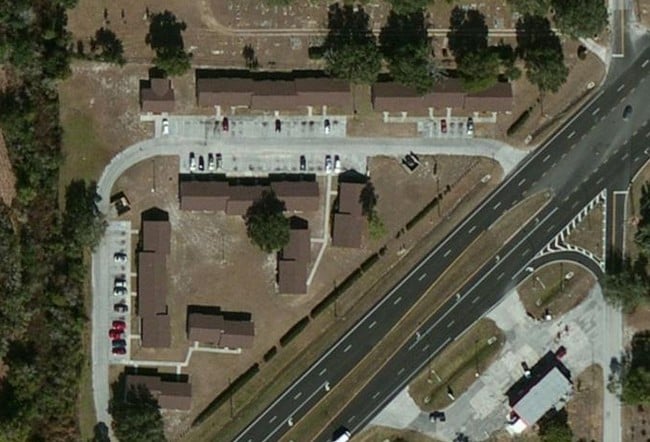

Property Detail
940 E Alfred St E
26-27-33-517500-000022
SECOND REPLAT OF OAK HILL ADD PB 32 PG 24 THAT PORTION LYING OUTSIDE CITY LIMITS TRACT 2 THAT PART DESC AS BEG NW COR OF NE1/4 OF SEC RUN S 596.15 FT N 47 DEG 41 MIN 09 SEC E 130.27 FT N 37 DEG 36 MIN 49 SEC E 70.71 FT N 46 DEG 35 MIN 58 SEC E 669.59
Multifamilydwelling
POLK
AE The base floodplain where base flood elevations are provided. AE Zones are now used on new format FIRMs instead of A1-A30 Zones.
Florida
2025
4.38 AC
2025
North Polk
012900
Tampa/St Petersburg
18,565 SF
Lakeland-Winter Haven, FL
NEARBY LISTINGS FOR SALE OR LEASE
-
-
View all Lake Alfred listings for sale on LoopNet.com
DEMOGRAPHICS near 940 E Alfred St E
1 mile
3 mile
5 mile
2025 Total Population
3,081
24,888
78,602
2030 Population
3,561
28,870
91,053
Pop Growth 2025-2030
+ 15.58%
+ 16.00%
+ 15.84%
Average Age
43
45
43
2025 Total Households
1,184
10,180
30,939
HH Growth 2025-2030
+ 15.96%
+ 16.13%
+ 16.03%
Median Household Inc
$49,867
$65,091
$63,181
Avg Household Size
2.50
2.40
2.50
2025 Avg HH Vehicles
1.00
2.00
2.00
Median Home Value
$271,428
$239,979
$260,480
Median Year Built
1988
1992
1990
Nearby Places
Map Layers
Map Styles
 Street
 Aerial
Layers
 Traffic
 Biking
Places
Listings with unknown addresses are not visible on the map
- Restaurants
- Banks
- Shops
- Fitness
- Groceries
PUBLIC TRANSPORTATION
COMMUTER RAIL
Winter Haven (Silver Meteor - Amtrak, Silver Star - Amtrak)
Drive
Walk
Distance
Winter Haven (Silver Meteor - Amtrak, Silver Star - Amtrak)
15 min
7.7 mi
Freight Ports
Port of Tampa Bay
Drive
Walk
Distance
Port of Tampa Bay
71 min
57.5 mi
Nearby Properties
Address
Land Use
TOTAL SIZE
Lot Size
Zoning
Address
Land Use
TOTAL SIZE
Lot Size
Zoning
975,257 SF
103.84 AC
IM
Address
Land Use
TOTAL SIZE
Lot Size
Zoning
386,137 SF
39.91 AC
Address
Land Use
TOTAL SIZE
Lot Size
Zoning
91,812 SF
36.58 AC
R1
Address
Land Use
TOTAL SIZE
Lot Size
Zoning
122,364 SF
34.98 AC
Address
Land Use
TOTAL SIZE
Lot Size
Zoning
181,804 SF
52.32 AC
XX
Address
Land Use
TOTAL SIZE
Lot Size
Zoning
259,700 SF
51.97 AC
Address
Land Use
TOTAL SIZE
Lot Size
Zoning
96,370 SF
5.08 AC
Address
Land Use
TOTAL SIZE
Lot Size
Zoning
75,696 SF
55.09 AC
XX
Address
Land Use
TOTAL SIZE
Lot Size
Zoning
179,894 SF
67.73 AC
Address
Land Use
TOTAL SIZE
Lot Size
Zoning
28,304 SF
10.28 AC
RE1
Address
Land Use
TOTAL SIZE
Lot Size
Zoning
45,376 SF
20.38 AC
Address
Land Use
TOTAL SIZE
Lot Size
Zoning
28,850 SF
12.62 AC
Address
Land Use
TOTAL SIZE
Lot Size
Zoning
49,456 SF
3.50 AC
RM
Address
Land Use
TOTAL SIZE
Lot Size
Zoning
68,760 SF
12.20 AC
XX
Address
Land Use
TOTAL SIZE
Lot Size
Zoning
68,650 SF
6.34 AC
XX
Address
Land Use
TOTAL SIZE
Lot Size
Zoning
41.18 AC
PUD
Address
Land Use
TOTAL SIZE
Lot Size
Zoning
31,246 SF
15.66 AC
IM
Address
Land Use
TOTAL SIZE
Lot Size
Zoning
Address
Land Use
TOTAL SIZE
Lot Size
Zoning
61,570 SF
8.59 AC
Address
Land Use
TOTAL SIZE
Lot Size
Zoning
42,714 SF
7.60 AC
Address
Land Use
TOTAL SIZE
Lot Size
Zoning
49,768 SF
8.60 AC
Address
Land Use
TOTAL SIZE
Lot Size
Zoning
109,209 SF
8.40 AC
M
Address
Land Use
TOTAL SIZE
Lot Size
Zoning
39,240 SF
3.70 AC
Address
Land Use
TOTAL SIZE
Lot Size
Zoning
28,798 SF
3.03 AC
Address
Land Use
TOTAL SIZE
Lot Size
Zoning
22,363 SF
2.48 AC
R2
Address
Land Use
TOTAL SIZE
Lot Size
Zoning
26,200 SF
9.23 AC
C3
Address
Land Use
TOTAL SIZE
Lot Size
Zoning
16,493 SF
1.32 AC
R2
Address
Land Use
TOTAL SIZE
Lot Size
Zoning
24.88 AC
XX
Address
Land Use
TOTAL SIZE
Lot Size
Zoning
17,700 SF
1.50 AC
C2
Address
Land Use
TOTAL SIZE
Lot Size
Zoning
17,450 SF
92.79 AC
The World's #1 Commercial Real Estate Marketplace
Connect with us
© 2026 CoStar Group
The information above has been obtained from sources believed reliable. While we do not doubt its accuracy we have not verified it and make no guarantee, warranty or representation about it. It is your responsibility to independently confirm its accuracy and completeness. Any projections, opinions, assumptions, or estimates used are for example only and do not represent the current or future performance of the property. The value of this transaction to you depends on tax and other factors which should be evaluated by your tax, financial, and legal advisors. You and your advisors should conduct a careful, independent investigation of the property to determine to your satisfaction the suitability of the property for your needs.