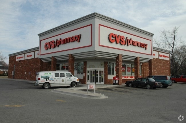
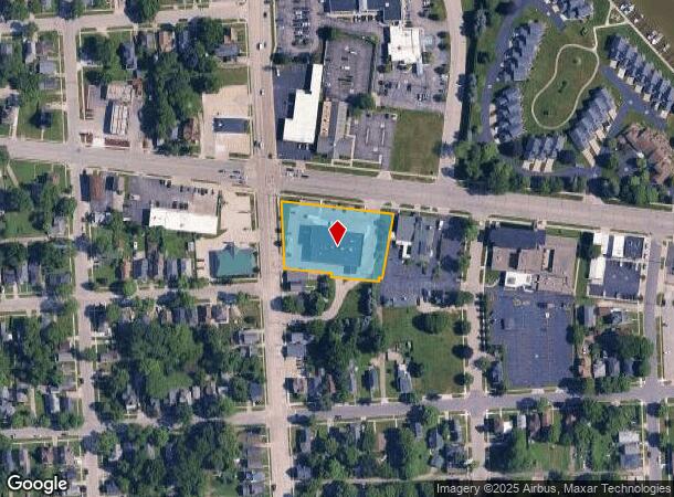
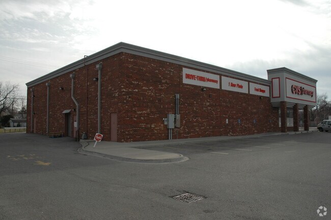
Property Record
940 Lapeer Ave, Port Huron, MI 48060
NEARBY LISTINGS FOR SALE OR LEASE
Property Detail
940 Lapeer Ave
06-743-0861-000
LOTS 4, 5 AND PART OF 6 BLK 101 AND PART OF THE VAC E AND W ALLEY ADJ, (FORMER GILLETT ST), WHITE'S PLAT COMM AT THE NW COR
Storebuilding
St. Clair
X
Michigan
26147C0356E
4-5,7
2024
1.15 AC
2025
St Clair & Lapeer Counties
624000
Detroit
10,880 SF
Detroit-Warren-Dearborn, MI
DEMOGRAPHICS near 940 Lapeer Ave
1 Mile
3 Mile
5 Mile
2024 Total Population
12,861
33,573
56,521
2029 Population
12,966
33,611
56,465
Pop Growth 2024-2029
+ 0.82%
+ 0.11%
(0.10%)
Average Age
39
40
41
2024 Total Households
5,348
13,933
23,475
HH Growth 2024-2029
+ 0.92%
+ 0.06%
(0.16%)
Median Household Inc
$40,076
$48,206
$53,428
Avg Household Size
2.30
2.30
2.30
2024 Avg HH Vehicles
1.00
2.00
2.00
Median Home Value
$79,939
$129,728
$153,295
Median Year Built
1950
1957
1968
Nearby Places
Map Layers
Map Styles
 Street
 Aerial
- Restaurants
- Banks
- Shops
- Fitness
- Groceries
PUBLIC TRANSPORTATION
COMMUTER RAIL
DRIVE
WALK
Distance
4 min
1.7 mi
DRIVE
WALK
Distance
17 min
7.7 mi
Nearby Properties
Address
Land Use
TOTAL SIZE
Lot Size
Zoning
Address
Land Use
TOTAL SIZE
Lot Size
Zoning
206,565 SF
22.08 AC
I
Address
Land Use
TOTAL SIZE
Lot Size
Zoning
241,664 SF
50.15 AC
B-3
Address
Land Use
TOTAL SIZE
Lot Size
Zoning
Address
Land Use
TOTAL SIZE
Lot Size
Zoning
88,524 SF
1.41 AC
CBD
Address
Land Use
TOTAL SIZE
Lot Size
Zoning
Address
Land Use
TOTAL SIZE
Lot Size
Zoning
115,172 SF
11.29 AC
A1
Address
Land Use
TOTAL SIZE
Lot Size
Zoning
83,563 SF
7.46 AC
CBD
Address
Land Use
TOTAL SIZE
Lot Size
Zoning
173,584 SF
9.50 AC
M1
Address
Land Use
TOTAL SIZE
Lot Size
Zoning
Address
Land Use
TOTAL SIZE
Lot Size
Zoning
149,732 SF
12.48 AC
M1
Address
Land Use
TOTAL SIZE
Lot Size
Zoning
109,097 SF
6.47 AC
A2
Address
Land Use
TOTAL SIZE
Lot Size
Zoning
12.31 AC
C1
Address
Land Use
TOTAL SIZE
Lot Size
Zoning
40,690 SF
0.89 AC
CBD
Address
Land Use
TOTAL SIZE
Lot Size
Zoning
76,352 SF
4.88 AC
C1
Address
Land Use
TOTAL SIZE
Lot Size
Zoning
137,720 SF
12.04 AC
B-3
Address
Land Use
TOTAL SIZE
Lot Size
Zoning
94,537 SF
12.63 AC
B-3
Address
Land Use
TOTAL SIZE
Lot Size
Zoning
112,566 SF
7.20 AC
B-3
Address
Land Use
TOTAL SIZE
Lot Size
Zoning
73,882 SF
6.50 AC
B-3
Address
Land Use
TOTAL SIZE
Lot Size
Zoning
39,547 SF
A1
Address
Land Use
TOTAL SIZE
Lot Size
Zoning
33,810 SF
0.92 AC
CBD
Address
Land Use
TOTAL SIZE
Lot Size
Zoning
140,230 SF
7.90 AC
M1
Address
Land Use
TOTAL SIZE
Lot Size
Zoning
333,076 SF
23.19 AC
M2
Address
Land Use
TOTAL SIZE
Lot Size
Zoning
85,200 SF
4.23 AC
M1
Address
Land Use
TOTAL SIZE
Lot Size
Zoning
0.32 AC
CBD
Address
Land Use
TOTAL SIZE
Lot Size
Zoning
28,225 SF
3.74 AC
C1
Address
Land Use
TOTAL SIZE
Lot Size
Zoning
45,750 SF
M1
Address
Land Use
TOTAL SIZE
Lot Size
Zoning
26,962 SF
3.03 AC
C1
Address
Land Use
TOTAL SIZE
Lot Size
Zoning
198,647 SF
26.04 AC
B-3
Address
Land Use
TOTAL SIZE
Lot Size
Zoning
168,310 SF
8.90 AC
M1
Address
Land Use
TOTAL SIZE
Lot Size
Zoning
118,606 SF
9.15 AC
A1
The World's #1 Commercial Real Estate Marketplace
Connect with us
© 2025 CoStar Group
The information above has been obtained from sources believed reliable. While we do not doubt its accuracy we have not verified it and make no guarantee, warranty or representation about it. It is your responsibility to independently confirm its accuracy and completeness. Any projections, opinions, assumptions, or estimates used are for example only and do not represent the current or future performance of the property. The value of this transaction to you depends on tax and other factors which should be evaluated by your tax, financial, and legal advisors. You and your advisors should conduct a careful, independent investigation of the property to determine to your satisfaction the suitability of the property for your needs.