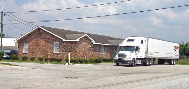
Property Record
940 Molly Pond Rd, Augusta, GA 30901

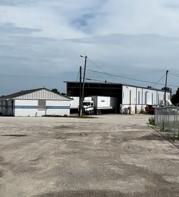

Current Lease Availabilities
Property Detail
940 Molly Pond Rd
0733011010
940 MOLLY POND RD
Commercialacreage
Richmond
HI
Georgia
AE The base floodplain where base flood elevations are provided. AE Zones are now used on new format FIRMs instead of A1-A30 Zones.
2.92 AC
2025
South Richmond County
2025
Augusta/Richmond County
010602
Augusta-Richmond County, GA-SC
3,000 SF
NEARBY LISTINGS FOR SALE OR LEASE
DEMOGRAPHICS near 940 Molly Pond Rd
1 mile
3 mile
5 mile
2025 Total Population
3,657
42,476
98,957
2030 Population
3,799
43,207
100,217
Pop Growth 2025-2030
+ 3.88%
+ 1.72%
+ 1.27%
Average Age
39
40
40
2025 Total Households
1,512
18,428
42,319
HH Growth 2025-2030
+ 4.30%
+ 1.93%
+ 1.47%
Median Household Inc
$18,194
$32,511
$44,723
Avg Household Size
2.30
2.10
2.20
2025 Avg HH Vehicles
1.00
1.00
1.00
Median Home Value
$97,609
$150,313
$182,031
Median Year Built
1957
1957
1964
Nearby Places
Map Layers
Map Styles
 Street
 Aerial
Layers
 Traffic
 Biking
Places
Listings with unknown addresses are not visible on the map
- Restaurants
- Banks
- Shops
- Fitness
- Groceries
PUBLIC TRANSPORTATION
AIRPORT
Augusta Regional at Bush Field
Drive
Walk
Distance
Augusta Regional at Bush Field
9 min
6.0 mi
Freight Ports
Georgia Ports - Savannah
Drive
Walk
Distance
Georgia Ports - Savannah
1 min
103.4 mi
Nearby Properties
Address
Land Use
TOTAL SIZE
Lot Size
Zoning
Address
Land Use
TOTAL SIZE
Lot Size
Zoning
954,084 SF
18.30 AC
B-2
Address
Land Use
TOTAL SIZE
Lot Size
Zoning
52,025 SF
6.46 AC
Address
Land Use
TOTAL SIZE
Lot Size
Zoning
627,990 SF
20 AC
P-1
Address
Land Use
TOTAL SIZE
Lot Size
Zoning
1,100 SF
97.38 AC
R-1A
Address
Land Use
TOTAL SIZE
Lot Size
Zoning
197,726 SF
2.93 AC
B-2
Address
Land Use
TOTAL SIZE
Lot Size
Zoning
169,662 SF
3.09 AC
B-2
Address
Land Use
TOTAL SIZE
Lot Size
Zoning
202,994 SF
19.25 AC
P-1
Address
Land Use
TOTAL SIZE
Lot Size
Zoning
179,743 SF
9.52 AC
007
Address
Land Use
TOTAL SIZE
Lot Size
Zoning
102,429 SF
7.31 AC
PUD
Address
Land Use
TOTAL SIZE
Lot Size
Zoning
255,834 SF
5.56 AC
B-1
Address
Land Use
TOTAL SIZE
Lot Size
Zoning
102,748 SF
22.60 AC
R-3B
Address
Land Use
TOTAL SIZE
Lot Size
Zoning
179,779 SF
5.91 AC
B-2
Address
Land Use
TOTAL SIZE
Lot Size
Zoning
267,960 SF
2.13 AC
B-2
Address
Land Use
TOTAL SIZE
Lot Size
Zoning
137,062 SF
4.45 AC
B-2
Address
Land Use
TOTAL SIZE
Lot Size
Zoning
127,728 SF
1.34 AC
B-2
Address
Land Use
TOTAL SIZE
Lot Size
Zoning
88,279 SF
19.63 AC
R-1C
Address
Land Use
TOTAL SIZE
Lot Size
Zoning
109,076 SF
4.23 AC
R-3C
Address
Land Use
TOTAL SIZE
Lot Size
Zoning
106,500 SF
1.41 AC
Address
Land Use
TOTAL SIZE
Lot Size
Zoning
21,615 SF
207.78 AC
R-1
Address
Land Use
TOTAL SIZE
Lot Size
Zoning
225,546 SF
1.28 AC
B-2
Address
Land Use
TOTAL SIZE
Lot Size
Zoning
90,447 SF
1.28 AC
B-1
Address
Land Use
TOTAL SIZE
Lot Size
Zoning
431,971 SF
21.07 AC
007
Address
Land Use
TOTAL SIZE
Lot Size
Zoning
17,954 SF
6.61 AC
LI
Address
Land Use
TOTAL SIZE
Lot Size
Zoning
94,850 SF
0.90 AC
B-2
Address
Land Use
TOTAL SIZE
Lot Size
Zoning
4,507 SF
56.06 AC
HI
Address
Land Use
TOTAL SIZE
Lot Size
Zoning
97,846 SF
1.85 AC
B-2
Address
Land Use
TOTAL SIZE
Lot Size
Zoning
73,064 SF
3.11 AC
B-1 SPEX
Address
Land Use
TOTAL SIZE
Lot Size
Zoning
5,544 SF
3.56 AC
PUD
Address
Land Use
TOTAL SIZE
Lot Size
Zoning
52,896 SF
22.90 AC
B-1
Address
Land Use
TOTAL SIZE
Lot Size
Zoning
142,300 SF
1.11 AC
B-2
The World's #1 Commercial Real Estate Marketplace
Connect with us
© 2026 CoStar Group
The information above has been obtained from sources believed reliable. While we do not doubt its accuracy we have not verified it and make no guarantee, warranty or representation about it. It is your responsibility to independently confirm its accuracy and completeness. Any projections, opinions, assumptions, or estimates used are for example only and do not represent the current or future performance of the property. The value of this transaction to you depends on tax and other factors which should be evaluated by your tax, financial, and legal advisors. You and your advisors should conduct a careful, independent investigation of the property to determine to your satisfaction the suitability of the property for your needs.