Property Record
2046 W Riverview Auto Dr, Mesa, AZ 85201


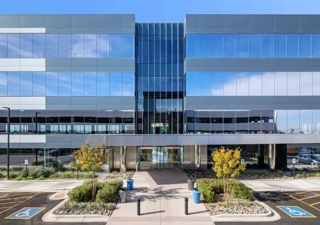
Property Detail
2046 W Riverview Auto Dr
135-38-010A
CUBS SPRING TRAINING FACILITY & RIVERVIEW PARK MCR 1257-29
Officebuilding
MARICOPA
GC
Arizona
AE The base floodplain where base flood elevations are provided. AE Zones are now used on new format FIRMs instead of A1-A30 Zones.
9
2025
8.13 AC
2025
Mesa East
421102
Phoenix
501,927 SF
Phoenix-Mesa-Chandler, AZ
NEARBY LISTINGS FOR SALE OR LEASE
DEMOGRAPHICS near 2046 W Riverview Auto Dr
1 mile
3 mile
5 mile
2025 Total Population
8,596
135,249
362,695
2030 Population
8,984
141,510
377,828
Pop Growth 2025-2030
+ 4.51%
+ 4.63%
+ 4.17%
Average Age
35
36
36
2025 Total Households
3,896
57,525
147,800
HH Growth 2025-2030
+ 4.80%
+ 4.75%
+ 4.44%
Median Household Inc
$76,635
$59,622
$70,186
Avg Household Size
2.10
2.20
2.30
2025 Avg HH Vehicles
2.00
1.00
2.00
Median Home Value
$345,195
$362,138
$438,605
Median Year Built
1986
1983
1980
Nearby Places
Map Layers
Map Styles
 Street
 Aerial
Transit
 Traffic
 Biking
Places
Listings with unknown addresses are not visible on the map
- Restaurants
- Banks
- Shops
- Fitness
- Groceries
SALE & LEASE HISTORY
LISTING DATE
SALE/LEASE

Nov 18, 2019
For Lease
May 22, 2018
For Lease
Jun 11, 2020
For Lease
Feb 13, 2018
For Lease
Nearby Properties
Address
Land Use
TOTAL SIZE
Lot Size
Zoning
Address
Land Use
TOTAL SIZE
Lot Size
Zoning
1,870,689 SF
46.77 AC
I-P
Address
Land Use
TOTAL SIZE
Lot Size
Zoning
3.77 AC
PNC
Address
Land Use
TOTAL SIZE
Lot Size
Zoning
8.79 AC
PF
Address
Land Use
TOTAL SIZE
Lot Size
Zoning
197,454 SF
18.97 AC
PF
Address
Land Use
TOTAL SIZE
Lot Size
Zoning
401,437 SF
17.70 AC
C-R
Address
Land Use
TOTAL SIZE
Lot Size
Zoning
377,442 SF
0.21 AC
C-DT
Address
Land Use
TOTAL SIZE
Lot Size
Zoning
420,534 SF
1.62 AC
PAD
Address
Land Use
TOTAL SIZE
Lot Size
Zoning
564,649 SF
7.19 AC
RCC
Address
Land Use
TOTAL SIZE
Lot Size
Zoning
448,308 SF
6.30 AC
GID
Address
Land Use
TOTAL SIZE
Lot Size
Zoning
267,023 SF
19.58 AC
PEP
Address
Land Use
TOTAL SIZE
Lot Size
Zoning
573,715 SF
3.37 AC
MU4
Address
Land Use
TOTAL SIZE
Lot Size
Zoning
459,103 SF
13.27 AC
MU4
Address
Land Use
TOTAL SIZE
Lot Size
Zoning
562,356 SF
6.70 AC
MU4
Address
Land Use
TOTAL SIZE
Lot Size
Zoning
782,618 SF
6.70 AC
PAD
Address
Land Use
TOTAL SIZE
Lot Size
Zoning
485,625 SF
45.99 AC
PF
Address
Land Use
TOTAL SIZE
Lot Size
Zoning
32,619 SF
2.40 AC
C-G
Address
Land Use
TOTAL SIZE
Lot Size
Zoning
435,896 SF
3.40 AC
PCC2
Address
Land Use
TOTAL SIZE
Lot Size
Zoning
200,465 SF
17.69 AC
R5
Address
Land Use
TOTAL SIZE
Lot Size
Zoning
601,858 SF
7.63 AC
Address
Land Use
TOTAL SIZE
Lot Size
Zoning
403,077 SF
25.49 AC
I-1
Address
Land Use
TOTAL SIZE
Lot Size
Zoning
407,570 SF
6.22 AC
PEP
Address
Land Use
TOTAL SIZE
Lot Size
Zoning
23,030 SF
0.99 AC
M-H
Address
Land Use
TOTAL SIZE
Lot Size
Zoning
380,536 SF
19.24 AC
M-H
Address
Land Use
TOTAL SIZE
Lot Size
Zoning
336,606 SF
7.05 AC
I-1
Address
Land Use
TOTAL SIZE
Lot Size
Zoning
172,072 SF
12.07 AC
I-1
Address
Land Use
TOTAL SIZE
Lot Size
Zoning
454,015 SF
10.03 AC
DB1
Address
Land Use
TOTAL SIZE
Lot Size
Zoning
342,562 SF
2.59 AC
MU4
Address
Land Use
TOTAL SIZE
Lot Size
Zoning
570,051 SF
4.26 AC
The World's #1 Commercial Real Estate Marketplace
Connect with us
© 2026 CoStar Group
The information above has been obtained from sources believed reliable. While we do not doubt its accuracy we have not verified it and make no guarantee, warranty or representation about it. It is your responsibility to independently confirm its accuracy and completeness. Any projections, opinions, assumptions, or estimates used are for example only and do not represent the current or future performance of the property. The value of this transaction to you depends on tax and other factors which should be evaluated by your tax, financial, and legal advisors. You and your advisors should conduct a careful, independent investigation of the property to determine to your satisfaction the suitability of the property for your needs.