Property Record
940 Sw 29Th Ave, Miami, FL 33135


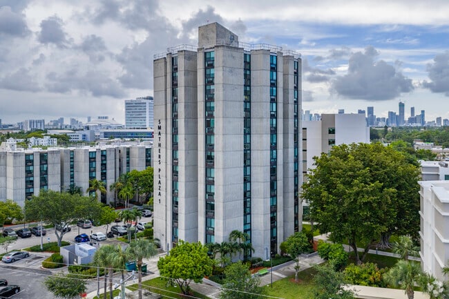

Property Detail
940 Sw 29Th Ave
01-4109-048-0010
3.48 AC PB 81-26 PUBLIC HOUSING PROJECT FLA 5-18 TRACT A LESS PORT DESC BEG SW COR OF TR A TH E 375.06FT TO SE COR OF TR A NWLY & NLY 140.09FT NELY & NLY 30.77FT N 00 DEG E 106.20FT W 259FT N 00 DEG E 16.25FT N 62 DEG W 150.50FT S 00 DEG W 253.50FT S
Countyproperty
MIAMI/DADE
4600
Florida
B and X Area of moderate flood hazard, usually the area between the limits of the 100-year and 500-year floods.
3.48 AC
0
Little Havana
2025
South Florida
005407
Miami-Miami Beach-Kendall, FL
342,272 SF
NEARBY LISTINGS FOR SALE OR LEASE
DEMOGRAPHICS near 940 Sw 29Th Ave
1 mile
3 mile
5 mile
2025 Total Population
40,479
302,859
590,367
2030 Population
42,951
324,598
636,594
Pop Growth 2025-2030
+ 6.11%
+ 7.18%
+ 7.83%
Average Age
44
43
42
2025 Total Households
16,016
124,895
242,958
HH Growth 2025-2030
+ 6.13%
+ 7.38%
+ 8.13%
Median Household Inc
$57,267
$61,915
$71,531
Avg Household Size
2.40
2.30
2.30
2025 Avg HH Vehicles
1.00
1.00
1.00
Median Home Value
$517,703
$655,102
$647,560
Median Year Built
1958
1971
1976
Nearby Places
Map Layers
Map Styles
 Street
 Aerial
Layers
 Traffic
 Biking
Places
Listings with unknown addresses are not visible on the map
- Restaurants
- Banks
- Shops
- Fitness
- Groceries
PUBLIC TRANSPORTATION
COMMUTER RAIL
Coconut Grove (Metrorail Green Line - Miami-Dade Transit (Metrorail/Metromover))
Drive
Walk
Distance
Coconut Grove (Metrorail Green Line - Miami-Dade Transit (Metrorail/Metromover))
4 min
2.1 mi
Vizcaya (Metrorail Green Line - Miami-Dade Transit (Metrorail/Metromover))
Drive
Walk
Distance
Vizcaya (Metrorail Green Line - Miami-Dade Transit (Metrorail/Metromover))
8 min
4.1 mi
AIRPORT
Miami International
Drive
Walk
Distance
Miami International
19 min
9.4 mi
Fort Lauderdale/Hollywood International
Drive
Walk
Distance
Fort Lauderdale/Hollywood International
38 min
25.8 mi
Freight Ports
Port of Miami
Drive
Walk
Distance
Port of Miami
15 min
6.0 mi
Nearby Properties
Address
Land Use
TOTAL SIZE
Lot Size
Zoning
Address
Land Use
TOTAL SIZE
Lot Size
Zoning
955,966 SF
38.91 AC
9600
Address
Land Use
TOTAL SIZE
Lot Size
Zoning
928,000 SF
14.30 AC
8000
Address
Land Use
TOTAL SIZE
Lot Size
Zoning
2,789,683 SF
33.23 AC
7300
Address
Land Use
TOTAL SIZE
Lot Size
Zoning
2,403,353 SF
7.37 AC
6100
Address
Land Use
TOTAL SIZE
Lot Size
Zoning
870,720 SF
1.90 AC
4800
Address
Land Use
TOTAL SIZE
Lot Size
Zoning
727,757 SF
0.64 AC
6408
Address
Land Use
TOTAL SIZE
Lot Size
Zoning
2 AC
8000
Address
Land Use
TOTAL SIZE
Lot Size
Zoning
1,101,032 SF
5.18 AC
8000
Address
Land Use
TOTAL SIZE
Lot Size
Zoning
615,867 SF
1.87 AC
6402
Address
Land Use
TOTAL SIZE
Lot Size
Zoning
211,121 SF
3.16 AC
4603
Address
Land Use
TOTAL SIZE
Lot Size
Zoning
996,100 SF
3.58 AC
9600
Address
Land Use
TOTAL SIZE
Lot Size
Zoning
1,428,214 SF
31.07 AC
8000
Address
Land Use
TOTAL SIZE
Lot Size
Zoning
612,782 SF
2.41 AC
6402
Address
Land Use
TOTAL SIZE
Lot Size
Zoning
91,119 SF
50.72 AC
8000
Address
Land Use
TOTAL SIZE
Lot Size
Zoning
375,762 SF
3.39 AC
8000
Address
Land Use
TOTAL SIZE
Lot Size
Zoning
451,993 SF
0.69 AC
6408
Address
Land Use
TOTAL SIZE
Lot Size
Zoning
345,178 SF
6.73 AC
5005
Address
Land Use
TOTAL SIZE
Lot Size
Zoning
1,212,604 SF
10.50 AC
9600
Address
Land Use
TOTAL SIZE
Lot Size
Zoning
648,350 SF
9.78 AC
6118
Address
Land Use
TOTAL SIZE
Lot Size
Zoning
1,168,390 SF
0.04 AC
7100
Address
Land Use
TOTAL SIZE
Lot Size
Zoning
526,358 SF
3.62 AC
6100
Address
Land Use
TOTAL SIZE
Lot Size
Zoning
545,220 SF
15.32 AC
6100
Address
Land Use
TOTAL SIZE
Lot Size
Zoning
482,246 SF
0.83 AC
5005
Address
Land Use
TOTAL SIZE
Lot Size
Zoning
525,786 SF
2.64 AC
6100
Address
Land Use
TOTAL SIZE
Lot Size
Zoning
408,292 SF
0.88 AC
6110
Address
Land Use
TOTAL SIZE
Lot Size
Zoning
275,755 SF
6.73 AC
5005
Address
Land Use
TOTAL SIZE
Lot Size
Zoning
247,488 SF
4.25 AC
5005
Address
Land Use
TOTAL SIZE
Lot Size
Zoning
221,240 SF
1.77 AC
6408
Address
Land Use
TOTAL SIZE
Lot Size
Zoning
498,242 SF
2.69 AC
6100
Address
Land Use
TOTAL SIZE
Lot Size
Zoning
688,104 SF
3.16 AC
6101
The World's #1 Commercial Real Estate Marketplace
Connect with us
© 2026 CoStar Group
The information above has been obtained from sources believed reliable. While we do not doubt its accuracy we have not verified it and make no guarantee, warranty or representation about it. It is your responsibility to independently confirm its accuracy and completeness. Any projections, opinions, assumptions, or estimates used are for example only and do not represent the current or future performance of the property. The value of this transaction to you depends on tax and other factors which should be evaluated by your tax, financial, and legal advisors. You and your advisors should conduct a careful, independent investigation of the property to determine to your satisfaction the suitability of the property for your needs.