Property Record
9401 Route 29 Hwy, Fairfax, VA 22031

Current Lease Availabilities
NEARBY LISTINGS FOR SALE OR LEASE
Property Detail
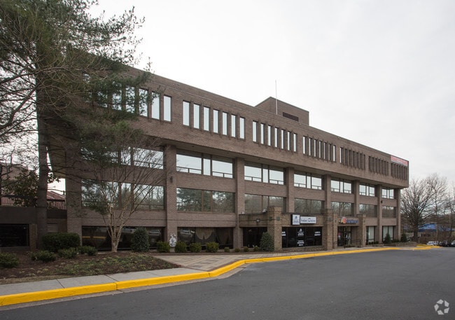
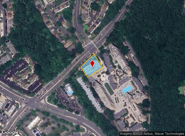
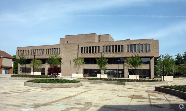
9401 Route 29 Hwy
Washington-Arlington-Alexandria, DC-VA-MD-WV
Circle Towers
0483-01-0053
CIRCLE TOWERS PCL C
Officebuilding
Fairfax
X
Virginia
5155240003E
53
2024
0.63 AC
2025
Vienna
461700
Washington, DC
54,315 SF
DEMOGRAPHICS near 9401 Route 29 Hwy
1 Mile
3 Mile
5 Mile
2024 Total Population
22,609
120,567
319,433
2029 Population
22,620
120,266
316,709
Pop Growth 2024-2029
+ 0.05%
(0.25%)
(0.85%)
Average Age
38
39
39
2024 Total Households
8,585
43,462
114,234
HH Growth 2024-2029
+ 0.06%
(0.32%)
(0.86%)
Median Household Inc
$136,354
$148,971
$142,598
Avg Household Size
2.60
2.70
2.70
2024 Avg HH Vehicles
2.00
2.00
2.00
Median Home Value
$641,368
$735,702
$726,813
Median Year Built
1980
1978
1977
Nearby Places
- Restaurants
- Banks
- Shops
- Fitness
- Groceries
PUBLIC TRANSPORTATION
TRANSIT/SUBWAY
Vienna/Fairfax-GMU (Orange Line - Washington Metropolitan Area Transit Authority Metrorail (Metrorail))
DRIVE
WALK
Distance
Vienna/Fairfax-GMU (Orange Line - Washington Metropolitan Area Transit Authority Metrorail (Metrorail))
8 min
14 min
0.7 mi
COMMUTER RAIL
Burke Centre (Manassas Line - Virginia Railway Express)
DRIVE
WALK
Distance
Burke Centre (Manassas Line - Virginia Railway Express)
16 min
6.7 mi
Rolling Road (Manassas Line - Virginia Railway Express)
DRIVE
WALK
Distance
Rolling Road (Manassas Line - Virginia Railway Express)
14 min
6.9 mi
AIRPORT
Washington Dulles International
DRIVE
WALK
Distance
Washington Dulles International
32 min
16.2 mi
Ronald Reagan Washington Ntl
DRIVE
WALK
Distance
Ronald Reagan Washington Ntl
28 min
17.5 mi
Freight Ports
Port of Baltimore
DRIVE
WALK
Distance
Port of Baltimore
72 min
53.2 mi
Nearby Properties
Address
Land Use
TOTAL SIZE
Lot Size
Zoning
Address
Land Use
TOTAL SIZE
Lot Size
Zoning
1,434,346 SF
29.59 AC
430
Address
Land Use
TOTAL SIZE
Lot Size
Zoning
829,629 SF
21.30 AC
430
Address
Land Use
TOTAL SIZE
Lot Size
Zoning
1,464,969 SF
39.52 AC
403
Address
Land Use
TOTAL SIZE
Lot Size
Zoning
1,393,336 SF
43.08 AC
400
Address
Land Use
TOTAL SIZE
Lot Size
Zoning
538,794 SF
3.44 AC
400
Address
Land Use
TOTAL SIZE
Lot Size
Zoning
819,540 SF
8.81 AC
COMMERCIAL
Address
Land Use
TOTAL SIZE
Lot Size
Zoning
82,818 SF
6.16 AC
PLANNED DE
Address
Land Use
TOTAL SIZE
Lot Size
Zoning
327,430 SF
4.24 AC
350
Address
Land Use
TOTAL SIZE
Lot Size
Zoning
775,934 SF
13.98 AC
312
Address
Land Use
TOTAL SIZE
Lot Size
Zoning
400,226 SF
33.12 AC
SPLIT ZONE
Address
Land Use
TOTAL SIZE
Lot Size
Zoning
382,776 SF
11.02 AC
400
Address
Land Use
TOTAL SIZE
Lot Size
Zoning
255,553 SF
25.61 AC
RESIDENTIA
Address
Land Use
TOTAL SIZE
Lot Size
Zoning
225,058 SF
596
Address
Land Use
TOTAL SIZE
Lot Size
Zoning
300,730 SF
9.60 AC
400
Address
Land Use
TOTAL SIZE
Lot Size
Zoning
504,528 SF
20.91 AC
220
Address
Land Use
TOTAL SIZE
Lot Size
Zoning
817,044 SF
10.97 AC
960
Address
Land Use
TOTAL SIZE
Lot Size
Zoning
354,464 SF
7.51 AC
400
Address
Land Use
TOTAL SIZE
Lot Size
Zoning
230,346 SF
25.18 AC
460
Address
Land Use
TOTAL SIZE
Lot Size
Zoning
245,351 SF
16.83 AC
960
Address
Land Use
TOTAL SIZE
Lot Size
Zoning
3,000 SF
9.26 AC
497
Address
Land Use
TOTAL SIZE
Lot Size
Zoning
779,512 SF
22.66 AC
550
Address
Land Use
TOTAL SIZE
Lot Size
Zoning
260,278 SF
5.78 AC
400
Address
Land Use
TOTAL SIZE
Lot Size
Zoning
234,391 SF
10.77 AC
960
Address
Land Use
TOTAL SIZE
Lot Size
Zoning
424,763 SF
47.76 AC
SPLIT ZONE
Address
Land Use
TOTAL SIZE
Lot Size
Zoning
342,659 SF
3.41 AC
400
Address
Land Use
TOTAL SIZE
Lot Size
Zoning
264,495 SF
15.55 AC
403
Address
Land Use
TOTAL SIZE
Lot Size
Zoning
315,292 SF
14.98 AC
220
Address
Land Use
TOTAL SIZE
Lot Size
Zoning
500 SF
9.67 AC
180
Address
Land Use
TOTAL SIZE
Lot Size
Zoning
268,877 SF
2.86 AC
400
Address
Land Use
TOTAL SIZE
Lot Size
Zoning
164,186 SF
596
The World's #1 Commercial Real Estate Marketplace
Connect with us
© 2025 CoStar Group
The information above has been obtained from sources believed reliable. While we do not doubt its accuracy we have not verified it and make no guarantee, warranty or representation about it. It is your responsibility to independently confirm its accuracy and completeness. Any projections, opinions, assumptions, or estimates used are for example only and do not represent the current or future performance of the property. The value of this transaction to you depends on tax and other factors which should be evaluated by your tax, financial, and legal advisors. You and your advisors should conduct a careful, independent investigation of the property to determine to your satisfaction the suitability of the property for your needs.